Report on Pinatubo (Philippines) — August 1992
Bulletin of the Global Volcanism Network, vol. 17, no. 8 (August 1992)
Managing Editor: Lindsay McClelland.
Pinatubo (Philippines) Lahars kill more than 60 people; large secondary explosions; continued lava-dome growth
Please cite this report as:
Global Volcanism Program, 1992. Report on Pinatubo (Philippines) (McClelland, L., ed.). Bulletin of the Global Volcanism Network, 17:8. Smithsonian Institution. https://doi.org/10.5479/si.GVP.BGVN199208-273083
Pinatubo
Philippines
15.13°N, 120.35°E; summit elev. 1486 m
All times are local (unless otherwise noted)
Growth of the lava dome in the summit caldera continued. Poor weather limited observations, but the dome's dimensions were estimated at 300-320 m in diameter and 100 m high during an early-September overflight. Heavy rains continued to trigger large secondary explosions and numerous lahars from the 1991 pyroclastic-flow deposits. Despite construction of sabo dams and levees, lahars had filled the channels of most flank drainages, endangering the remaining residents of river valleys around the volcano; almost 400 villages were identified by PHIVOLCS to be at high risk from lahars. Lahars reportedly killed more than 60 people in late August, and forced several hundred thousand to evacuate.
Observations by a geologic team on the W flank revealed continued development of large lahar fans that included numerous partially buried carbonized trees. The lahars repeatedly damaged or destroyed containment dikes, and progressively buried a village near the observation site. Hyperconcentrated flows, composed of 50-75% volcanic debris, were dominant at the site (along the Bucao River) because of dilution by streams not carrying large sediment loads. Less common were laharic debris flows with water contents of 25% to as little as 15%. Along one zone where the channel was only 30-100 m wide, hyperconcentrated flows typically advanced at 10-15 km/hour, marked by antidune standing waves 5-12 m long and 1-2 m high. Debris flows were laminar, moving at up to 30 km/hour.
Several large secondary explosions were documented between mid-August and mid-September. Explosions on 20 August at 0940 and 21 August at 0740 produced plumes that were tracked to 9 km altitude by radar (at Cubi Point). The top of each plume moved NNW and mid-level material (near 5.5 km) was carried NE. A large secondary explosion from pyroclastic-flow deposits in the SW flank's Marella valley occurred at 1650 on 15 September. The cloud reached 18 km altitude and drifted SW, depositing 3 mm of ash about 30 km SW of the summit (at San Marcelino) and 2 mm about 35 km SSW of the summit (at Subic Bay). Additional large secondary explosions took place on 21 September at 0957 and 1758. The first plume rose to more than 12 km altitude, appearing initially on satellite imagery as a circular cloud about 100 km in diameter above heavy weather clouds. The second plume reached 9 km altitude and moved rapidly WSW, causing heavy ashfall and muddy rain.
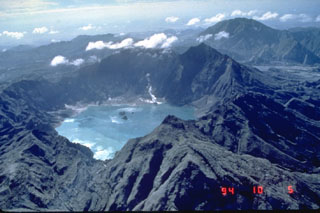
Geological Summary. Prior to 1991 Pinatubo volcano was a relatively unknown, heavily forested lava dome complex located 100 km NW of Manila with no records of historical eruptions. The 1991 eruption, one of the world's largest of the 20th century, ejected massive amounts of tephra and produced voluminous pyroclastic flows, forming a small, 2.5-km-wide summit caldera whose floor is now covered by a lake. Caldera formation lowered the height of the summit by more than 300 m. Although the eruption caused hundreds of fatalities and major damage with severe social and economic impact, successful monitoring efforts greatly reduced the number of fatalities. Widespread lahars that redistributed products of the 1991 eruption have continued to cause severe disruption. Previous major eruptive periods, interrupted by lengthy quiescent periods, have produced pyroclastic flows and lahars that were even more extensive than in 1991.
Information Contacts: PHIVOLCS; SAB; Kelvin Rodolfo, Univ of Illinois.

