Report on Asosan (Japan) — March 1993
Bulletin of the Global Volcanism Network, vol. 18, no. 3 (March 1993)
Managing Editor: Edward Venzke.
Asosan (Japan) Activity decreases; crater lake forms
Please cite this report as:
Global Volcanism Program, 1993. Report on Asosan (Japan) (Venzke, E., ed.). Bulletin of the Global Volcanism Network, 18:3. Smithsonian Institution. https://doi.org/10.5479/si.GVP.BGVN199303-282110
Asosan
Japan
32.8849°N, 131.085°E; summit elev. 1592 m
All times are local (unless otherwise noted)
Activity in March and early April was lower than in previous months. Rain created a small lake in part of Crater 1. On roughly half of the March visits, mud and blocks were seen being ejected a few meters above the lake. A white steam plume continually rose 200-500 m; it contained a minor amount of ash on 7 March. Seismic activity was low.
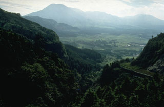
Geological Summary. The 24-km-wide Asosan caldera was formed during four major explosive eruptions from 300,000 to 90,000 years ago. These produced voluminous pyroclastic flows that covered much of Kyushu. The last of these, the Aso-4 eruption, produced more than 600 km3 of airfall tephra and pyroclastic-flow deposits. A group of 17 central cones was constructed in the middle of the caldera, one of which, Nakadake, is one of Japan's most active volcanoes. It was the location of Japan's first documented historical eruption in 553 CE. The Nakadake complex has remained active throughout the Holocene. Several other cones have been active during the Holocene, including the Kometsuka scoria cone as recently as about 210 CE. Historical eruptions have largely consisted of basaltic to basaltic andesite ash emission with periodic strombolian and phreatomagmatic activity. The summit crater of Nakadake is accessible by toll road and cable car, and is one of Kyushu's most popular tourist destinations.
Information Contacts: JMA.