Report on Kama'ehuakanaloa (United States) — January 1998
Bulletin of the Global Volcanism Network, vol. 23, no. 1 (January 1998)
Managing Editor: Richard Wunderman.
Kama'ehuakanaloa (United States) Repaired observatory reveals February eruption
Please cite this report as:
Global Volcanism Program, 1998. Report on Kama'ehuakanaloa (United States) (Wunderman, R., ed.). Bulletin of the Global Volcanism Network, 23:1. Smithsonian Institution. https://doi.org/10.5479/si.GVP.BGVN199801-332000
Kama'ehuakanaloa
United States
18.92°N, 155.27°W; summit elev. -975 m
All times are local (unless otherwise noted)
The Hawaii Undersea Geo-Observatory (HUGO) was visited on 19 January by the Pisces V submersible for the first time since its installation in mid-October 1997 (BGVN 22:09). The observatory, which consists of a hydrophone, and temperature and pressure sensors at a depth of 1.2 km, ceased operating in late October due to electrical problems; it was repaired and immediately began recording. At this time, whale sounds, but no volcanic activity, were heard at the seamount.
In early February, HUGO monitors indicated an eruption was underway. Transient acoustic signals with varying frequencies from several hertz to several kilohertz were recorded on the hydrophone. The signals varied in duration from seconds to minutes. A signal consisting of a low frequency "roar" followed by a high frequency "hiss" that lasted for several minutes occurred several times per day. The exact location of the eruption has not been determined; based on signal arrival times at the HUGO instruments and at the ocean surface, the eruption was estimated to be occurring within 2 km of the HUGO array at Lōʻihi.
[Later sonobuoy data showed that the eruption signals recorded by HUGO were caused by explosive activity at Kīlauea lava-flow ocean entries; there was no eruptive activity at Lōʻihi during the 27 January-26 April 1998 time period (Caplan-Auerbach and Duennebier, 2001).]
An article by The 1996 Lōʻihi Science Team (1997) discusses mid-1996 observations and includes a contoured bathymetric map of the summit area.
Reference. The 1996 Lōʻihi Science Team, 1997, Researchers rapidly respond to submarine activity at Lōʻihi volcano: Hawaii, Eos, Transactions, American Geophysical Union, v. 78, no. 22 (3 June 1997), p. 229.
Caplan-Auerbach, J., and Duennebier, F., 2001, Seismic and acoustic signals detected at Lōʻihi seamount by the Hawaii Undersea Geo-Observatory: Geochem. Geophys. Geosyst., 2, paper 2000GC000113, May 25 2001.
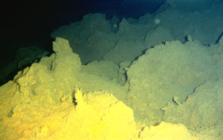
Geological Summary. The Kama’ehuakanaloa seamount, previously known as Loihi, lies about 35 km off the SE coast of the island of Hawaii. This youngest volcano of the Hawaiian chain has an elongated morphology dominated by two curving rift zones extending north and south of the summit. The summit region contains a caldera about 3 x 4 km and exhibits numerous lava cones, the highest of which is about 975 m below the ocean surface. The summit platform also includes two well-defined pit craters, sediment-free glassy lava, and low-temperature hydrothermal venting. An arcuate chain of small cones on the western edge of the summit extends north and south of the pit craters and merges into the crests prominent rift zones. Seismicity indicates a magmatic system distinct from that of Kilauea. During 1996 a new pit crater formed at the summit, and lava flows were erupted. Continued volcanism is expected to eventually build a new island; time estimates for the summit to reach the ocean surface range from roughly 10,000 to 100,000 years.
Information Contacts: Ken Rubin and Mike Garcia, Hawaii Center for Volcanology, Department of Geology & Geophysics, University of Hawaii at Manoa, 2525 Correa Road, Honolulu, HI 96822 USA (URL: http://www.soest.hawaii.edu/GG/hcv.html).