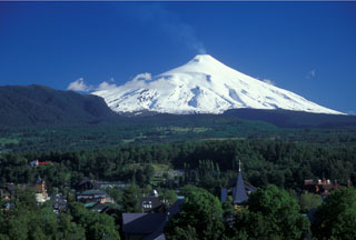
Report on Villarrica (Chile) — November 1998
Bulletin of the Global Volcanism Network, vol. 23, no. 11 (November 1998)
Managing Editor: Richard Wunderman.
Villarrica (Chile) Summary of February-November activity; intermittent lava pond pulses, phreatic explosions
Please cite this report as:
Global Volcanism Program, 1998. Report on Villarrica (Chile) (Wunderman, R., ed.). Bulletin of the Global Volcanism Network, 23:11. Smithsonian Institution. https://doi.org/10.5479/si.GVP.BGVN199811-357120
Villarrica
Chile
39.42°S, 71.93°W; summit elev. 2847 m
All times are local (unless otherwise noted)
This report summarizes daily visual observations by members of the Proyecto de Observación Villarrica (POVI), volcano guides, and other sources during February to November 1998. In late February, after two months of subsidence, the magmatic column reached the crater floor with a weak and irregular degassing. By mid-March the lava pond was clearly visible as an intermittent red glow from 12 km away. In April and May, three convective magmatic pushes, gas-poor, filled half of the funnel-shaped crater with pahoehoe lava. On 13, 25, and 30 June, small phreatic emissions rose up to 200 m above the summit. Since mid-October, the activity level in the lava pond has varied, with the low levels of degassing intensity occurring at irregular intervals. On 8 November, the red glow was seen for the only time that month.
It is inferred that the red glow indicates that a small volume of usually gas-enriched magma has reached the crater floor in phases and at irregular intervals. This causes a sudden occurrence of the glow, sometimes with increasing intensity and lasting from a few hours up to 3 days. Subsequently, a distinct reduction of the glow intensity is interpreted to mean that an insufficient supply of convecting magma and gas allows the lava pond to form a crust. During the report period, 16 such magmatic pulses were observed and 10 additional pulses were inferred for periods of non-observation due to weather conditions.
Geological Summary. The glacier-covered Villarrica stratovolcano, in the northern Lakes District of central Chile, is ~15 km south of the city of Pucon. A 2-km-wide caldera that formed about 3,500 years ago is located at the base of the presently active, dominantly basaltic to basaltic-andesite cone at the NW margin of a 6-km-wide Pleistocene caldera. More than 30 scoria cones and fissure vents are present on the flanks. Plinian eruptions and pyroclastic flows that have extended up to 20 km from the volcano were produced during the Holocene. Lava flows up to 18 km long have issued from summit and flank vents. Eruptions documented since 1558 CE have consisted largely of mild-to-moderate explosive activity with occasional lava effusion. Glaciers cover 40 km2 of the volcano, and lahars have damaged towns on its flanks.
Information Contacts: Werner Keller U., Proyecto de Observacion Villarrica (P.O.V.I.), Wiesenstrasse 8, 86438 Kissing, Germany (URL: https://www.povi.cl/).

