Report on Lopevi (Vanuatu) — February 1999

Bulletin of the Global Volcanism Network, vol. 24, no. 2 (February 1999)
Managing Editor: Richard Wunderman.
Lopevi (Vanuatu) Strombolian explosions beginning November 1998
Please cite this report as:
Global Volcanism Program, 1999. Report on Lopevi (Vanuatu) (Wunderman, R., ed.). Bulletin of the Global Volcanism Network, 24:2. Smithsonian Institution. https://doi.org/10.5479/si.GVP.BGVN199902-257050
Lopevi
Vanuatu
16.507°S, 168.346°E; summit elev. 1413 m
All times are local (unless otherwise noted)
During 1963-82 ash emissions, lava flows, lava fountains, and Strombolian explosions occurred intermittently at Lopevi. In 1968-69 activity mainly affected the SE flank (figure 1), where two lava flows from the summit reached the sea. The twenty-year pattern of activity ended with emission of a major plume that rose to 6,000 m on 24 October 1982 (SEAN 07:010).
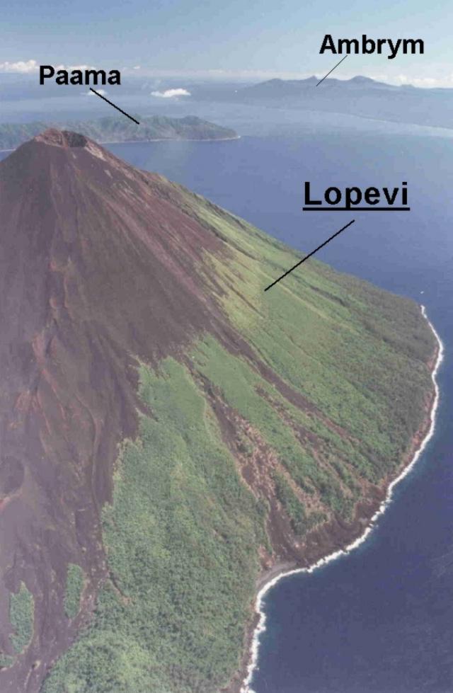 |
Figure 1. View of the SE flank of Lopevi volcano, looking toward the NW in May 1995. Paama Island, from which recent observations were made, and Ambrym Island, a currently active volcano, are in the background (to the N). Courtesy IRD; photo by P. Evin, IRD. |
Since then, activity had been generally fumarolic. Eruptive activity resumed in July 1998. A series of Strombolian explosions in the main 1963 crater (just NW of the central crater) was observed during November 1998. On 29, 30, and 31 December 1998, Strombolian explosions and Vulcanian emissions were observed from the island of Paama every 4-5 minutes.
Sporadic eruptive activity observed between the end of December 1998 and March 1999 was confined to the 1963 crater on the NW flank (figure 2). The appearance of this large crater, at ~900 m elevation, ruined the perfect conic profile of Lopevi, a rare volcano of the archipelago without a caldera.
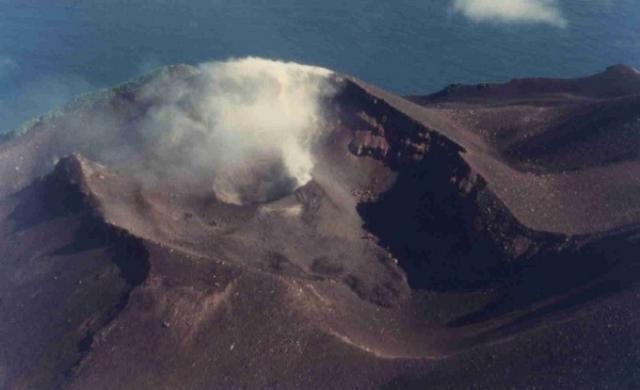 |
Figure 2. View of the active crater on Lopevi's NW flank as seen in January 1999. Courtesy IRD; photo by J-M. Bore, IRD. |
Lopevi, an island ~6 km in diameter, 1,450 m high, and 3,500 m above the seafloor, is one of the most active of the Vanuatu archipelago. The first written description came from Captain Cook, who in 1774 entered in his ship's log that the volcano was "seemingly without activity." Volcanic crises reported since 1863 appear to have occurred in cycles of ~15-20 years. In 1960, following a significant Plinian eruption from the NW flank, a series of pyroclastic flows, lava flows, Strombolian activity, and fumarolic emissions were observed during one month. In 1963, over a period of several months, large quantities of flowing lava and ash spread through ~ 1,000 ha in the NW part of the island.
Geological Summary. The small 7-km-wide conical island of Lopevi, known locally as Vanei Vollohulu, is one of Vanuatu's most active volcanoes. A small summit crater containing a cinder cone is breached to the NW and tops an older cone that is rimmed by the remnant of a larger crater. The basaltic-to-andesitic volcano has been active during historical time at both summit and flank vents, primarily along a NW-SE-trending fissure that cuts across the island, producing moderate explosive eruptions and lava flows that reached the coast. Historical eruptions at the 1413-m-high volcano date back to the mid-19th century. The island was evacuated following major eruptions in 1939 and 1960. The latter eruption, from a NW-flank fissure vent, produced a pyroclastic flow that swept to the sea and a lava flow that formed a new peninsula on the western coast.
Information Contacts: Michel Lardy, Institut de recherche pour le développement (IRD), B.P. 76, Port Vila, Vanuatu; Douglas Charley and Roland Priam, Department of Geology, Mines and Water Resources, PMB 01, Port Vila, Vanuatu.