Report on Batur (Indonesia) — September 2001
Bulletin of the Global Volcanism Network, vol. 26, no. 9 (September 2001)
Managing Editor: Richard Wunderman.
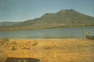
Batur (Indonesia) White, thin plume to 10 m above crater rim during March and April 2001
Please cite this report as:
Global Volcanism Program, 2001. Report on Batur (Indonesia) (Wunderman, R., ed.). Bulletin of the Global Volcanism Network, 26:9. Smithsonian Institution. https://doi.org/10.5479/si.GVP.BGVN200109-264010
Batur
Indonesia
8.2403°S, 115.3775°E; summit elev. 1711 m
All times are local (unless otherwise noted)
During March and April 2001, a thin-white plume was observed reaching up to 10 m above the crater rim at Batur. During January through April 2001 unspecified categories of monthly earthquakes numbered 6, 10, 20, and 6, respectively; their depths were 2-5 km. Some further details on specific types of March-April earthquakes appear in table 2. Based on these data, the Volcanological Survey of Indonesia (VSI) lowered the Alert Level from 2 to 1 (on a scale of 1-4) in early May. No further activity has been reported as of September 2001.
Table 2. Seismic activity registered at Batur during March and April 2001. Courtesy of VSI.
| Date | Deep volcanic (A-type) | Shallow volcanic (B-type) | Small explosion | Tectonic |
| 06 Mar-12 Mar 2001 | -- | 3 | 5 | 14 |
| 12 Mar-18 Mar 2001 | 4 | 3 | 3 | 2 |
| 19 Mar-23 Mar 2001 | -- | 1 | -- | 10 |
| 27 Mar-01 Apr 2001 | -- | -- | 8 | 7 |
| 02 Apr-09 Apr 2001 | 1 | 2 | 5 | 10 |
| 09 Apr-15 Apr 2001 | 2 | -- | 2 | 17 |
| 16 Apr-23 Apr 2001 | -- | 1 | 2 | 10 |
Geological Summary. The historically active Batur is located at the center of two concentric calderas NW of Agung volcano. The outer 10 x 13.5 km caldera was formed during eruption of the Bali (or Ubud) Ignimbrite about 29,300 years ago and now contains a caldera lake on its SE side, opposite the Gunung Abang cone, the topographic high of the complex. The inner 6.4 x 9.4 km caldera was formed about 20,150 years ago during eruption of the Gunungkawi Ignimbrite. The SE wall of the inner caldera lies beneath Lake Batur; Batur cone has been constructed within the inner caldera to a height above the outer caldera rim. The Batur stratovolcano has produced vents over much of the inner caldera, but a NE-SW fissure system has localized the Batur I, II, and III craters along the summit ridge. Recorded eruptions have been characterized by mild-to-moderate explosive activity sometimes accompanied by lava emission. Basaltic lava flows from both summit and flank vents have reached the caldera floor and the shores of Lake Batur in historical time.
Information Contacts: Dali Ahmad, Volcanological Survey of Indonesia (VSI), Jalan Diponegoro No. 57, Bandung 40122, Indonesia (URL: http://www.vsi.esdm.go.id/).