Report on Three Sisters (United States) — June 2004
Bulletin of the Global Volcanism Network, vol. 29, no. 6 (June 2004)
Managing Editor: Richard Wunderman.
Three Sisters (United States) March 2004 seismic swarm and continued magmatic uplift
Please cite this report as:
Global Volcanism Program, 2004. Report on Three Sisters (United States) (Wunderman, R., ed.). Bulletin of the Global Volcanism Network, 29:6. Smithsonian Institution. https://doi.org/10.5479/si.GVP.BGVN200406-322070
Three Sisters
United States
44.133°N, 121.767°W; summit elev. 3159 m
All times are local (unless otherwise noted)
At approximately 1000 on 23 March 2004, a swarm of small earthquakes began at the Three Sisters volcanic center in the central Oregon Cascade Range. As of the morning of 24 March, the regional seismic network had detected ~ 100 earthquakes, with M ~ 1.5; by the end of the swarm, over 300 volcano-tectonic earthquakes with M ~ 1.9 were recorded (figure 3), with the rate of earthquakes peaking late on 23 March. The earthquakes occurred in the NE part of an area centered 5 km W of South Sister volcano, a zone in which the ground had been uplifted by as much as 25 cm since late 1997.
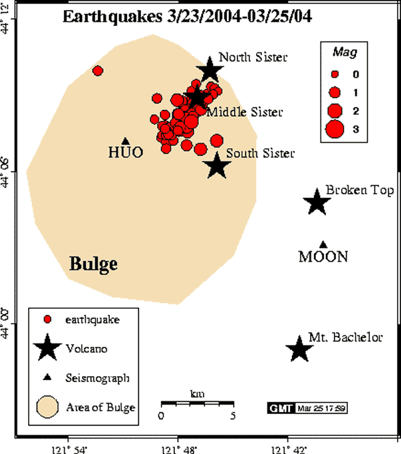 |
Figure 3. Map of the 23-25 March 2004 seismic swarm at Three Sisters volcanoes. Courtesy of Pacific Northwest Seismograph Network (PNSN) website. |
Scientists inferred that the cause of the uplift was continuing magmatic intrusion ~ 7 km below the surface. The intrusion volume was estimated at ~ 40 million cubic meters. Until 23 March, only a few earthquakes had accompanied this process, but scientists predicted that swarms of small earthquakes would eventually accompany the uplift, and they suggested that the most likely cause of the earthquakes was small amounts of slippage on faults as the crust adjusted to the slow ground deformation that had been occurring since 1997. Heat and gases related to the magmatic intrusion also likely caused increases in fluid pressure deep underground, helping trigger minor faulting events.
Scientists deployed another seismometer in order to locate earthquakes more precisely. They also planned additional fieldwork with the assistance of the Willamette and Deschutes National Forests, aiming to fix problems with some field instruments that resulted from a heavy winter snow-pack, and to assess sites for new instruments.
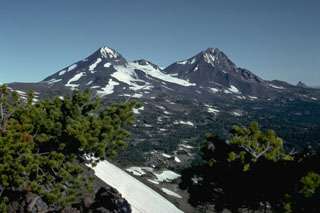
Geological Summary. The north-south-trending Three Sisters volcano group dominates the landscape of the Central Oregon Cascades. All Three Sisters stratovolcanoes ceased activity during the late Pleistocene, but basaltic-to-rhyolitic flank vents erupted during the Holocene, producing both blocky lava flows north of North Sister and rhyolitic lava domes and flows south of South Sister volcano. Glaciers have deeply eroded the Pleistocene andesitic-dacitic North Sister stratovolcano, exposing the volcano's central plug. Construction of the main edifice ceased at about 55,000 yrs ago, but north-flank vents produced blocky lava flows in the McKenzie Pass area as recently as about 1600 years ago. Middle Sister volcano is located only 2 km to the SW and was active largely contemporaneously with South Sister until about 14,000 years ago. South Sister is the highest of the Three Sisters. It was constructed beginning about 50,000 years ago and was capped by a symmetrical summit cinder cone formed about 22,000 years ago. The late Pleistocene or early Holocene Cayuse Crater on the SW flank of Broken Top volcano and other flank vents such as Le Conte Crater on the SW flank of South Sister mark mafic vents that have erupted at considerable distances from South Sister itself, and a chain of dike-fed rhyolitic lava domes and flows at Rock Mesa and Devils Chain south of South Sister erupted about 2000 years ago.
Information Contacts: Cascades Volcano Observatory (CVO), U.S. Geological Survey (USGS), Building 10, Suite 100, 1300 SE Cardinal Court, Vancouver, WA 98683 (URL: https://volcanoes.usgs.gov/observatories/cvo/); Volcano Hazards Team, USGS, 345 Middlefield Road, Menlo Park, CA 94025-3591 USA (URL: http://volcanoes.usgs.gov/); Pacific Northwest Seismograph Network (PNSN), University of Washington Geophysics Program, Box 351650, Seattle, WA 98195-1650, USA (URL: http://www.geophys.washington.edu/SEIS/PNSN/).