Report on McDonald Islands (Australia) — June 2005
Bulletin of the Global Volcanism Network, vol. 30, no. 6 (June 2005)
Managing Editor: Richard Wunderman.
McDonald Islands (Australia) Satellite infrared data suggests a new unwitnessed eruption
Please cite this report as:
Global Volcanism Program, 2005. Report on McDonald Islands (Australia) (Wunderman, R., ed.). Bulletin of the Global Volcanism Network, 30:6. Smithsonian Institution. https://doi.org/10.5479/si.GVP.BGVN200506-234011
McDonald Islands
Australia
53.03°S, 72.6°E; summit elev. 230 m
All times are local (unless otherwise noted)
The following report comes from Matt Patrick of the HIGP Thermal Alerts Team. Two night-time ASTER images (Band 10, 8.3 microns, at 90 m pixel size) of McDonald Island show activity centered on the NW shore of the island. The December 2002 image was examined some months ago, but it was not determined whether the long-wave infrared (IR) anomaly was genuine, since it was relatively low intensity and there was no anomaly in the shortwave IR. The most recent ASTER image (12 July 2005) shows a somewhat larger long-wave IR anomaly, but more importantly, there are five pixels in the shortwave IR (Band 9, 2.4 microns; not shown) which are saturated, indicating this is a significantly hot target. Based upon McDonald's typical activity, the anomaly probably reflects low-level effusive activity.
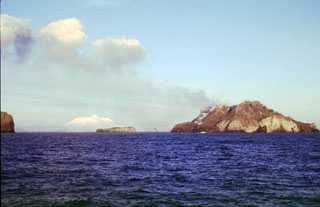
The first and only MODVOLC alert pixel showed up in November 2004 (BGVN 29:12). These ASTER images show that recent activity is centered around the NW flank of the island, very close to shore. Comparing the July 2005 image with the December 2002 image, there might be an indication of the shoreline growing westward, but it is hard to tell for sure with this resolution (90 meters). The location of this activity is generally consistent with recent BGVN reports: in 1999 steaming was observed on the N-NE part of the island (BGVN 24:01), and a recent Landsat ETM image indicated that island construction over the last two decades has expanded the northern portion of the volcano (BGVN 26:02 and 27:12).
Andrew Tupper noted that he found the hot spot identification plausible. The question of edifice collapse and possible tsunami generation associated with McDonald Islands has recently been a subject of interest but little technical information is available on topics such as edifice morphology and slope stability.
Geological Summary. Historical eruptions have greatly modified the morphology of the McDonald Islands, located on the Kerguelen Plateau about 75 km W of Heard Island. The largest island, McDonald, is composed of a layered phonolitic tuff plateau cut by phonolitic dikes and lava domes. A possible nearby active submarine center was inferred from phonolitic pumice that washed up on Heard Island in 1992. Volcanic plumes were observed in December 1996 and January 1997 from McDonald Island. During March 1997 the crew of a vessel that sailed near the island noted vigorous steaming from a vent on the N side of the island along with possible pyroclastic deposits and lava flows. A satellite image taken in November 2001 showed the island to have more than doubled in area since previous reported observations in November 2000. The high point of the island group had shifted to the McDonald's N end, which had merged with Flat Island.
Information Contacts: Matt Patrick, HIGP Thermal Alerts Team, Hawai'i Institute of Geophysics and Planetology (HIGP) / School of Ocean and Earth Science and Technology (SOEST), University of Hawai'i, 2525 Correa Road, Honolulu, HI 96822, USA (URL: http://modis.higp.hawaii.edu/); Andrew Tupper, Darwin Volcanic Ash Advisory Centre (VAAC), Commonwealth Bureau of Meteorology, Northern Territory Regional Office, PO Box 40050, Casuarina, NT 0811, Australia (URL: http://www.bom.gov.au/info/vaac/).