Report on Colima (Mexico) — March 2006

Bulletin of the Global Volcanism Network, vol. 31, no. 3 (March 2006)
Managing Editor: Richard Wunderman.
Colima (Mexico) Continued ash emission, including some high level ash plumes, since June 2005
Please cite this report as:
Global Volcanism Program, 2006. Report on Colima (Mexico) (Wunderman, R., ed.). Bulletin of the Global Volcanism Network, 31:3. Smithsonian Institution. https://doi.org/10.5479/si.GVP.BGVN200603-341040
Colima
Mexico
19.514°N, 103.62°W; summit elev. 3850 m
All times are local (unless otherwise noted)
Eruptive activity has continued at Colima from July 2005 through February 2006. Explosions that generated ash plumes were common during this period.
The Colima Volcano Observatory reported that ash emission continued at Colima during 29 June 2005 to 5 July 2005 and several plumes rose to 9-10 km altitude. On 30 June, lahars traveled SW down La Lumbre Ravine and SSE down Montegrande Ravine to a maximum length of ~ 10 km. The lahars did not reach populated areas. Due to the presence of new ash on the flanks of the volcano, seasonal heavy rains, and the subsequent threat of lahars forming, Universidad de Colima advised avoiding the ravines of La Lumbre, San Antonio, Monte Grande (in Colima state), and La Arena (in Jalisco state) throughout this interval.
The Washington VAAC reported that the Colima video camera and satellite imagery confirmed an explosive eruption on 5 July at 1821 (figure 80). The Mexico City Meteorological Watch Office (MWO) reported that the resultant ash plume reached an altitude of ~ 9.1 km and drifted NW. Pyroclastic flows accompanying the eruption traveled down the E flank.
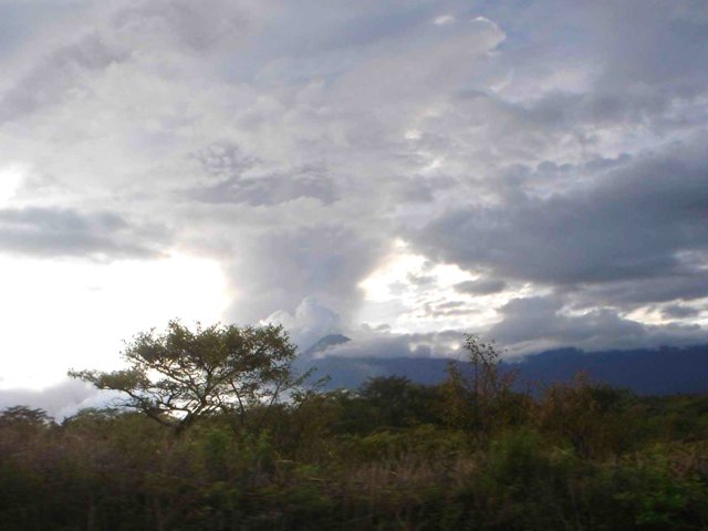 |
Figure 80. A photo of the explosive eruption on Colima on 5 July 2005 taken from the E. Courtesy of CVO. |
Several explosions continued during 6-19 July, and small landslides traveled down the volcano's flanks during 8-9 July and 15-18 July. On 21 and 23 July, small ash emissions and lahars occurred. On the 21st during 1750-1830 a lahar traveled SSE down the Monte Grande ravine. Emissions rose to a maximum altitude of 9.1 km on 27 July. During 29 July to 1 August, steam-and-ash emissions occurred at Colima. According to the Washington VAAC, the highest-rising emission reached 6.1 km altitude on 30 July.
On 4 August the Washington VAAC reported that the Mexico City MWO observed a steam plume rising to 7.2 km altitude in imagery seen on the Colima video camera. During15-31 August, small explosions produced low-level ash plumes. The largest events, on 21 and 22 August, produced plumes that drifted W. On 31 August a 45-minute seismic signal associated with a lahar was recorded at the Monte Grande station. The lahar caused no damage.
Throughout the month of September, several small explosions occurred at Colima. On 16 September at 1045 an explosion sent an ash plume to ~ 9.8 km altitude. The local civil defense agency stated in a news report that ash fell on towns NW of the volcano. Prior to the explosion, microseismicity was recorded for several days. Universidad de Colima reported that microseismicity often precedes significant explosions. On 27 September at 0507 an explosion produced a plume to a altitude of ~ 7.6 km altitude. The plume drifted WSW, depositing small amounts of ash in the cities of Colima, Villa de álvarez, and Comala. On 28 September another explosion sent an ash plume to an altitude of ~ 6.1 km altitude and drifted NNW.
Small explosions continued to occur from October through the end of February 2006 (the end of this report), and produced visible ash plumes. Several small explosions during 16-21 November 2005 produced steam-and-ash clouds to low levels above the volcano. Explosions on 12 December 2005 resulted in small amounts of ash deposited in areas SW of the volcano.
Geological Summary. The Colima complex is the most prominent volcanic center of the western Mexican Volcanic Belt. It consists of two southward-younging volcanoes, Nevado de Colima (the high point of the complex) on the north and the historically active Volcán de Colima at the south. A group of late-Pleistocene cinder cones is located on the floor of the Colima graben west and east of the complex. Volcán de Colima (also known as Volcán Fuego) is a youthful stratovolcano constructed within a 5-km-wide scarp, breached to the south, that has been the source of large debris avalanches. Major slope failures have occurred repeatedly from both the Nevado and Colima cones, producing thick debris-avalanche deposits on three sides of the complex. Frequent recorded eruptions date back to the 16th century. Occasional major explosive eruptions have destroyed the summit (most recently in 1913) and left a deep, steep-sided crater that was slowly refilled and then overtopped by lava dome growth.
Information Contacts: Observatorio Vulcanológico de la Universidad de Colima, Colima, Col., 28045, México (URL: https://portal.ucol.mx/cueiv/); Washington Volcanic Ash Advisory Center (VAAC), Satellite Analysis Branch (SAB), NOAA/NESDIS E/SP23, NOAA Science Center Room 401, 5200 Auth Rd, Camp Springs, MD 20746, USA (URL: http://www.ospo.noaa.gov/Products/atmosphere/vaac/).