Report on Anatahan (United States) — February 2007
Bulletin of the Global Volcanism Network, vol. 32, no. 2 (February 2007)
Managing Editor: Richard Wunderman.
Anatahan (United States) Increased seismicity and plumes during February-March 2007
Please cite this report as:
Global Volcanism Program, 2007. Report on Anatahan (United States) (Wunderman, R., ed.). Bulletin of the Global Volcanism Network, 32:2. Smithsonian Institution. https://doi.org/10.5479/si.GVP.BGVN200702-284200
Anatahan
United States
16.35°N, 145.67°E; summit elev. 790 m
All times are local (unless otherwise noted)
Regular plume emissions seen in satellite imagery and by aviators during March-May 2006 (BGVN 31:05) apparently ended in June, with the last reported activity being a pilot report of an ash cloud on 26 June that reached 3 km altitude. A report issued by the U.S. Geological Survey (USGS) on 7 December noted that the Alert Level was being lowered to Green and that seismic activity at Anatahan was very low during late November and early December, although diffuse steam-and-gas plumes were occasionally visible on recent satellite images or by aviators.
According to the USGS, seismometers recorded tremor starting on 24 February (UTC) that continued at high levels through 17 March. During that time, recorded tremor occasionally increased to much higher values. In addition, OMI satellite spectrometer data showed occasionally high amounts of sulfur dioxide over Anatahan. Tremor levels increased significantly starting at 1625 on 9 March (UTC) and continued for over 40 hours. As of 13 March the tremor bursts were infrequent, and some were high amplitude. In addition, a distinct gas plume was visible in Moderate Resolution Imaging Spectroradiometer (MODIS) imagery, suggesting increased emissions. On that day the Alert Level was raised to Advisory.
The MODIS flying onboard the Aqua satellite captured a view of the plume on 18 March 2007 as emissions continued. In the image, the volcanic plume headed SE, then changed direction slightly and trended towards for the islands of Saipan and Tinian. The same day MODIS acquired this image, the U.S. Air Force Weather Agency reported an odor of sulfur, which would also suggest the presence of vog (volcanic smog) on Guam, ~200 km SW of Saipan. USGS and Emergency Management Office air quality instruments on Saipan recorded a maximum 5-minute average of 959 ppb sulfur dioxide and 99 ppb hydrogen sulfide on 18 March.
As of 24 March, the USGS was reporting that tremor levels after 17 March had remained low at pre-24 February levels. The plume visible in MODIS imagery had also remained weak but distinct since 18 March. On 24 March the Alert Level was lowered to Normal, with an aviation color code of Green. No confirmed ash eruptions had occurred after 3 September 2005.
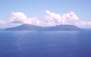
Geological Summary. The elongate, 9-km-long island of Anatahan in the central Mariana Islands consists of a large stratovolcano with a 2.3 x 5 km compound summit caldera. The larger western portion of the caldera is 2.3 x 3 km wide, and its western rim forms the island's high point. Ponded lava flows overlain by pyroclastic deposits fill the floor of the western caldera, whose SW side is cut by a fresh-looking smaller crater. The 2-km-wide eastern portion of the caldera contained a steep-walled inner crater whose floor prior to the 2003 eruption was only 68 m above sea level. A submarine cone, named NE Anatahan, rises to within 460 m of the sea surface on the NE flank, and numerous other submarine vents are found on the NE-to-SE flanks. Sparseness of vegetation on the most recent lava flows had indicated that they were of Holocene age, but the first historical eruption did not occur until May 2003, when a large explosive eruption took place forming a new crater inside the eastern caldera.
Information Contacts: Juan Takai Camacho and Ramon Chong, Emergency Management Office of the Commonwealth of the Northern Mariana Islands (EMO-CNMI), PO Box 100007, Saipan, MP 96950, USA (URL: http://www.cnmihsem.gov.mp/); Frank Trusdell, U.S. Geological Survey, 345 Middlefield Road, Menlo Park, CA 94025-3591, USA (URL: https://volcanoes.usgs.gov/nmi/activity/); U.S. Air Force Weather Agency (AFWA)/XOGM, Offutt Air Force Base, NE 68113, USA; NASA Earth Observatory (URL: http://earthobservatory.nasa.gov/NaturalHazards/); Washington Volcanic Ash Advisory Center (VAAC), Satellite Analysis Branch (SAB), NOAA/NESDIS E/SP23, NOAA Science Center Room 401, 5200 Auth Road, Camp Springs, MD 20746, USA (URL: http://www.ospo.noaa.gov/Products/atmosphere/vaac/).

