Report on Soputan (Indonesia) — November 2007

Bulletin of the Global Volcanism Network, vol. 32, no. 11 (November 2007)
Managing Editor: Richard Wunderman.
Soputan (Indonesia) Ash plumes and seismic activity continue through November 2007
Please cite this report as:
Global Volcanism Program, 2007. Report on Soputan (Indonesia) (Wunderman, R., ed.). Bulletin of the Global Volcanism Network, 32:11. Smithsonian Institution. https://doi.org/10.5479/si.GVP.BGVN200711-266030
Soputan
Indonesia
1.112°N, 124.737°E; summit elev. 1785 m
All times are local (unless otherwise noted)
Our last report on Soputan (BGVN 32:01) indicated that Soputan's lava dome was still emitting gas and generating rockfalls and ash plumes to 12 km in altitude through December 2006. This report, which includes a map (figure 3), discusses activity through November 2007.
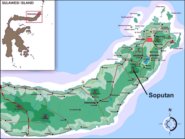 |
Figure 3. A map of northern Sulawesi island (Indonesia), with Soputan labeled. Inset shows entire island. Copyrighted map by pbi design (2002); graphic by Michael Wijaya. |
According to the Center of Volcanology and Geological Hazard Mitigation (CVGHM), diffuse ash plumes rose from Soputan to an altitude of 1.8 km during 20-25 June 2007. The Alert Level remained at 3 (on a scale of 1-4), where it had been since 15 December 2006. Between 11 June and 1 July 2007 the only seismicity recorded was caused by rockfalls, with 107 events during 11-17 June, 124 events during 18-24 June, and 78 events during 25 June-1 July.
News accounts reported that Soputan erupted on 14 August, producing ash plumes that, according to the Darwin Volcanic Ash Advisory Centre (VAAC), rose to 4.6 km altitude and drifted W. Lava and rock avalanches were also observed. According to Yahoo! Canada News, volcanologist Sandy Manengke indicated that no injuries or damage were reported, but that villages along Soputan's base were covered in volcanic dust, and many residents were wearing face masks. According to Reuters, Saut Simatupang, head of Indonesia's Volcanology Survey, told the news agency that no evacuation was ordered and the Alert Level was not raised to 4 (maximum) because Soputan was unlikely to erupt in a way that would threaten the nearest village, 11 km from its crater. On 15 August seismicity decreased.
Based on observations of satellite imagery and information from CVGHM, the Darwin VAAC reported that an ash plume rose to an altitude of 4.6 km and drifted W during 14-15 August. Visual observations were made on 24-25 October and 30-31 October 2007 of white and gray plumes that rose to altitudes of 1.8-3.3 km and drifted W. In addition, based upon pilot reports and satellite imagery, the Darwin VAAC reported that on 25-26 October, ash plumes rose to 13.7 km altitude and drifted WSW. On 25 October, lava flowed 500-600 m down the W flank and flowed again on 30 October. Villagers and tourists were warned not to travel within a 6 km radius of the summit.
MODVOLC data (which is MODIS satellite thermal infrared data processed to indicate possible volcanism) is sometimes helpful in assessing lava and dome emissions at volcanoes. Alerts for 2007 appeared in August (7 alerts), October (23 alerts), and November (2 alerts). During 2006, alerts took place in December (11 alerts) and October (5).
According to CVGHM, the Alert Status was lowered from 3 to 2 on 23 November, based on a decrease in the number of earthquakes and seismic intensity, deformation measurements, and visual observations.
Geological Summary. The Soputan stratovolcano on the southern rim of the Quaternary Tondano caldera on the northern arm of Sulawesi Island is one of Sulawesi's most active volcanoes. The youthful, largely unvegetated volcano is the only active cone in the Sempu-Soputan volcanic complex, which includes the Soputan caldera, Rindengan, and Manimporok (3.5 km ESE). Kawah Masem maar was formed in the W part of the caldera and contains a crater lake; sulfur has been extracted from fumarolic areas in the maar since 1938. Recent eruptions have originated at both the summit crater and Aeseput, a prominent NE-flank vent that formed in 1906 and was the source of intermittent major lava flows until 1924.
Information Contacts: Center of Volcanology and Geological Hazard Mitigation (CVGHM), Diponegoro 57, Bandung, Jawa Barat 40122, Indonesia (URL: http://vsi.esdm.go.id/); Jenny Farlow, Darwin Volcanic Ash Advisory Centre, Bureau of Meteorology, Australia (URL: http://www.bom.gov.au/info/vaac/); Hawai'i Institute of Geophysics and Planetology (HIGP) Hot Spots System, University of Hawai'i, 2525 Correa Road, Honolulu, HI 96822, USA (URL: http://modis.higp.hawaii.edu/); Reuters (URL: http://www.reuters.com/); Yahoo! Canada News (URL: http://ca.news.yahoo.com/).