Report on Izu-Tobu (Japan) — February 2013
Bulletin of the Global Volcanism Network, vol. 38, no. 2 (February 2013)
Managing Editor: Richard Wunderman.
Izu-Tobu (Japan) Quiet prevails despite the Tohoku megathrust of March 2011
Please cite this report as:
Global Volcanism Program, 2013. Report on Izu-Tobu (Japan) (Wunderman, R., ed.). Bulletin of the Global Volcanism Network, 38:2. Smithsonian Institution. https://doi.org/10.5479/si.GVP.BGVN201302-283010
Izu-Tobu
Japan
34.9°N, 139.098°E; summit elev. 1406 m
All times are local (unless otherwise noted)
Our previous report on Izu-Tobu (BGVN 23:04) summarized the elevated seismicity that began on 20 April 1998 in the eastern Izu Peninsula and started declining around 10 May. The activity included crustal deformation, indicating inflation likely linked to shallow magmatic activity. Izu-Tobu is located 100 km SW of Tokyo and just inland from the coast on the Izu peninsula.
Recent reports from the Japan Meteorological Agency (JMA) noted the Tohoku megathrust of March 2011, centered 400 km to the NE of Izu-Tobu, and that Izu-Tobu lacked any signs of correlated behavior as a result of that M 9.0 earthquake event and the numerous aftershocks.
Izu-Tobu had been quiet since March 2011 until 17 July when seismicity increased and small earthquakes with epicenters around Ito city (8.5 km N) were detected. Earthquakes on 18 July were M 2.5 and M 2.8 (interim values). A maximum seismic intensity of 1 on the JMA scale was observed in Ito-city and Higashi-Izu town (15 km SSW). Seismicity declined to the usual background level the following day. Ground deformation was observed around seismically active areas.
Seismicity along an area from Arai (8 km N) through offshore Shiofuki-zaki (2 km E of Ito-city), increased during 18-23 August 2011, then declined after 24 August. No earthquakes were observed until 22 September when the number of earthquakes temporarily increased at a shallower area around Usami; this activity was interpreted as not being directly related to magma intrusion.
Prior to the 22 September 2011 seismic activity, the volumetric strainmeter at Higashi-Izu town (15 km SSW) showed continuous contraction; the tiltmeter at Ito-city showed an apparent change on 18 September. The trend slowed as seismicity decreased; no change was observed after 23 September. GPS measurements did not exhibit remarkable changes and low-frequency earthquakes and tremor were not observed. The Alert Level at Izu-Tobu remained at 1.
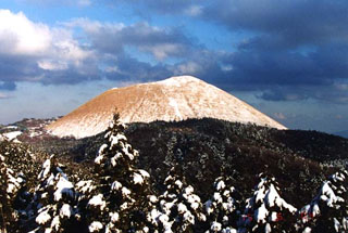
Geological Summary. The Izu-Tobu volcano group (Higashi-Izu volcano group) is scattered over a broad, plateau-like area of more than 400 km2 on the E side of the Izu Peninsula. Construction of several stratovolcanoes continued throughout much of the Pleistocene and overlapped with growth of smaller monogenetic volcanoes beginning about 300,000 years ago. About 70 subaerial monogenetic volcanoes formed during the last 140,000 years, and chemically similar submarine cones are located offshore. These volcanoes are located on a basement of late-Tertiary volcanic rocks and related sediments and on the flanks of three Quaternary stratovolcanoes: Amagi, Tenshi, and Usami. Some eruptive vents are controlled by fissure systems trending NW-SE or NE-SW. Thirteen eruptive episodes have been documented during the past 32,000 years. Kawagodaira maar produced pyroclastic flows during the largest Holocene eruption about 3,000 years ago. The latest eruption occurred in 1989, when a small submarine crater was formed NE of Ito City.
Information Contacts: Japan Meteorological Agency (JMA), Otemachi, 1-3-4, Chiyoda-ku Tokyo 100-8122, Japan (URL: http://www.jma.go.jp/).