Report on Nishinoshima (Japan) — October 2015

Bulletin of the Global Volcanism Network, vol. 40, no. 10 (October 2015)
Managing Editor: Edward Venzke.
Edited by A. Elizabeth Crafford.
Nishinoshima (Japan) New eruption covers and enlarges 1973 island with lava flows and Strombolian eruptions
Please cite this report as:
Global Volcanism Program, 2015. Report on Nishinoshima (Japan) (Crafford, A.E., and Venzke, E., eds.). Bulletin of the Global Volcanism Network, 40:10. Smithsonian Institution. https://doi.org/10.5479/si.GVP.BGVN201510-284096
Nishinoshima
Japan
27.247°N, 140.874°E; summit elev. 100 m
All times are local (unless otherwise noted)
Nishinoshima volcano continued its dramatic above-sea-level growth with lava flows, Strombolian eruptions, discolored water, and ash plumes in 2014. The Hydrographic and Oceanographic Department of the Japan Coast Guard (JCG) and the Japan Maritime Self Defense Force (JMSDF) provided monthly photographic and video documentation and measurements of the growth of the island, which is located approximately 940 km S of Tokyo along the Izu-Bonin trench. The Japan Meteorological Agency (JMA) has also provided monthly reports of the eruption.
New subaerial activity began on 20 November 2013, almost 40 years after the last recorded island-building event in 1973-74. During the interval between these eruptions, a number of submarine events are suspected based on discolored water and volcanic debris reported, but no lava had breached the ocean surface. The emergence of the volcanic center and its merging with the adjacent island between November 2013 and February 2014 were described in a previous Bulletin (BGVN 38:11).
After lava flows from the new vent flowed north and reached the older island in late December 2013, the lava flows continued in all directions away from the central crater (Crater 1) and a second smaller crater (Crater 2) that formed adjacent to crater 1. By early January 2014 many active lava flows from the two craters were simultaneously entering the ocean (figure 13).
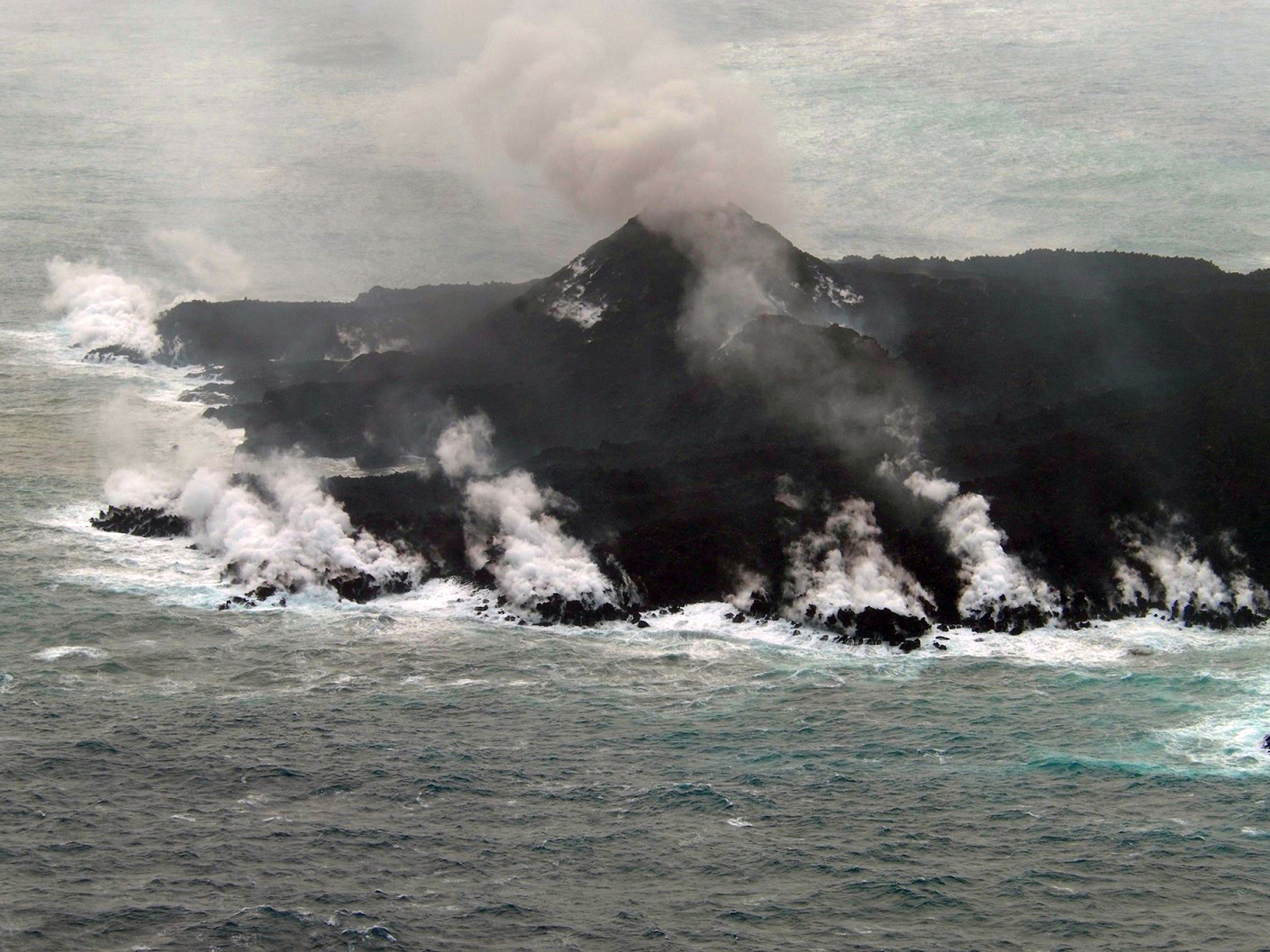 |
Figure 13. At least seven steam plumes at Nishinoshima indicating lava reaching the ocean are visible in this 16 January 2014 photograph. Plumes of steam and ash are also visible coming from the two central craters. Courtesy of JMSDF. |
Based on satellite analysis, Tokyo VAAC reported ash plumes on 21 and 26 January 2014. The 21 January plume rose to 900 m and drifted E. The 26 January plume rose to 1,200 m and drifted NE. Crater 2, a short distance north of Crater 1, first opened on 24 December 2013 and was actively emitting steam by the end of January 2014 (figure 14). Incandescent material was observed by JMSDF inside Crater 2 on 29 January; light grayish-white plumes intermittently rose to 800 m at intervals of approximately one minute, and ejecta were scattered several tens of meters into the air above the crater. Bluish-white plumes also continuously rose to approximately 500 m above Crater 1.
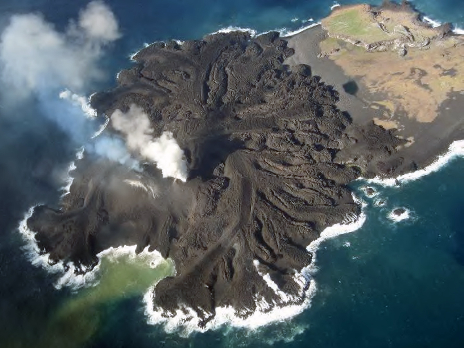 |
Figure 14. Two active craters on the new volcanic edifice at Nishinoshima are visible in this 29 January 2014 photograph. Note the bluish-white plumes rising from the southern crater (Crater 1) and the white steam plumes issuing from the northern crater (Crater 2). A yellow-orange plume drifts easterly in the water at the base of the active vents. Courtesy of JMSDF and the JMA. |
Plumes rose as high as 1,500 m in February 2014 according to JCG. By 11 February, the Japan Coast Guard reported the new land area from lava flows was 920 m E-W and 750 m N-S. Incandescence was photographed at Crater 2 along with a rapidly changing landscape from the active lava flows (figure 15). In just three weeks, the lagoon on the eastern side of the island went from open (figure 14), to closed off by lava flows and volcanic debris (figure 16).
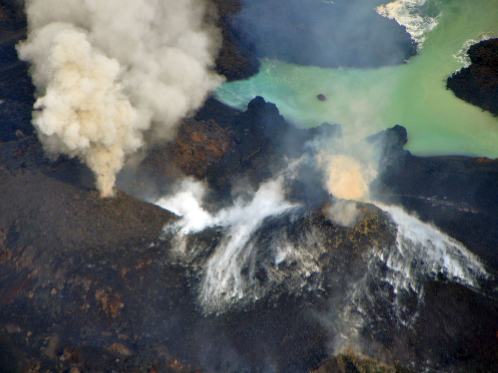 |
Figure 15. Crater 2 (left) at Nishinoshima issues gray and white plumes on 11 February 2014 from an incandescent center, while cooling flows around the cone of Crater 1 (right) emit steam, along with a smaller brown ash plume. Note the lagoon (upper right) has been almost closed off from lava flows since 29 January (figure 14). Courtesy of JCG. |
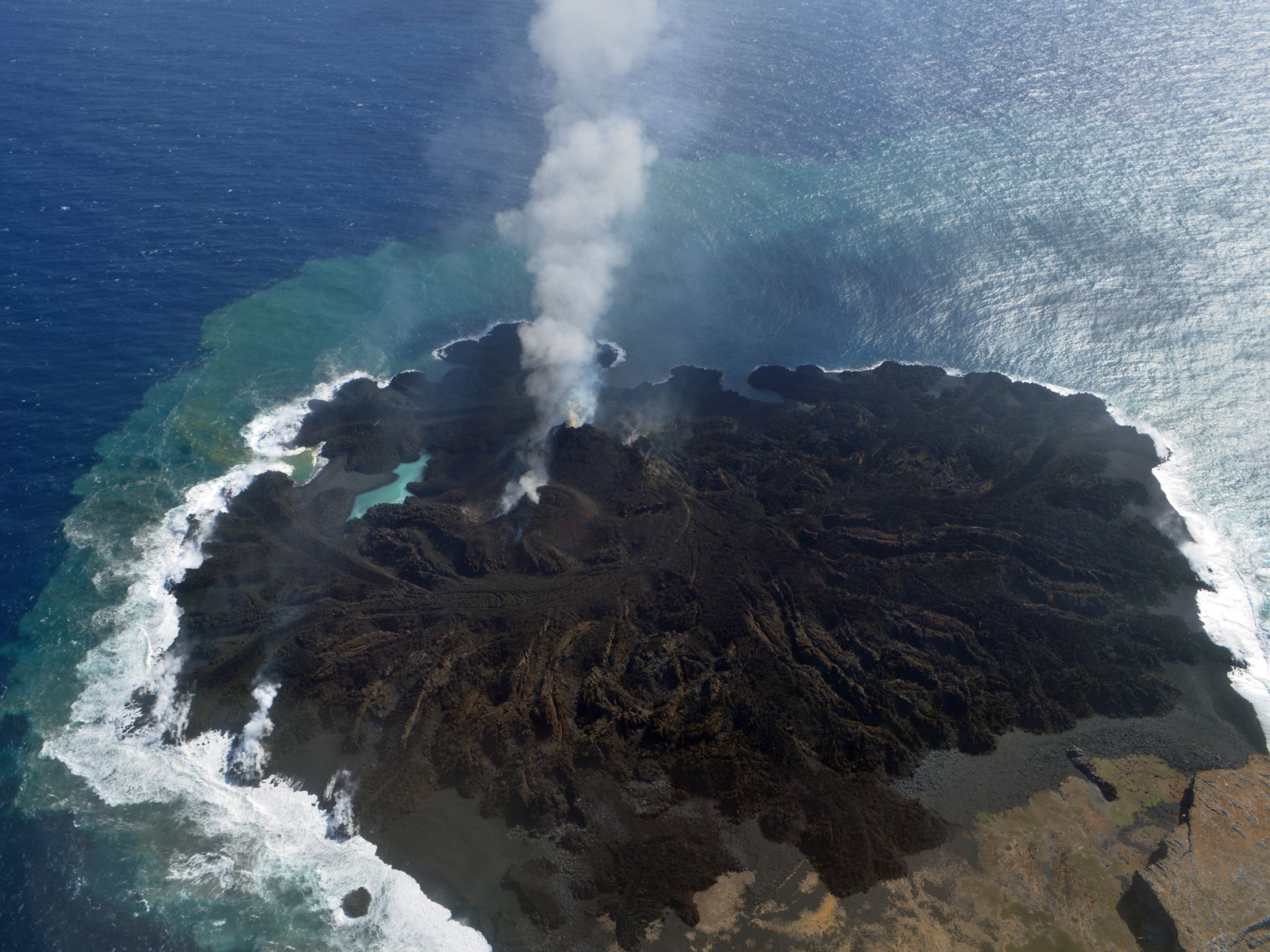 |
Figure 16. Photograph of Nishinoshima on 21 February 2014 showing that the lagoon at the base of the cones is completely cut off by lava flows, and active plumes rising from both craters. Courtesy of JCG. |
Based on satellite images, Tokyo VAAC reported a plume on 18 April 2015 rising to just over 2,100 m and drifting E. On 15 April, the land area was reported by JCG as 1,190 x 1,000 m, with an elevation of 72 m at the highest point. A new cone (Crater 3) that emerged in between the first two was first observed on 21 May 2015 with incandescent spatter reaching tens of meters into the air (figure 17).
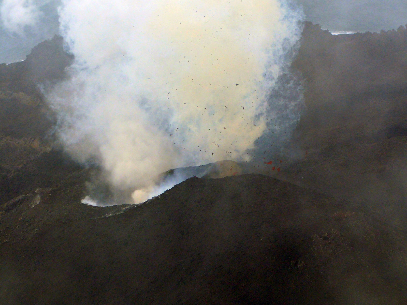 |
Figure 17. Incandescent spatter from the newly formed Crater 3 at Nishinoshima on 21 May 2014, located between craters 1 and 2. Courtesy of JCG. |
New land area was rapidly forming from lava flows from three active craters and sedimentation of pyroclastic materials around the island in May and June, especially eastward (figure 18).
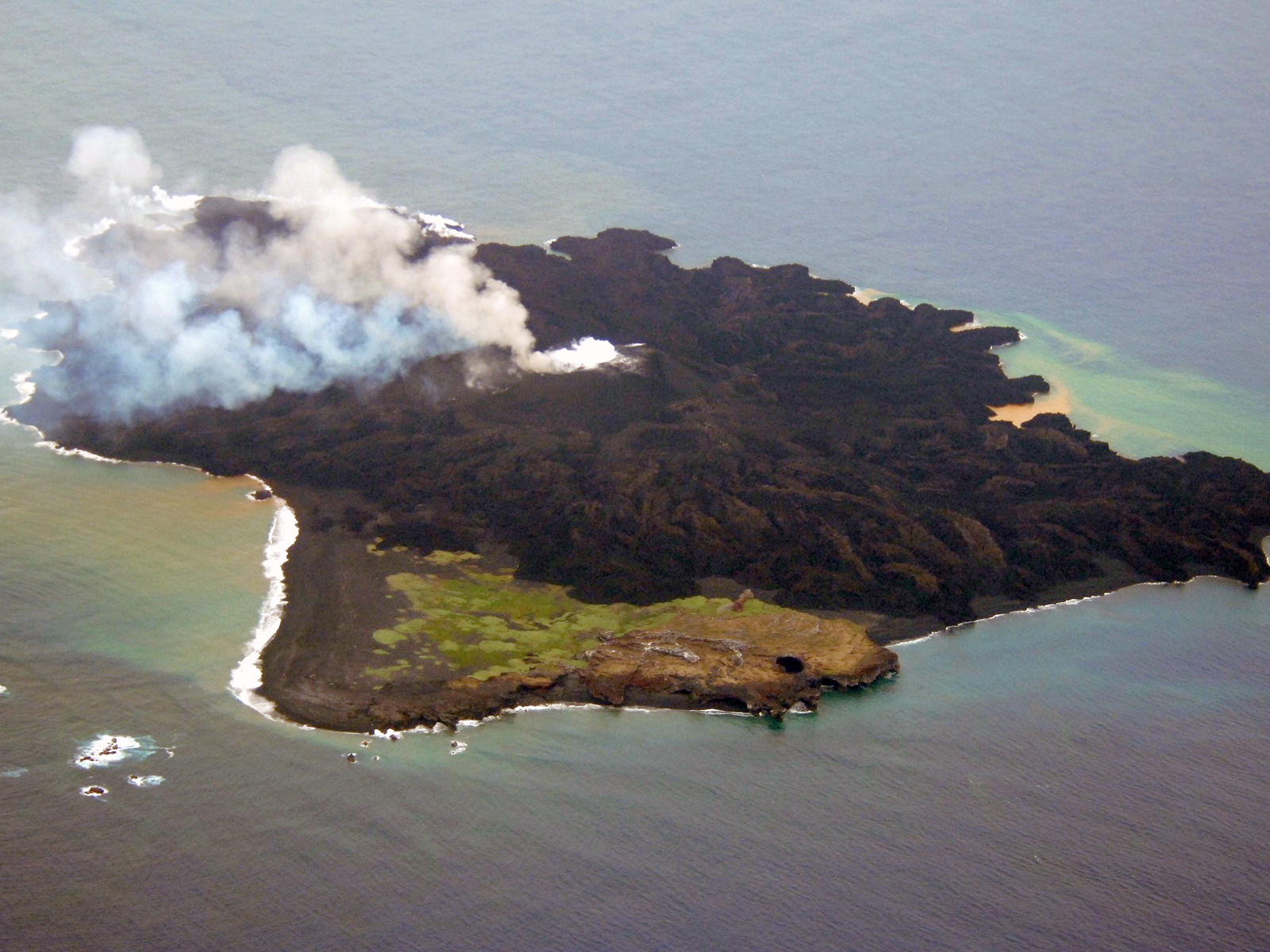 |
Figure 18. The extensive growth of Nishinoshima island is apparent in this 11 June 2014 photo. Note extensive lava flows to the east (upper left). View looking south. All three craters in the center are active. Courtesy of JMSDF. |
On 13 June 2014 a fourth crater was seen emitting brown ash plumes (figures 19, 20). The Japan Meteorological Agency (JMA) increased warning levels to a 6 mile radius around the island in case of submarine eruptions on 11 June.
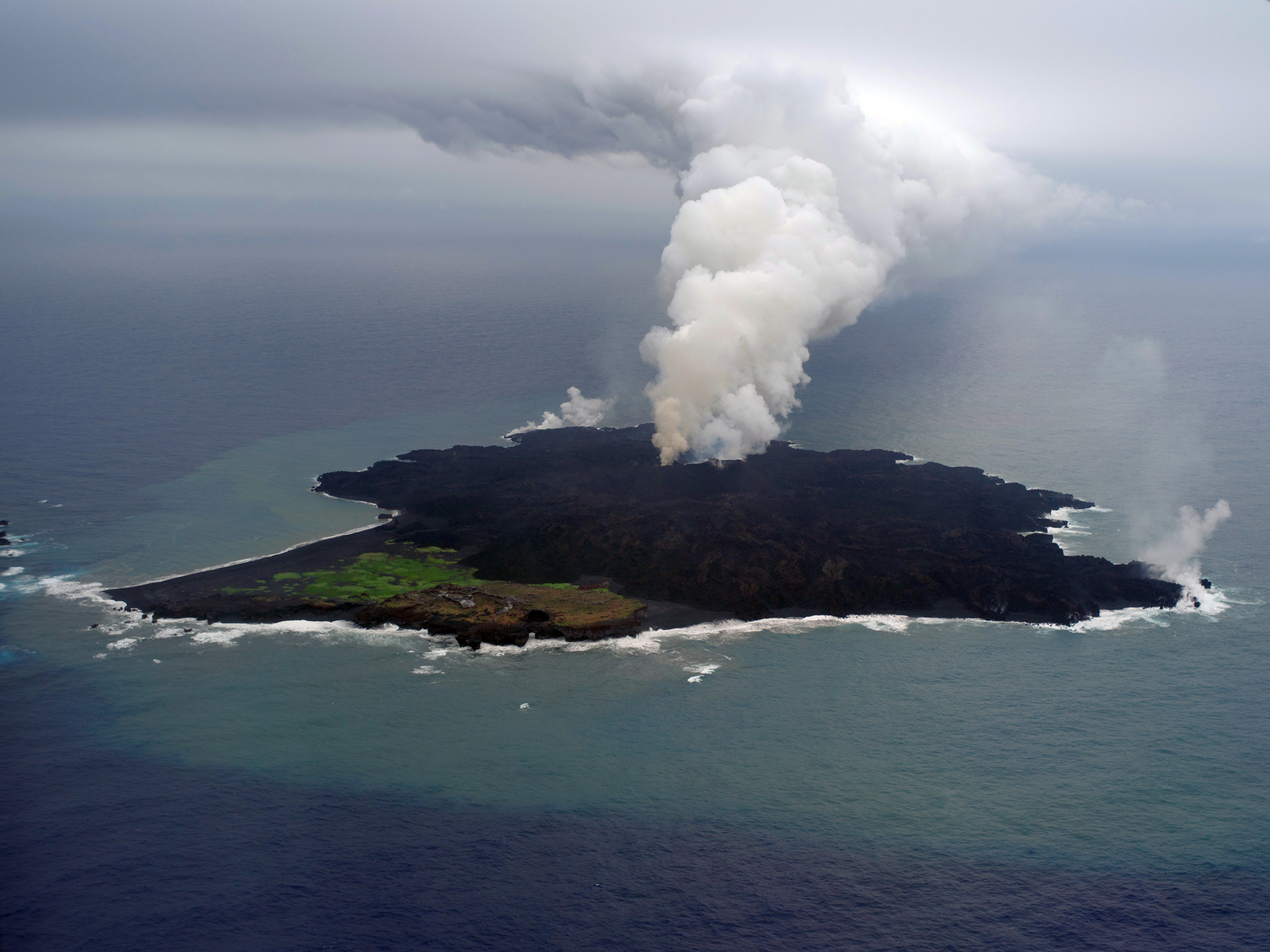 |
Figure 19. New Crater 4 at Nishinoshima emitted a small brown ash plume on 13 June 2014. Much larger steam plumes are rising from the older craters. Steam is also visible in at least two places from multiple lava ocean entry sites. Courtesy of JCG. |
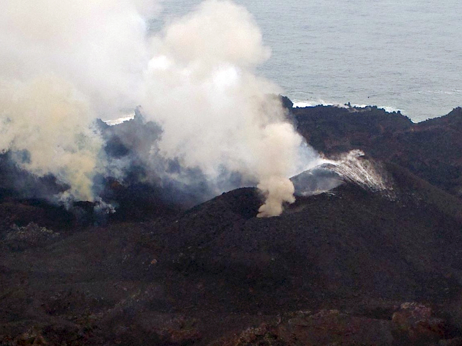 |
Figure 20. Closeup of Crater 4 (left) at Nishinoshima emitting a brown ash plume, and craters 2 and 3 (right) emitting steam and ash plumes on 13 June 2014. Courtesy JCG. |
Tokyo VAAC reported an ash plume rising to 3,000 m and drifting NW on 30 June 2014. JCG observed another new crater (Crater 5) on the east side of the island generating a continuous steam-and-ash plume on 23 July 2014 (figures 21, 22).
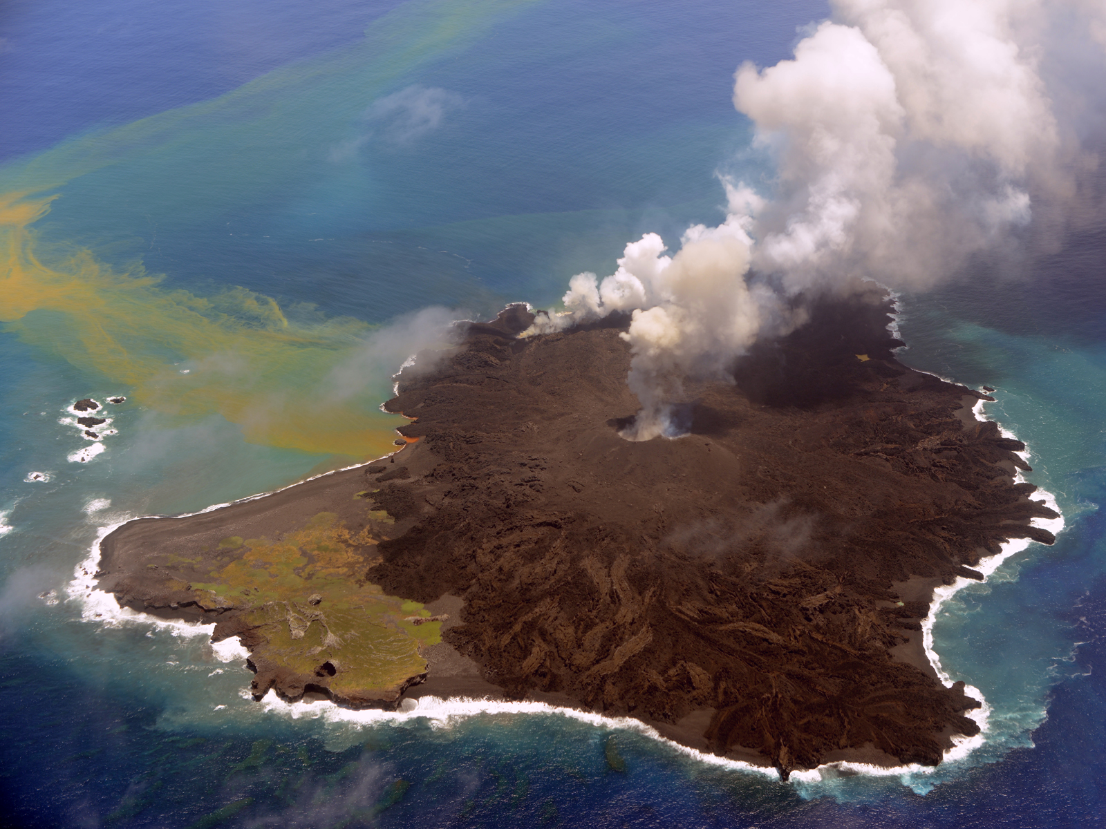 |
Figure 21. A new crater (crater 5) on Nishinoshima emits ash and steam on 23 July 2014 on the far E side of the island. The large central crater area (craters 1-3) remained incandescent, and emitted continuous ash plumes. Note the large orange plume of volcanic material in the ocean drifting east and south away from the island. Courtesy of JCG. |
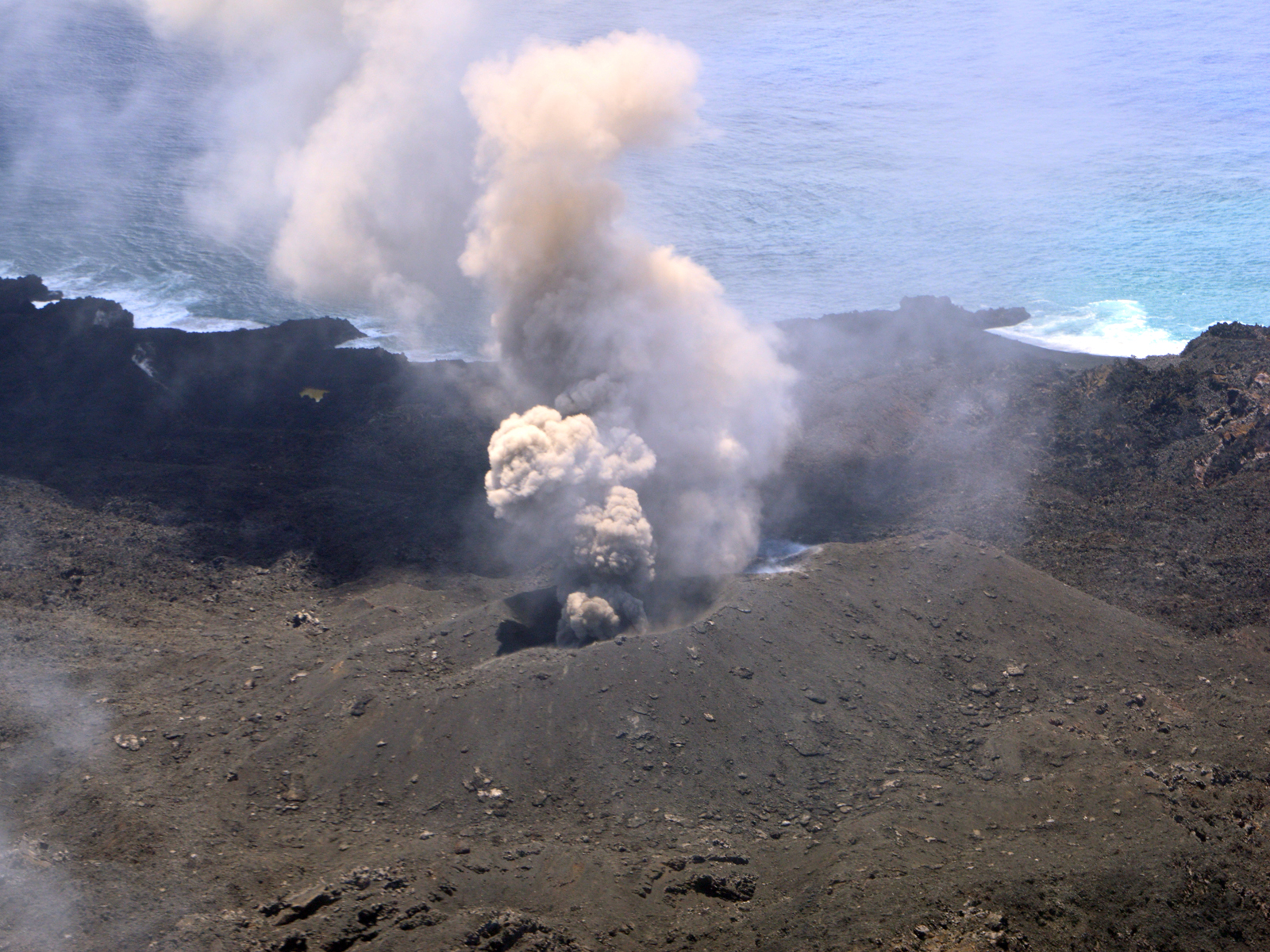 |
Figure 22. A close up view of Nishinoshima on 23 July 2014 showing Crater 5 emitting ash and steam. Courtesy of JCG. |
Crater 6 was first observed to the E of the main crater complex on 26 August 2014 (figure 23). Lava flowing from the central crater complex had enlarged Crater 2 and created an oval lava mound with dimensions of 90 x 60 m. The overall dimensions of newly formed land were around 1,550 m E-W and 1,250 m N-S, and the highest elevation was 87 m.
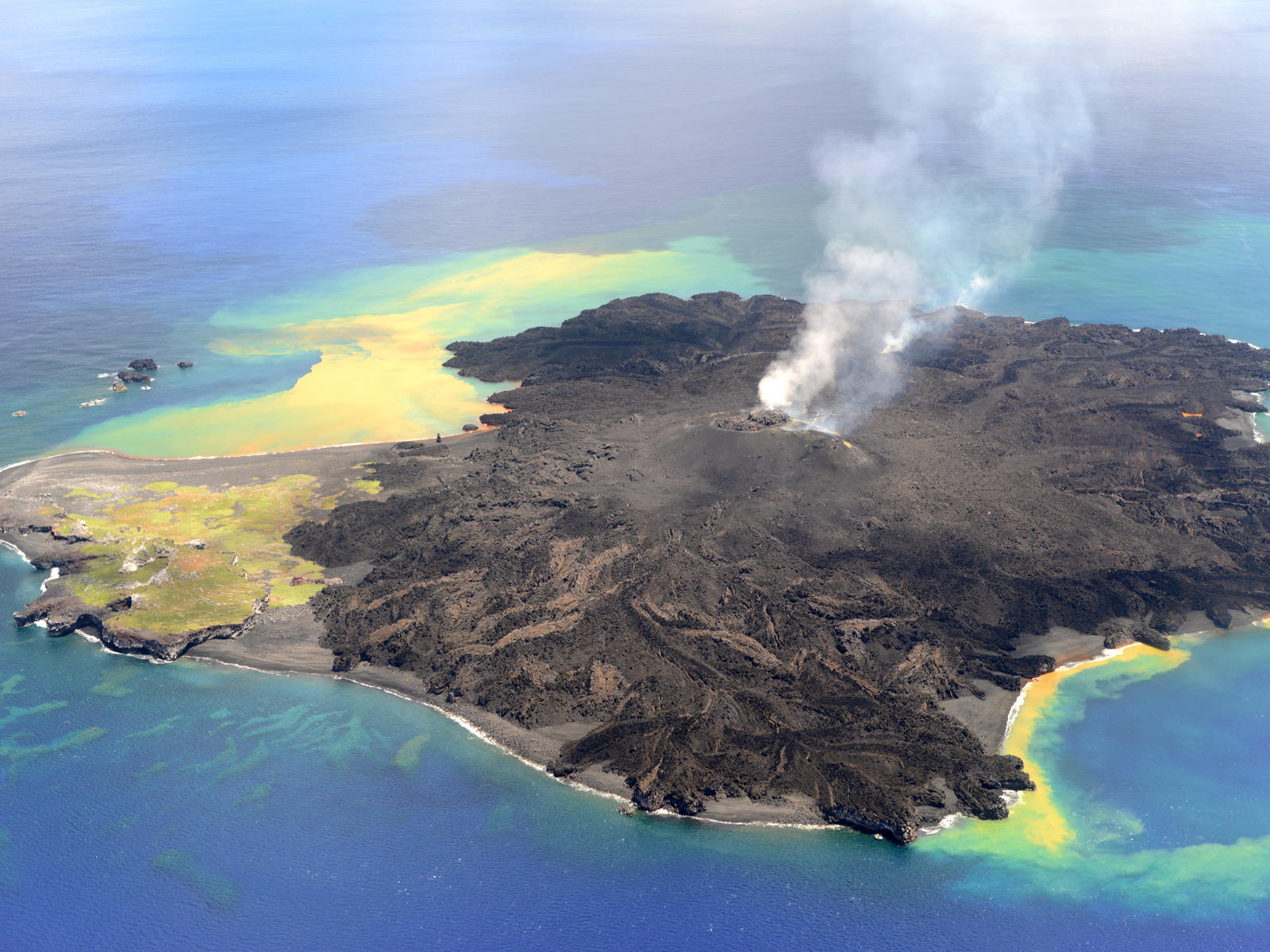 |
Figure 23. Crater 6 is visible in the distance in this view of Nishinoshima on 26 August 2014, behind the main crater complex. Lava flows have covered over much of the original land to the north (towards the left). Note the large ocean plume of yellow volcanic debris drifting E and S from the island, and smaller yellow and green plume drifting south from the west side. Courtesy of JCG. |
Tokyo VAAC reported an ash plume that rose to 3,000 m and drifted S on 16 September. Aerial observation conducted by JCG on 17 September 2014 found that most of the lava mound identified on 26 August had become buried in a new pyroclastic cone that had formed to the north of it. A new row of three craters (vent 7) was found to the north of this new cone. Lava was flowing northward from the new row of craters and covering much of the original island (figures 24, 25), and discolored water in hues from brown to light brown was observed around the island. The change in the amount of lava since 26 August is easily recognized (compare figures 23 and 25). Most of the old part of the island was covered by 17 September 2014.
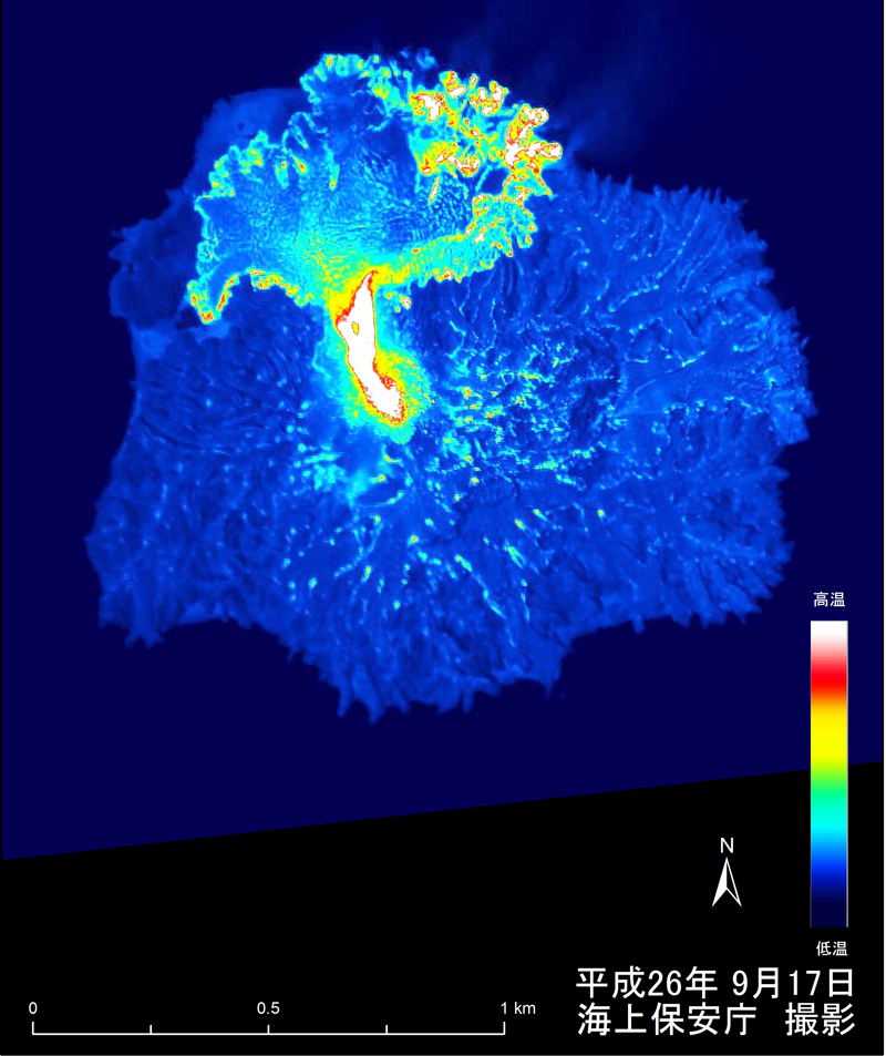 |
Figure 24. A thermal image taken of Nishinoshima on 17 September 2014 reveals the extent of new lava flowing northward from Crater 7, covering the older part of the island. Courtesy of JCG. |
 |
Figure 25. Photograph of Nishinoshima on 17 September 2014 which reveals the extent of new lava formed since 26 August image (figure 23). The flows are coming from a string of three vents inside Crater 7, located in the region of the original crater. Courtesy of JCG. |
A detailed series of sketches provided by the Japan Coast Guard shows the growth of the island from 21 November 2013 through 17 September 2014, highlighting the different cones, craters, and lava flows throughout this time (figure 26). Photographs of many of these stages are shown in the previous images.
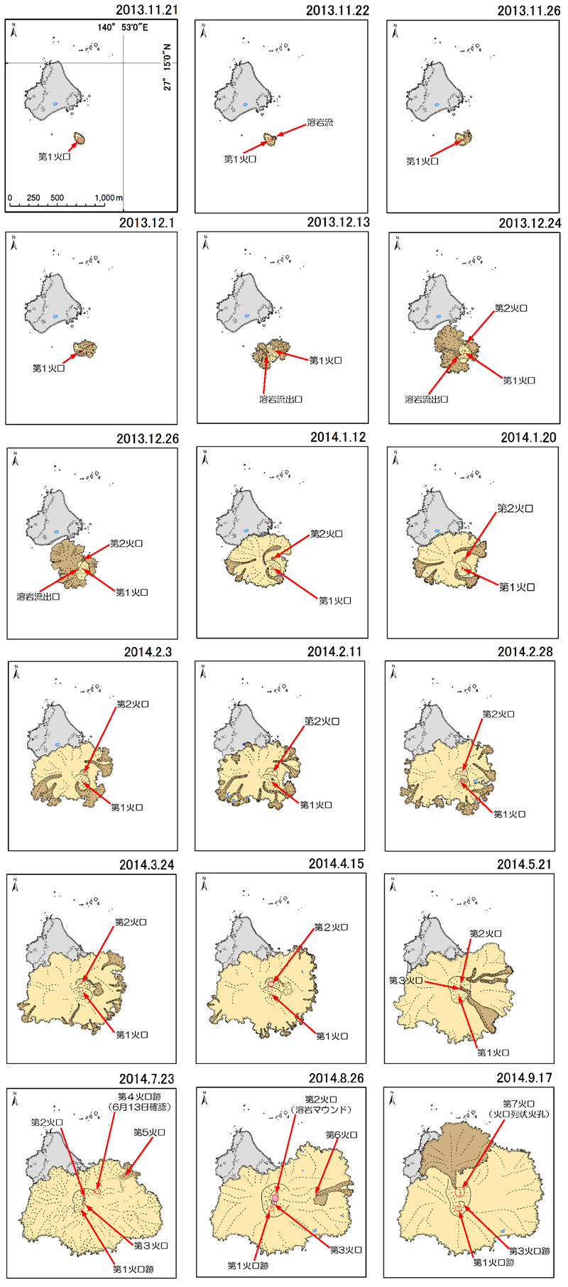 |
Figure 26. A series of sketches highlighting the growth of Nishinoshima from 21 November 2013 to 17 September 2014. Lava flows are shown in pale yellow and brown. The original pre-eruption island is shown in gray. The images chronical the growth of seven different craters that contributed lava flows and pyroclastic debris to the growing island, and are shown in red. Numbered red arrows identify each crater. Courtesy of JCG. |
By the middle of October a large new area of lava flows had extended to the north and east well beyond the older part of the island, and lava flows were entering the sea over the entire northeastern quadrant of the island at many locations (figure 27). Strombolian eruptions with ejecta and ash plumes were observed coming from Crater 7 on the pyroclastic cone at the center of the island by JCG on 16 October 2014. The height of the cone was measured at 96 m above sea level.
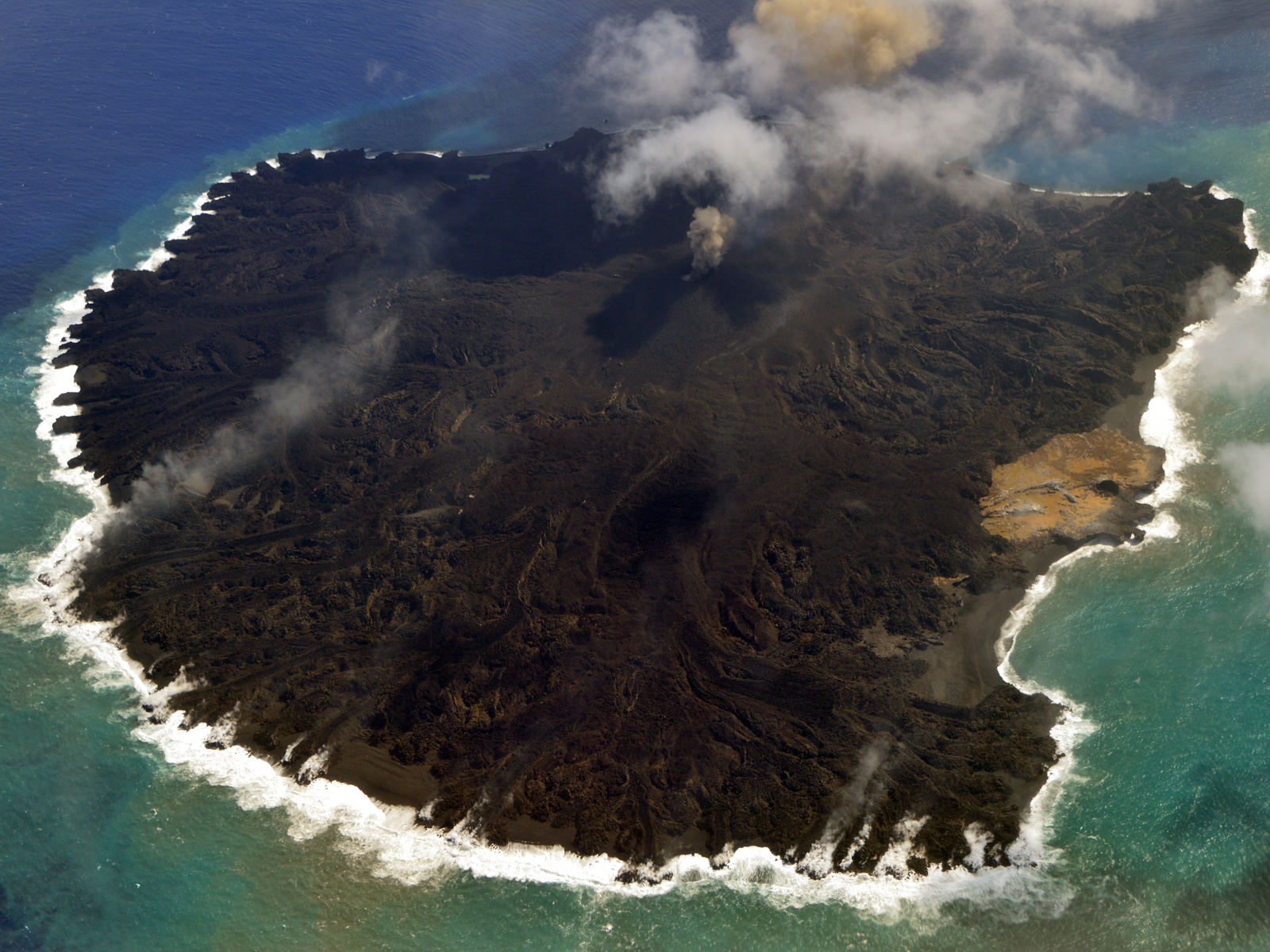 |
Figure 27. The large area of new lava flows on northeastern side of Nishinoshima on 16 October 2014 are visible in the foreground of this photograph. Note the numerous steam plumes where lava flows are entering the sea. The remnant of the old island is visible as the light brown area on the right side of image. Strombolian eruptions with ash plumes and ejecta are coming from the crater at the center of the pyroclastic cone. Courtesy of JCG. |
Aerial observations by the National Institute of Advanced Industrial Science and Technology (AIST) on 14 November 2014 found a pyroclastic cone with a single clear conical crater at the summit (Crater 7). At the crater, Strombolian eruptions were observed which produced a grayish-brown plume containing volcanic ash and ejecta. Lava was observed flowing northward from the crater and then splitting into two directions that covered both the NW and NE coasts; white-vapor spouts formed where it entered the ocean.
Data from infrasound monitoring on Chichijima Island (134 km E) facilitated by the University of Tokyo's Earthquake Research Institute (ERI) showed an air shock starting on 13 November 2014, indicating high volcanic activity at Nishinoshima along with a series of eruptions. According to Ogasawara Village Office, rumbling was heard on the island and a shock wave was also reported. Very strong thermal anomalies were seen in MODIS data using MODVOLC throughout 2014.
Aerial observation conducted by JCG on 25 December revealed periodic eruptions at Crater 7, which was producing gray plumes and emitting ejecta; lava was flowing to the NW and NE to the ocean. The extent of the island was about 1,710 m E-W and 1,830 m N-S, creating an area of around 2.29 km2 (figure 28). Plumes were also seen in aerial observation conducted by JCG on 31 December, and the last remnant of the 1973 island was barely discernable north of the pyroclastic cone (figure 29).
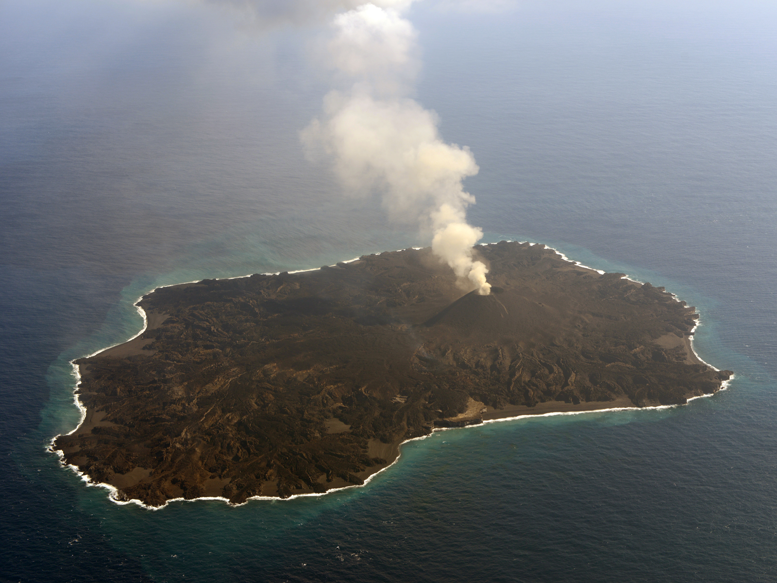 |
Figure 28. View of Nishinoshima on 25 December 2014 looking SW at the central pyroclastic cone with steam plume coming from Crater 7. Note the extent of lava flows to the NE (lower left). The only remnant of the old northern part of the island is the lighter brown area in the center foreground in front of the pyroclastic cone. Courtesy of JCG. |
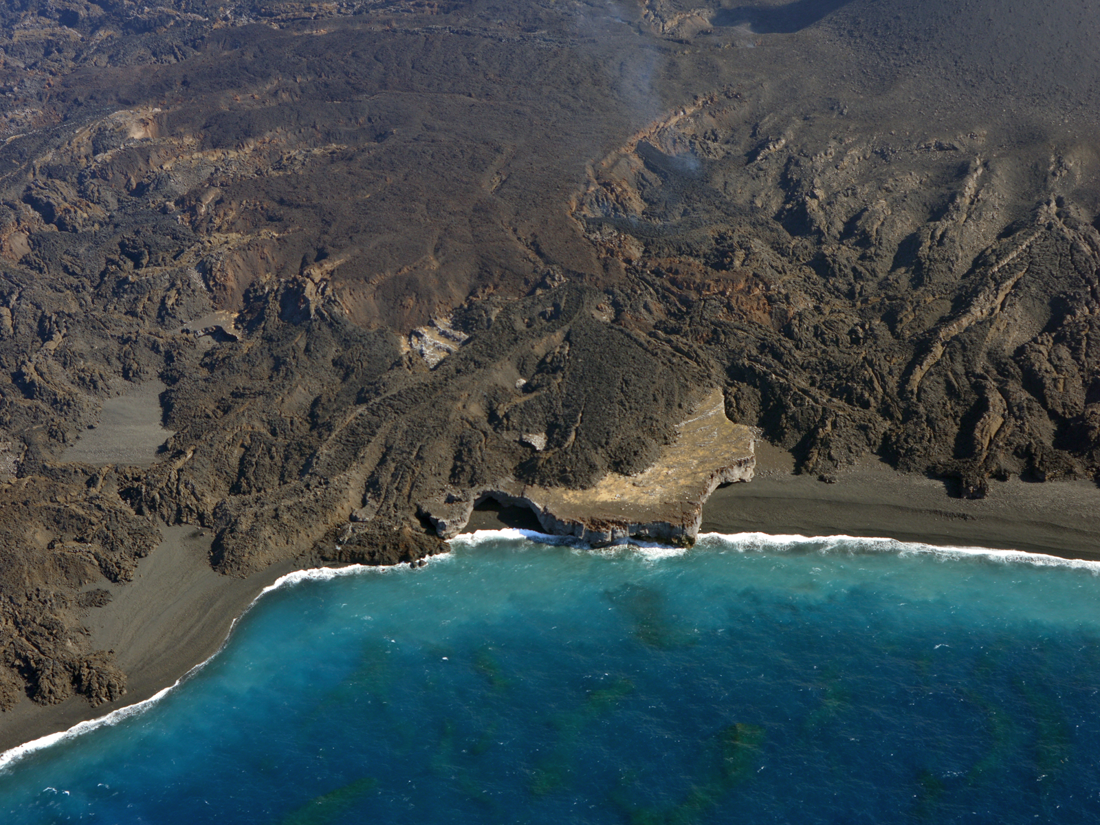 |
Figure 29. Closeup of Nishinoshima on 25 December 2014 showing the remaining fragment of the 1973 island surrounded by new lava flows and volcanic sand beaches. Courtesy of JCG. |
Geological Summary. The small island of Nishinoshima was enlarged when several new islands coalesced during an eruption in 1973-74. Multiple eruptions that began in 2013 completely covered the previous exposed surface and continued to enlarge the island. The island is the summit of a massive submarine volcano that has prominent peaks to the S, W, and NE. The summit of the southern cone rises to within 214 m of the ocean surface 9 km SSE.
Information Contacts: Japan Coast Guard (JCG), Policy Evaluation and Public Relations Office, 100-8918, 2-1-3 Kasumigaseki, Chiyoda-ku, Tokyo, Telephone, 03-3591-6361 (URL: http://www.kaiho.mlit.go.jp/e/index_e.htm); JCG Nishinoshima Data Site: http://www1.kaiho.mlit.go.jp/GIJUTSUKOKUSAI/kaiikiDB/kaiyo18-e1.htm); Japan Meteorological Agency (JMA), Otemachi, 1-3-4, Chiyoda-ku Tokyo 100-8122, Japan (URL: http://www.jma.go.jp/)