Report on Marapi (Indonesia) — June 2018
Bulletin of the Global Volcanism Network, vol. 43, no. 6 (June 2018)
Managing Editor: Edward Venzke.
Research and preparation by Paul Berger.
Marapi (Indonesia) Two explosions during April-May 2018 cause ashfall to the southeast
Please cite this report as:
Global Volcanism Program, 2018. Report on Marapi (Indonesia) (Venzke, E., ed.). Bulletin of the Global Volcanism Network, 43:6. Smithsonian Institution. https://doi.org/10.5479/si.GVP.BGVN201806-261140
Marapi
Indonesia
0.38°S, 100.474°E; summit elev. 2885 m
All times are local (unless otherwise noted)
The Marapi volcano on Sumatra (not to be confused with the better known Merapi volcano on Java) previously erupted on 4 June 2017, generating dense ash-and-steam plumes that rose as high as 700 m above the crater and caused minor ashfall in a nearby district (BGVN 42:10). The volcano is monitored by the Pusat Vulkanologi dan Mitigasi Bencana Geologi (PVMBG, also known as Centre for Volcanology and Geological Hazard Mitigation or CVGHM).
On 27 April 2018, a phreatic explosion produced an ash plume that rose 300 m above the crater rim (figure 8); a thin ash deposit was reported in the Cubadak area (Tanah Datar Regency), about 12 km SE. Another explosion at 0703 on 2 May 2018 (figure 9) produced a voluminous dense gray ash plume that rose 4 km above the crater rim and drifted SE; seismic data recorded by PVMBG indicated that the event lasted just over 8 minutes (485 seconds).
The Alert Level has remained at 2 (on a scale of 1-4), where it has been since August 2011. Residents and visitors have been advised not to enter an area within 3 km of the summit.
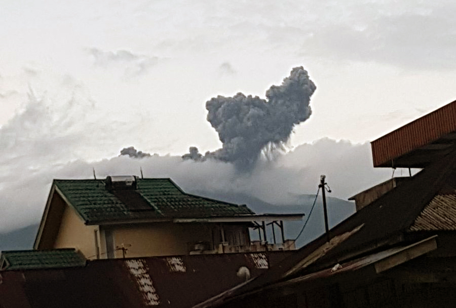 |
Figure 8. Ash plume from a phreatic explosion at Marapi on 27 April 2018. Courtesy of Sutopo Purwo Nugroho (BNPB). |
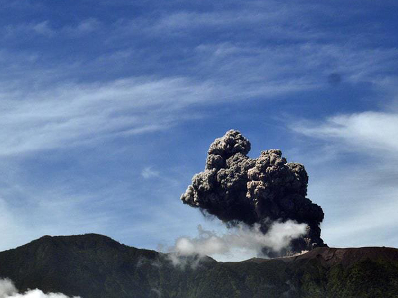 |
Figure 9. An explosion from Marapi on 2 May 2018 sent an ash plume to a height of 4 km. Courtesy of PVMBG. |
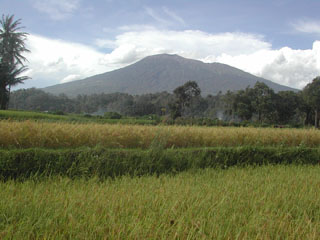
Geological Summary. Gunung Marapi, not to be confused with the better-known Merapi volcano on Java, is Sumatra's most active volcano. This massive complex stratovolcano rises 2,000 m above the Bukittinggi Plain in the Padang Highlands. A broad summit contains multiple partially overlapping summit craters constructed within the small 1.4-km-wide Bancah caldera. The summit craters are located along an ENE-WSW line, with volcanism migrating to the west. More than 50 eruptions, typically consisting of small-to-moderate explosive activity, have been recorded since the end of the 18th century; no lava flows outside the summit craters have been reported in historical time.
Information Contacts: Pusat Vulkanologi dan Mitigasi Bencana Geologi (PVMBG, also known as Indonesian Center for Volcanology and Geological Hazard Mitigation, CVGHM), Jalan Diponegoro 57, Bandung 40122, Indonesia (URL: http://www.vsi.esdm.go.id/); Badan Nasional Penanggulangan Bencana (BNPB), National Disaster Management Agency, Graha BNPB - Jl. Scout Kav.38, East Jakarta 13120, Indonesia (URL: http://www.bnpb.go.id/).