Report on San Miguel (El Salvador) — December 2022
Bulletin of the Global Volcanism Network, vol. 47, no. 12 (December 2022)
Managing Editor: Edward Venzke.
Edited by Kadie L. Bennis.
San Miguel (El Salvador) Frequent explosions, gas-and-ash emissions, and elevated sulfur dioxide during November 2022
Please cite this report as:
Global Volcanism Program, 2022. Report on San Miguel (El Salvador) (Bennis, K.L., and Venzke, E., eds.). Bulletin of the Global Volcanism Network, 47:12. Smithsonian Institution.
San Miguel
El Salvador
13.434°N, 88.269°W; summit elev. 2130 m
All times are local (unless otherwise noted)
San Miguel in El Salvador, also locally known as Chaparrastique, is a broad, deep crater complex that has been frequently modified by eruptions recorded since the early 16th century. Flank eruptions have produced many lava flows, including several during the 17th to 19th centuries that extended to the N, NE, and SE. Eruptive activity during February 2020 consisted of small ash emissions with weak thermal anomalies (BGVN 45:03). This report covers explosive activity during November 2022 based on special reports from the Ministero de Medio Ambiente y Recursos Naturales (MARN) in addition to various satellite data.
According to MARN, an eruption at the central crater began on 15 November that consisted of intermittent phreatic explosions generating gas-and-ash emissions that generally rose 500 m above the crater (figure 30). By 1100 on 20 November a total of 62 phreatic explosions had been recorded, averaging 10 explosions per day. Seismicity was characterized by volcano-tectonic (VT) events, long-period (LP) earthquakes, and tremor (TR).
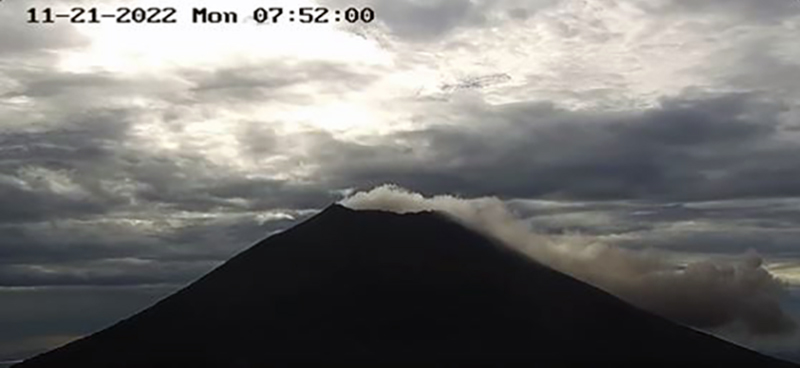 |
Figure 30. Webcam image showing a gas-and-ash plume from San Miguel on 21 November 2022. Courtesy of MARN. |
Eruption plumes at 1336 on 18 November and at 1206 on 19 November rose as high as 1.1 km above the crater rim. Some explosion events were accompanied by crater incandescence during 15-20 November; Sentinel-2 infrared satellite imagery showed a small thermal anomaly at the summit crater on 17 and 22 November (figure 31). Energetic explosions were reported at 1302 and 1642 on 26 November and at 0718 and 0802 on 27 November that ejected hot rocks onto the flanks and generated eruption plumes that rose as high as 1.1 km above the crater rim. A total of 194 explosions were recorded during 15-29 November, with a daily average of 12. On 7 December MARN reported that seismicity had decreased, and no explosions had been detected since 29 November.
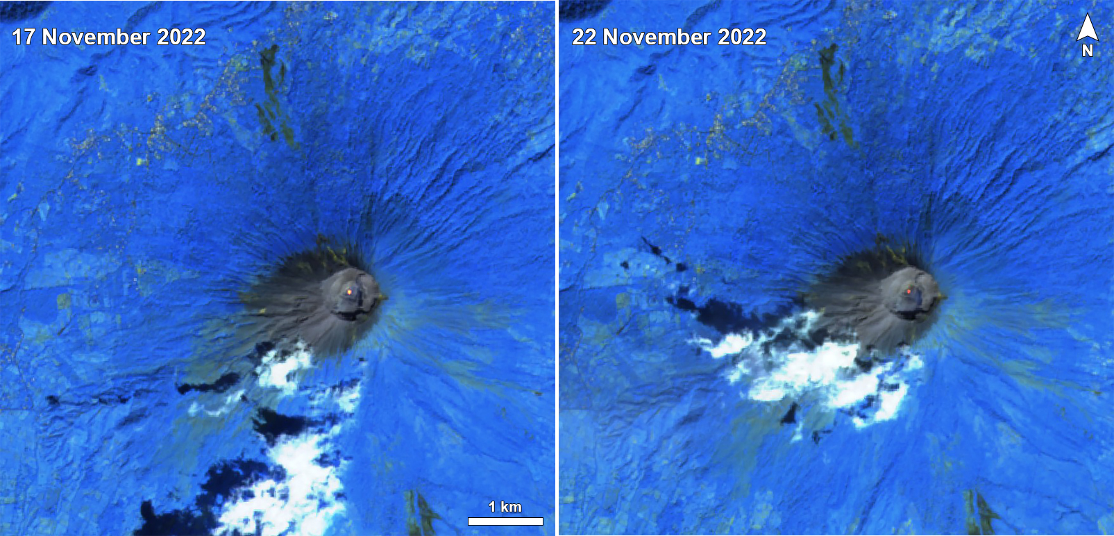 |
Figure 31. Sentinel-2 infrared satellite images showed a small thermal anomaly at the summit crater of San Miguel on 17 and 22 November 2022 (left and right). Images with "Atmospheric penetration" (bands 12, 11, 8A) rendering. Courtesy of Sentinel Hub Playground. |
Sulfur dioxide measurements that were taken during explosive events showed higher levels of sulfur dioxide emissions. On 19 November, during one of the largest explosions, SO2 emissions were 1,200 t/d, though on 21 November emissions were again lower at 378 t/d. During the more energetic explosions over 26-27 November, sulfur dioxide emission rates were again as high as 1,200 t/d, but they were otherwise 100-170 tons per day (t/d) on the 26th and 283 t/d on the 27th, which was lower than the typical baseline of 300 t/d. After 30 November sulfur dioxide emissions were again below baseline levels.
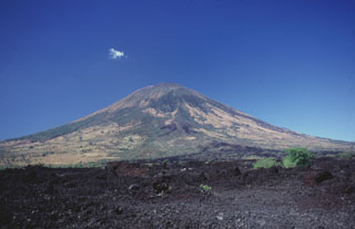
Geological Summary. The symmetrical cone of San Miguel, one of the most active volcanoes in El Salvador, rises from near sea level to form one of the country's most prominent landmarks. A broad, deep, crater complex that has been frequently modified by eruptions recorded since the early 16th century caps the truncated unvegetated summit, also known locally as Chaparrastique. Flanks eruptions of the basaltic-andesitic volcano have produced many lava flows, including several during the 17th-19th centuries that extended to the N, NE, and SE. The SE-flank flows are the largest and form broad, sparsely vegetated lava fields crossed by highways and a railroad skirting the base of the volcano. Flank vent locations have migrated higher on the edifice during historical time, and the most recent activity has consisted of minor ash eruptions from the summit crater.
Information Contacts: Ministero de Medio Ambiente y Recursos Naturales (MARN), Km. 5½ Carretera a Nueva San Salvador, Avenida las Mercedes, San Salvador, El Salvador (URL: http://www.snet.gob.sv/ver/vulcanologia); Sentinel Hub Playground (URL: https://www.sentinel-hub.com/explore/sentinel-playground).