Report on Soufriere St. Vincent (Saint Vincent and the Grenadines) — August 1979
Scientific Event Alert Network Bulletin, vol. 4, no. 8 (August 1979)
Managing Editor: David Squires.
Soufriere St. Vincent (Saint Vincent and the Grenadines) Lava extrusion slows
Please cite this report as:
Global Volcanism Program, 1979. Report on Soufriere St. Vincent (Saint Vincent and the Grenadines) (Squires, D., ed.). Scientific Event Alert Network Bulletin, 4:8. Smithsonian Institution. https://doi.org/10.5479/si.GVP.SEAN197908-360150
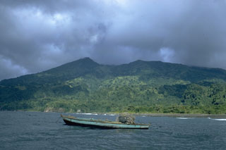
Soufriere St. Vincent
Saint Vincent and the Grenadines
13.33°N, 61.18°W; summit elev. 1220 m
All times are local (unless otherwise noted)
Lava extrusion continued through August. However the extrusion rate has decreased during the past 3 months, as shown in table 7. The mean diameter of the lava extrusion increased from 820 m on 4 August to 832 m on 21 August, but the highest point has remained at 130 m above the crater floor since 11 August, after 13 m of vertical growth from 10 July to 11 August.
Table 7. Rate of lava extrusion in the summit crater of Soufrière St. Vincent, 25 May-25 October 1979, calculated by John Tomblin.
| Date | Daily Volume Increase (x 106 m3) |
| 25 May-02 Jul 1979 | 0.30 |
| 02 Jul-04 Aug 1979 | 0.24 |
| 04 Aug-21 Aug 1979 | 0.17 |
| 21 Aug-23 Sep 1979 | 0.06 |
| 23 Sep-02 Oct 1979 | 0.10 |
| 02 Oct-25 Oct 1979 | 0.01 |
Between 50 and 200 very small local earthquakes continued to be recorded daily by the summit seismic station, but very few were detected by seismometers on the flanks.
When the summit was not obscured by clouds, gentle but continuous steam emission was visible. Steam frequently rose slightly above the crater rim. Water was sometimes present in the crater, especially after heavy rains, but the volume of water remained small and water depths did not exceed ~1 m.
Geological Summary. Soufrière St. Vincent is the northernmost and youngest volcano on St. Vincent Island. The NE rim of the 1.6-km wide summit crater is cut by a crater formed in 1812. The crater itself lies on the SW margin of a larger 2.2-km-wide caldera, which is breached widely to the SW as a result of slope failure. Frequent explosive eruptions after about 4,300 years ago produced pyroclastic deposits of the Yellow Tephra Formation, which cover much of the island. The first historical eruption took place in 1718; it and the 1812 eruption produced major explosions. Much of the northern end of the island was devastated by a major eruption in 1902 that coincided with the catastrophic Mont Pelée eruption on Martinique. A lava dome was emplaced in the summit crater in 1971 during a strictly effusive eruption, forming an island within a lake that filled the crater. A series of explosive eruptions in 1979 destroyed the 1971 dome and ejected the lake; a new dome was then built.
Information Contacts: J. Tomblin, UWI.