Report on Nyamulagira (DR Congo) — January 1980
Scientific Event Alert Network Bulletin, vol. 5, no. 1 (January 1980)
Managing Editor: David Squires.
Nyamulagira (DR Congo) Lava flowing northward
Please cite this report as:
Global Volcanism Program, 1980. Report on Nyamulagira (DR Congo) (Squires, D., ed.). Scientific Event Alert Network Bulletin, 5:1. Smithsonian Institution. https://doi.org/10.5479/si.GVP.SEAN198001-223020
Nyamulagira
DR Congo
1.408°S, 29.2°E; summit elev. 3058 m
All times are local (unless otherwise noted)
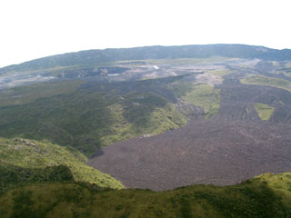
The Agence Zairoise de Presse (AZAP) news agency reports that an eruption from the N side of Nyamuragira began at 2100 on 30 January. As of 1 February lava was moving northward toward the agricultural community of Mweso at what was described as a "quite rapid" rate. A "considerable" distance and area had been covered by the lava.
Geological Summary. Africa's most active volcano, Nyamulagira (also known as Nyamuragira), is a massive high-potassium basaltic shield about 25 km N of Lake Kivu and 13 km NNW of the steep-sided Nyiragongo volcano. The summit is truncated by a small 2 x 2.3 km caldera that has walls up to about 100 m high. Documented eruptions have occurred within the summit caldera, as well as from the numerous flank fissures and cinder cones. A lava lake in the summit crater, active since at least 1921, drained in 1938, at the time of a major flank eruption. Recent lava flows extend down the flanks more than 30 km from the summit as far as Lake Kivu; extensive lava flows from this volcano have covered 1,500 km2 of the western branch of the East African Rift.
Information Contacts: AZAP.

