Report on Galunggung (Indonesia) — October 1982
Scientific Event Alert Network Bulletin, vol. 7, no. 10 (October 1982)
Managing Editor: Lindsay McClelland.
Galunggung (Indonesia) Explosions continue
Please cite this report as:
Global Volcanism Program, 1982. Report on Galunggung (Indonesia) (McClelland, L., ed.). Scientific Event Alert Network Bulletin, 7:10. Smithsonian Institution. https://doi.org/10.5479/si.GVP.SEAN198210-263140
Galunggung
Indonesia
7.25°S, 108.058°E; summit elev. 2168 m
All times are local (unless otherwise noted)
Occasional explosions continued through early November. On 14 October, emission of thick grayish clouds was accompanied by intermittent thunderous rumbling sounds. An explosion at 1145 ejected ash that fell on the area around the volcano. At 1300, a GMS image showed a small plume moving SE. By the next image, three hours later, the plume was dispersing. After roughly two weeks of quiet, strong earthquakes were felt and several flashes of light preceded an explosion during the night of 3-4 November that ejected a thick cloud. Ash again fell near the volcano. GMS images showed a moderate to small plume from activity that probably began about 1700 on 4 November. The plume, which drifted SSE, was visible on the 1900 image but had dissipated four hours later. Inspection of satellite data revealed no other explosions, but the rainy season has begun in Indonesia and weather clouds are making eruption plumes considerably more difficult to detect by satellite.
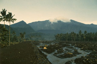
Local authorities and villagers were building small dams near the volcano to prevent lahars from causing damage in river valleys during the rainy season.
Geological Summary. The forested slopes of Galunggung in western Java SE of Bandung are cut by a 2-km-wide collapse scarp open towards the ESE. The "Ten Thousand Hills of Tasikmalaya" dotting the plain below the volcano are debris-avalanche hummocks from the collapse about 4,200 years ago. An eruption in 1822 produced pyroclastic flows and lahars that killed over 4,000 people. A series of major explosive eruptions starting in April 1982 destroyed a number of villages, killed as many as 30 people, and forced over 60,000 to evacuate. Pyroclastic flows and heavy widespread ash caused significant damage. A large passenger jet that encountered the ash plume on 24 June lost power to all four engines but managed to land safely in Jakarta. The 1982 activity destroyed a 1918 dome and formed the Warirang crater, almost as wide as the valley, about 2 km down from the summit.
Information Contacts: D. Haller, E. Hooper, and A. Smith, NOAA; AFP; Kantor Berita Antara, Jakarta.