Report on Manam (Papua New Guinea) — February 1984
Scientific Event Alert Network Bulletin, vol. 9, no. 2 (February 1984)
Managing Editor: Lindsay McClelland.
Manam (Papua New Guinea) Pyroclastic avalanches, scoria flows; eruption columns to 5-8 km; stage-1 alert in force
Please cite this report as:
Global Volcanism Program, 1984. Report on Manam (Papua New Guinea) (McClelland, L., ed.). Scientific Event Alert Network Bulletin, 9:2. Smithsonian Institution. https://doi.org/10.5479/si.GVP.SEAN198402-251020
Manam
Papua New Guinea
4.08°S, 145.037°E; summit elev. 1807 m
All times are local (unless otherwise noted)
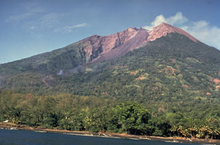
"A phase of major eruptive activity commenced at Manam's Southern crater in mid-February when a series of pyroclastic avalanches was discharged into the SE valley. Moderate Strombo-vulcanian explosive activity took place at Southern crater during the first half of the month, but an intensification was noted from 12 February, and on the 17th the first pyroclastic avalanche was discharged. This and the succeeding avalanche on the 21st descended about 4 km from the summit. Smaller avalanches were produced on most days after the 21st, usually terminating about 2 km from the summit.
"Ground and aerial inspections near the end of the month revealed that the numerous avalanches had obliterated most of the pre-existing surface in the upper half of the valley. Trees were flattened and had lost limbs and foliage. Scorching of vegetation had taken place on the 200 m-high valley walls and beyond to distances of 100 m. In addition to these hot pyroclastic avalanches, numerous flows of loose scoria from rapidly accumulated airfall deposits around the vent were also noted. These scoria flows descended into both the SE and SW valleys, terminating within 2 km from the summit.
"Vertical explosion activity at Southern crater produced an impressive eruption column that rose 5-8 km above the vent on several days. Incandescent pyroclasts were ejected to heights of about 700 m, 17-29 February. Ashfalls in coastal areas were generally light, although the accumulated thickness may have been up to several cm in places, resulting in the loss of branches from some trees.
"Main crater was moderately active throughout the month. The rate of ash and vapour emission was generally weak to moderate. Weak, fluctuating glow at night indicated small ejections of incandescent lava within the crater.
"Seismicity showed a strong increase at mid-month corresponding with the intensified visible explosive activity. Between 14 and 19 February, the amplitude of B-type events was about 8 times normal. During the remainder of the month a slight reduction to about 5 times normal was noted. Daily totals of volcanic earthquakes were steady at about 1700 (1-12 February), rose to 2100 (13-25 February), then returned to 1700. Tiltmeter measurements indicated a steady deflationary change of about 2 µrad.
"The stage-1 volcano alert, declared on 24 January in anticipation of increased activity, was maintained in force throughout the month. Warnings were issued to the local population to stay out of the SE and SW valleys."
Further Reference. Johnson, R.W., 1984, Volcanological inspections in Papua New Guinea, February 1984: Geological Survey of Papua New Guinea Report 84/8.
Geological Summary. The 10-km-wide island of Manam, lying 13 km off the northern coast of mainland Papua New Guinea, is one of the country's most active volcanoes. Four large radial valleys extend from the unvegetated summit of the conical basaltic-andesitic stratovolcano to its lower flanks. These valleys channel lava flows and pyroclastic avalanches that have sometimes reached the coast. Five small satellitic centers are located near the island's shoreline on the northern, southern, and western sides. Two summit craters are present; both are active, although most observed eruptions have originated from the southern crater, concentrating eruptive products during much of the past century into the SE valley. Frequent eruptions, typically of mild-to-moderate scale, have been recorded since 1616. Occasional larger eruptions have produced pyroclastic flows and lava flows that reached flat-lying coastal areas and entered the sea, sometimes impacting populated areas.
Information Contacts: C. McKee, RVO.

