Report on Ulawun (Papua New Guinea) — March 1984
Scientific Event Alert Network Bulletin, vol. 9, no. 3 (March 1984)
Managing Editor: Lindsay McClelland.
Ulawun (Papua New Guinea) Explosions and January seismic crisis; 3-month summary
Please cite this report as:
Global Volcanism Program, 1984. Report on Ulawun (Papua New Guinea) (McClelland, L., ed.). Scientific Event Alert Network Bulletin, 9:3. Smithsonian Institution. https://doi.org/10.5479/si.GVP.SEAN198403-252120
Ulawun
Papua New Guinea
5.05°S, 151.33°E; summit elev. 2334 m
All times are local (unless otherwise noted)
"Following increased seismicity and reports of audible explosions and vapour rings in December 1983, a phase of mild explosive activity took place in January. The eruptions were probably phreatic or phreatomagmatic as some correlation with rainfall is evident. Explosions producing tephra clouds were observed 12-14 and 19-20 January. These emissions rose as high as 2,000 m above the summit. Seismicity throughout this period was of low intensity and characterized by occasional bursts of tremor. A major seismic crisis began at about 1400 on 20 January. Tremor rapidly became strong and continuous. Large-amplitude volcanic earthquakes were discernible in the tremor by 2300. Soon afterwards tremor began to subside. It is not known whether eruptive activity accompanied this seismicity as the volcano was obscured by clouds. For the remainder of January and throughout February, no eruptive activity took place, and seismicity was low.
"An explosion sound from Ulawun was reported on 4 March, and tephra emissions were observed on the 5th and 13th. The emissions on the 13th rose to about 2000 m above the summit. Seismicity was generally at a low level in March. On most days, 100-300 volcanic earthquakes were recorded, but a peak of about 750 events was reached on 9 March. Earthquake amplitudes were slightly higher 9-11 March."
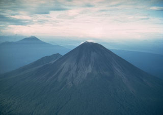
Geological Summary. The symmetrical basaltic-to-andesitic Ulawun stratovolcano is the highest volcano of the Bismarck arc, and one of Papua New Guinea's most frequently active. The volcano, also known as the Father, rises above the N coast of the island of New Britain across a low saddle NE of Bamus volcano, the South Son. The upper 1,000 m is unvegetated. A prominent E-W escarpment on the south may be the result of large-scale slumping. Satellitic cones occupy the NW and E flanks. A steep-walled valley cuts the NW side, and a flank lava-flow complex lies to the south of this valley. Historical eruptions date back to the beginning of the 18th century. Twentieth-century eruptions were mildly explosive until 1967, but after 1970 several larger eruptions produced lava flows and basaltic pyroclastic flows, greatly modifying the summit crater.
Information Contacts: C. McKee, RVO.

