Report on Colima (Mexico) — June 1989

Scientific Event Alert Network Bulletin, vol. 14, no. 6 (June 1989)
Managing Editor: Lindsay McClelland.
Colima (Mexico) Summit morphology and seismicity described
Please cite this report as:
Global Volcanism Program, 1989. Report on Colima (Mexico) (McClelland, L., ed.). Scientific Event Alert Network Bulletin, 14:6. Smithsonian Institution. https://doi.org/10.5479/si.GVP.SEAN198906-341040
Colima
Mexico
19.514°N, 103.62°W; summit elev. 3850 m
All times are local (unless otherwise noted)
When Julián Flores Díaz and José Angel Cortés visited Colima 13-14 and 25-26 May, the summit area consisted of a dome on the N side, a semicircular depression on the SE side, and an irregular platform (figure 3). Fumaroles were concentrated in three areas on the dome (figure 4). On 14 May, gas emission, dominated by SO2, had increased and the gas was light-brown in color, but it had substantially diminished by 25-26 May.
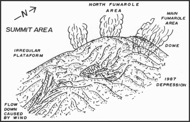 |
Figure 3. Sketch of Colima's summit, May 1989. Courtesy of J.F. Díaz. |
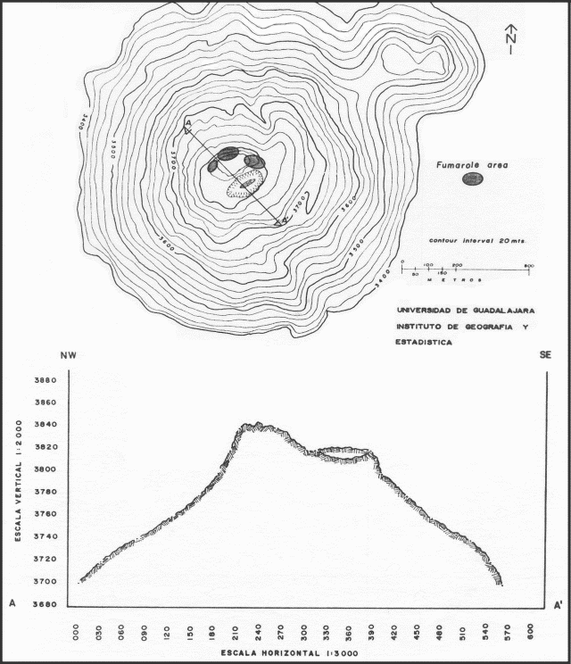 |
Figure 4. Map (top) and cross-section (bottom) of Colima's summit area, showing positions of the dome, fumarolic activity, and the summit depression. Courtesy of J.F. Díaz. |
The depression that formed 2 July [1987] after a phreatic explosion and avalanche from the summit was 100-150 in diameter and 30-40 m deep (from the high point in the middle of the summit area) [but see 15:12]. The area was warm but fumaroles observed during a November 1988 overflight had disappeared. Altered fragmented rocks and sand were present on the depression's floor. The remainder of the summit area, an irregular platform, was composed of blocks of many shapes and sizes. Warm gases containing SO2 were emitted, and blocks were altered and covered with sulfur. On the SW flank, a talus slope of scoria and sand had developed. Thermometric equipment was not available to the team.
A group from CICBAS, Universidad de Colima (Guillermo Castellanos, Carlos Ariel Ramírez-Vázquez, and Juan Reyes-Gómez) visited the volcano 23-25 May. Average temperatures adjacent to fumaroles were 167°C, a decrease from 216°C measured in May 1988. Emissions were dense, dark-gray in color, and had a pH of 2-3. New fractures were observed near the fumaroles. Rockfall avalanches, persisting for much of the past year, were last seen 14-15 April on the W flank (observed 20 km from the volcano). Three avalanche paths were visible, on the W, E, and N flanks.
Two digital high-gain 3-component seismographs and one analog single-component seismic station were installed near the volcano (figure 5). The seismographs collected data continuously for about 40 hours and recorded an average of 30 events/day. Preliminary analysis of the data by Reyes and Ramírez showed that most of the activity was tectonic with long separation between P- and S-wave arrivals. On 1, 14, and 22 June, the operators of the Red Sismologica Telemetrizada de Colima (a network that will consist of eight short-period, vertical seismograph stations; figure 6) installed three telemetric stations. Data are telemetered to CICBAS in the city of Colima. No deformation data are available, but changes in Colima's shape are visible and geodetic studies would be welcomed.
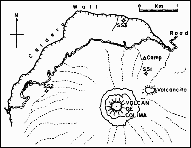 |
Figure 5. Location of digital high-gain 3-component seismographs (SS2, SS3) and an analog single-component (SS1) seismograph installed near Colima. Courtesy of G. Castellanos. |
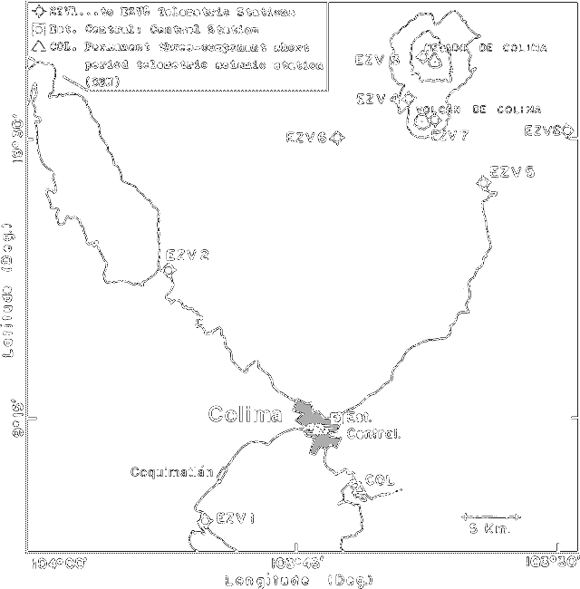 |
Figure 6. Distribution of instruments for the planned Colima Telemetric Seismological Network (RESCO). Courtesy of G. Castellanos. |
Geological Summary. The Colima complex is the most prominent volcanic center of the western Mexican Volcanic Belt. It consists of two southward-younging volcanoes, Nevado de Colima (the high point of the complex) on the north and the historically active Volcán de Colima at the south. A group of late-Pleistocene cinder cones is located on the floor of the Colima graben west and east of the complex. Volcán de Colima (also known as Volcán Fuego) is a youthful stratovolcano constructed within a 5-km-wide scarp, breached to the south, that has been the source of large debris avalanches. Major slope failures have occurred repeatedly from both the Nevado and Colima cones, producing thick debris-avalanche deposits on three sides of the complex. Frequent recorded eruptions date back to the 16th century. Occasional major explosive eruptions have destroyed the summit (most recently in 1913) and left a deep, steep-sided crater that was slowly refilled and then overtopped by lava dome growth.
Information Contacts: Julián Flores-Díaz, Instituto de Geografía y Estadística, Univ de Guadalajara; Guillermo Castellanos, Gilberto Ornelas-Arciniega, C. Ariel Ramírez-Vázquez, G.A. Reyes-Dávila, and Hector Tamez, CICBAS, Universidad de Colima.