Report on Pelee (France) — 6 January-12 January 2021
Smithsonian Institution / US Geological Survey
Weekly Volcanic Activity Report, 6 January-12 January 2021
Managing Editor: Sally Sennert.
Please cite this report as:
Global Volcanism Program, 2021. Report on Pelee (France) (Sennert, S, ed.). Weekly Volcanic Activity Report, 6 January-12 January 2021. Smithsonian Institution and US Geological Survey.
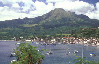
Pelee
France
14.809°N, 61.166°W; summit elev. 1372 m
All times are local (unless otherwise noted)
L'Observatoire Volcanologique et Sismologique de Martinique (OVSM) reported that seismicity related to volcanism has typically remained low at Pelée since 1980, when monitoring instrumentation was first installed, with a few dozen earthquakes recorded per year. Swarms were recorded in 1980, 1985-1986, 2007, and 2014, though the latter two swarms were associated with tectonic events. Volcanic seismicity appeared in April 2019 centered 4-5 km below the summit and deeper (more than 10 km below sea level). In addition, tremor-type signals were recorded during 8-9 November 2020, possibly signifying a reactivation of the hydrothermal system. The seismic data recorded since April 2019 represented an increase above baseline levels recorded during 1 January 2015 to April 2019. As a result of this activity OVSM raised the Alert Level to Yellow (the second lowest level on a four-color scale) on 4 December 2020.
Seismicity remained above background levels during 18 December 2020-1 January 2021, with at least 14 volcano-tectonic earthquakes detected with magnitudes less than or equal to 1. Scientists did not observe fumarolic activity during an overflight on 29 December 2020. The number of high-frequency, volcano-tectonic earthquakes (M 1 or less) totaled 65 during 1-8 January. A significant number (249) of long-period earthquakes in a volcanic tremor-type signal were distributed over two periods, 0000-0200 on 3 January and between 2100 on 3 January and 0200 on 4 January. Two isolated, low-frequency, long-period signals were also recorded. The data suggested ongoing perturbation of the hydrothermal system.
Geological Summary. Montagne Pelée forms the northern end of the island of Martinique. Three major edifice failures since the late Pleistocene, the last about 9,000 years ago, have left large scarps open to the SW inside which the modern volcano has been constructed. More than 20 large eruptions have occurred here during the past 5,000 years. Extensive pyroclastic-flow deposits, incised by steep-walled ravines, mantle the slopes of the volcano. The l'Etang Sec summit crater is filled by two lava domes emplaced during the 1902 and 1929 eruptions. Moderate phreatic or phreatomagmatic eruptions in the Upper Rivière Claire valley were recorded in 1792 and 1851-52. The catastrophic 1902 eruption, which destroyed the city of St. Pierre, became the type-example of Pelean eruptions and marked the onset of modern volcanological studies of pyroclastic density currents.
Source: L'Observatoire Volcanologique et Sismologique de Martinique (OVSM)