Report on Koryaksky (Russia) — 22 April-28 April 2009
Smithsonian Institution / US Geological Survey
Weekly Volcanic Activity Report, 22 April-28 April 2009
Managing Editor: Sally Sennert.
Please cite this report as:
Global Volcanism Program, 2009. Report on Koryaksky (Russia) (Sennert, S, ed.). Weekly Volcanic Activity Report, 22 April-28 April 2009. Smithsonian Institution and US Geological Survey.
Koryaksky
Russia
53.321°N, 158.712°E; summit elev. 3430 m
All times are local (unless otherwise noted)
During 17-25 April, KVERT reported that seismic activity at Koryaksky was above background levels and weak volcanic tremor was detected. Gas plumes containing a small amount of ash drifted in multiple directions during 17-18 April. On 17 and 18 April, gas-and-ash plumes were also seen on satellite imagery and drifted 100 km NE. On 20 April, a sulfur dioxide plume extended about 15 km from the volcano. During 26-28 April, seismic activity decreased to background levels; tremor was occasionally detected. The Level of Concern Color Code was lowered to Yellow.
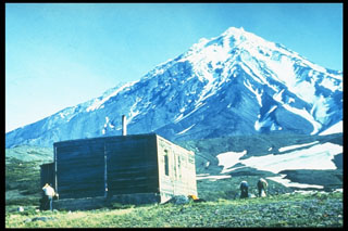
Geological Summary. The large symmetrical Koryaksky stratovolcano is the most prominent landmark of the NW-trending Avachinskaya volcano group, which towers above Kamchatka's largest city, Petropavlovsk. Erosion has produced a ribbed surface on the eastern flanks of the 3430-m-high volcano; the youngest lava flows are found on the upper W flank and below SE-flank cinder cones. Extensive Holocene lava fields on the western flank were primarily fed by summit vents; those on the SW flank originated from flank vents. Lahars associated with a period of lava effusion from south- and SW-flank fissure vents about 3900-3500 years ago reached Avacha Bay. Only a few moderate explosive eruptions have occurred during historical time, but no strong explosive eruptions have been documented during the Holocene. Koryaksky's first historical eruption, in 1895, also produced a lava flow.

