Report on Sinabung (Indonesia) — 23 October-29 October 2013
Smithsonian Institution / US Geological Survey
Weekly Volcanic Activity Report, 23 October-29 October 2013
Managing Editor: Sally Sennert.
Please cite this report as:
Global Volcanism Program, 2013. Report on Sinabung (Indonesia) (Sennert, S, ed.). Weekly Volcanic Activity Report, 23 October-29 October 2013. Smithsonian Institution and US Geological Survey.
Sinabung
Indonesia
3.17°N, 98.392°E; summit elev. 2460 m
All times are local (unless otherwise noted)
PVMBG reported that after 29 September, the day the Alert Level was lowered to 2 (on a scale of 1-4), seismicity at Sinabung declined but continued to fluctuate through 22 October. White plumes were seen rising 100-300 m from the crater. On 22 October plumes were also grayish and rose 250 m. Vents appeared on the N flank and produced dense white plumes that rose 70 m. On 23 October landslides at two locations were observed, and explosions occurred at 1619 and 1651. Plumes rose from the summit crater and from a fracture formed on 15 October near Lau Kawar. Fog prevented observations for a period after the explosions; once the fog cleared dense gray plumes were observed. A third explosion occurred at 2100. On 24 October an explosion at 0550 generated an ash plume that rose 3 km and caused ashfall in areas S. Another explosion was detected at 0612. According to a news article about 3,300 people that evacuated their homes were mostly from two villages within 3 km of Sinabung, in the Karo district.
Based on information from the Indonesian Meteorological Office, the Darwin VAAC reported that an eruption at 1737 on 26 October generated an ash plume that rose to an altitude of 4.9 km (16,000 ft) a.s.l. At 0700 and 1200 on 27 October a webcam showed an ash plume rising to an altitude of 3.7 km (12,000 ft) a.s.l. and drifting over 35 km NE.
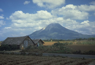
Geological Summary. Gunung Sinabung is a Pleistocene-to-Holocene stratovolcano with many lava flows on its flanks. The migration of summit vents along a N-S line gives the summit crater complex an elongated form. The youngest crater of this conical andesitic-to-dacitic edifice is at the southern end of the four overlapping summit craters. The youngest deposit is a SE-flank pyroclastic flow 14C dated by Hendrasto et al. (2012) at 740-880 CE. An unconfirmed eruption was noted in 1881, and solfataric activity was seen at the summit and upper flanks in 1912. No confirmed historical eruptions were recorded prior to explosive eruptions during August-September 2010 that produced ash plumes to 5 km above the summit.
Sources: Pusat Vulkanologi dan Mitigasi Bencana Geologi (PVMBG, also known as CVGHM), Darwin Volcanic Ash Advisory Centre (VAAC), Associated Press

