Report on Marapi (Indonesia) — 26 February-4 March 2014
Smithsonian Institution / US Geological Survey
Weekly Volcanic Activity Report, 26 February-4 March 2014
Managing Editor: Sally Sennert.
Please cite this report as:
Global Volcanism Program, 2014. Report on Marapi (Indonesia) (Sennert, S, ed.). Weekly Volcanic Activity Report, 26 February-4 March 2014. Smithsonian Institution and US Geological Survey.
Marapi
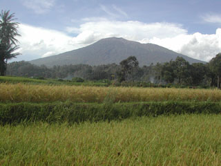
Indonesia
0.38°S, 100.474°E; summit elev. 2885 m
All times are local (unless otherwise noted)
According to news articles, an explosion at Marapi on 26 February produced an ash plume that caused ashfall in areas as far as 10 km S. According to PVMBG the Alert Level remained at 2 (on a scale of 1-4).
Geological Summary. Gunung Marapi, not to be confused with the better-known Merapi volcano on Java, is Sumatra's most active volcano. This massive complex stratovolcano rises 2,000 m above the Bukittinggi Plain in the Padang Highlands. A broad summit contains multiple partially overlapping summit craters constructed within the small 1.4-km-wide Bancah caldera. The summit craters are located along an ENE-WSW line, with volcanism migrating to the west. More than 50 eruptions, typically consisting of small-to-moderate explosive activity, have been recorded since the end of the 18th century; no lava flows outside the summit craters have been reported in historical time.
Sources: Pusat Vulkanologi dan Mitigasi Bencana Geologi (PVMBG, also known as CVGHM), The Free Press Journal