Report on Brava (Cabo Verde) — 3 August-9 August 2016
Smithsonian Institution / US Geological Survey
Weekly Volcanic Activity Report, 3 August-9 August 2016
Managing Editor: Sally Sennert.
Please cite this report as:
Global Volcanism Program, 2016. Report on Brava (Cabo Verde) (Sennert, S, ed.). Weekly Volcanic Activity Report, 3 August-9 August 2016. Smithsonian Institution and US Geological Survey.
Brava
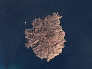
Cabo Verde
14.8514°N, 24.7041°W; summit elev. 956 m
All times are local (unless otherwise noted)
According to the Universidade de Cabo Verde in a report posted on 4 August, Instituto Nacional da Meteorologia e Geofísica (INMG) recorded increased seismicity at Brava beginning at dawn on 2 August. In response authorities evacuated 300 people, based on a news report. Earthquakes were felt by residents during 3-4 August. Scientists and technicians from the Universidade de Cabo Verde (UniCV), Instituto Vulcanológico das Canárias (INVOLCAN), and Serviço Nacional da Protecção Civil (SNPC) began monitoring carbon dioxide emissions though found nothing unusual during 4-7 August.
Geological Summary. Brava Island, 18 km W of Fogo, is the westernmost of the southern Cape Verde islands. The 10-km-wide island contains 15 morphologically youthful craters located along two or three lineaments intersecting along the crest of the island. Most of the younger eruptions originated from the interaction of phonolitic magmas with a large groundwater reservoir contained within an older volcanic series characterized by thick welded ignimbrites and block-and-ash flow deposits. Carbonatitic lavas are also found.
Sources: Universidade of Cabo Verde, Africa News