Report on Agung (Indonesia) — 11 October-17 October 2017
Smithsonian Institution / US Geological Survey
Weekly Volcanic Activity Report, 11 October-17 October 2017
Managing Editor: Sally Sennert.
Please cite this report as:
Global Volcanism Program, 2017. Report on Agung (Indonesia) (Sennert, S, ed.). Weekly Volcanic Activity Report, 11 October-17 October 2017. Smithsonian Institution and US Geological Survey.
Agung
Indonesia
8.343°S, 115.508°E; summit elev. 2997 m
All times are local (unless otherwise noted)
PVMBG reported that although foggy conditions at Agung sometimes prevented visual observations, during 11-17 October dense white plumes were seen rising 200 m above the crater rim. On 14 October BNPB stated that seismicity remained high; PVMBG noted that seismicity was dominated by shallow volcanic events, and the number of volcanic earthquakes remained steady. The governor of Bali extended the state of emergency to 26 October, noting that the Alert Level remained at 4 (the highest level on a scale of 1-4). The number of evacuees was 139,199 (spread out in 389 shelters).
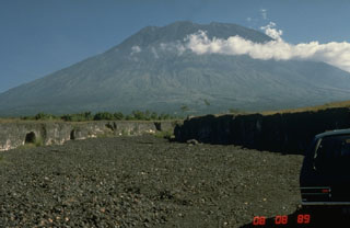
Geological Summary. Symmetrical Agung stratovolcano, Bali's highest and most sacred mountain, towers over the eastern end of the island. The volcano, whose name means "Paramount," rises above the SE rim of the Batur caldera, and the northern and southern flanks extend to the coast. The summit area extends 1.5 km E-W, with the high point on the W and a steep-walled 800-m-wide crater on the E. The Pawon cone is located low on the SE flank. Only a few eruptions dating back to the early 19th century have been recorded in historical time. The 1963-64 eruption, one of the largest in the 20th century, produced voluminous ashfall along with devastating pyroclastic flows and lahars that caused extensive damage and many fatalities.
Sources: Pusat Vulkanologi dan Mitigasi Bencana Geologi (PVMBG, also known as CVGHM), Badan Nacional Penanggulangan Bencana (BNPB)

