Report on Lewotolok (Indonesia) — 25 November-1 December 2020
Smithsonian Institution / US Geological Survey
Weekly Volcanic Activity Report, 25 November-1 December 2020
Managing Editor: Sally Sennert.
Please cite this report as:
Global Volcanism Program, 2020. Report on Lewotolok (Indonesia) (Sennert, S, ed.). Weekly Volcanic Activity Report, 25 November-1 December 2020. Smithsonian Institution and US Geological Survey.
Lewotolok
Indonesia
8.274°S, 123.508°E; summit elev. 1431 m
All times are local (unless otherwise noted)
According to PVMBG continuous tremor at Lewotolo began to be recorded at 1943 on 26 November, and a series of volcanic earthquakes began at 1947. A new eruption started at 0557 on 27 November, producing dense blackish gray ash plumes that rose 500 m above the summit and drifted W. Incandescence at the summit was visible, and the emissions turned white around 0630. Seismicity slightly decreased after the eruption, though continuous tremor persisted for a period of time. Dense white plumes rose as high as 400 m and nighttime incandescence was noted during 27-28 November.
During the morning of 29 November seismicity again increased, characterized by six deep volcanic earthquakes; continuous tremor appeared around 0930. At 0945 a 10-minute eruption sent dense gray-to-black ash plumes 4 km above the summit that drifted W and NW at lower heights and SE and E near the top of the plume. Ashfall was reported in several surrounding villages and video posted on social media showed tephra falling on roofs in residential areas. According to BNPB, Badan Penanggulangan Bencana Daerah (BPBD) evacuated almost 4,500 residents from 26 villages to seven evacuation centers. At 1300, the Alert Level was raised to 3 (on a scale of 1-4) and the public was warned to stay 4 km away from the summer crater.
Ash plumes continued to rise on at least six more occasions, and around 1900 Strombolian activity was visible. A pungent sulfur odor was noted at the Lewotolo observation post. Satellite data showed that a sulfur dioxide plume had drifted over the N half of Australia by 30 November. Ash plumes continued to be emitted during 30 November-1 December, with dense white-and-gray ash plumes rising 700-2,000 m above the summit. Lava flows near the summit were visible and incandescent material traveled down the flanks.
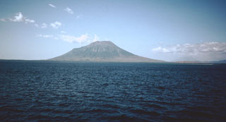
Geological Summary. The Lewotolok (or Lewotolo) stratovolcano occupies the eastern end of an elongated peninsula extending north into the Flores Sea, connected to Lembata (formerly Lomblen) Island by a narrow isthmus. It is symmetrical when viewed from the north and east. A small cone with a 130-m-wide crater constructed at the SE side of a larger crater forms the volcano's high point. Many lava flows have reached the coastline. Eruptions recorded since 1660 have consisted of explosive activity from the summit crater.
Sources: Pusat Vulkanologi dan Mitigasi Bencana Geologi (PVMBG, also known as CVGHM), Badan Nacional Penanggulangan Bencana (BNPB), Advanced geospatial Data Management Platform (ADAM)