Report on Nyiragongo (DR Congo) — 26 May-1 June 2021
Smithsonian Institution / US Geological Survey
Weekly Volcanic Activity Report, 26 May-1 June 2021
Managing Editor: Sally Sennert.
Please cite this report as:
Global Volcanism Program, 2021. Report on Nyiragongo (DR Congo) (Sennert, S, ed.). Weekly Volcanic Activity Report, 26 May-1 June 2021. Smithsonian Institution and US Geological Survey.
Nyiragongo
DR Congo
1.52°S, 29.25°E; summit elev. 3470 m
All times are local (unless otherwise noted)
Satellite data and analysis indicated that the lava flows at Nyiragongo during 22-23 May were the result of a N-S trending dike that had intruded beneath the volcano and Goma, and likely extended beneath Lake Kivu. Though lava effusion ceased, intense seismicity continued afterwards and indicated the dike continued to be active, according to GeoRiskA. Ground cracking in the city and damage to buildings from earthquakes continued to be reported. On 27 May authorities mandated an evacuation of the at least 400,000 residents in higher risk areas (about 10 districts) according to news organizations. The total population of Goma is an estimated 670,000 people. Photos in news articles showed masses of people and cars jammed for kilometers on roads leading out of the city. During 28-29 May GeoRiskA reported that seismicity began to decrease and continued a downward trend at least through 1 June; both the seismic data and GPS data indicated that the dike was no longer propagating. A news article noted that residents had begun returning to their homes within a few days.
Humanitarian organizations noted that within five days after lava flow stopped nearly 700 children had been re-united with their families, and more than 200 were in foster care or other transitional facilities. More than 170 families continued to search for missing children. The eruption had destroyed 3,629 homes, 12 schools, and 3 health facilities. More than 20,000 people were displaced and 31 had died. Goma’s international airport remained closed, though one across the border in Rwanda was operating.
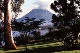
Geological Summary. The Nyiragongo stratovolcano contained a lava lake in its deep summit crater that was active for half a century before draining catastrophically through its outer flanks in 1977. The steep slopes contrast to the low profile of its neighboring shield volcano, Nyamuragira. Benches in the steep-walled, 1.2-km-wide summit crater mark levels of former lava lakes, which have been observed since the late-19th century. Two older stratovolcanoes, Baruta and Shaheru, are partially overlapped by Nyiragongo on the north and south. About 100 cones are located primarily along radial fissures south of Shaheru, east of the summit, and along a NE-SW zone extending as far as Lake Kivu. Many cones are buried by voluminous lava flows that extend long distances down the flanks, which is characterized by the eruption of foiditic rocks. The extremely fluid 1977 lava flows caused many fatalities, as did lava flows that inundated portions of the major city of Goma in January 2002.
Sources: GeoRiskA, UN News Centre, SCK TV Dans Le Monde, European Commission - Directorate General for Humanitarian Aid and Civil Protection, Actualite.cd

