Report on Asosan (Japan) — 13 October-19 October 2021
Smithsonian Institution / US Geological Survey
Weekly Volcanic Activity Report, 13 October-19 October 2021
Managing Editor: Sally Sennert.
Please cite this report as:
Global Volcanism Program, 2021. Report on Asosan (Japan) (Sennert, S, ed.). Weekly Volcanic Activity Report, 13 October-19 October 2021. Smithsonian Institution and US Geological Survey.
Asosan
Japan
32.8849°N, 131.085°E; summit elev. 1592 m
All times are local (unless otherwise noted)
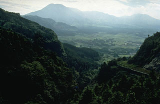
According to JMA the number of volcanic tremor signals at Asosan began on 12 October. Tremor amplitude began increasing at 1530 on 13 October, prompting JMA to raise the Alert Level to 2 (on a scale of 1-5) almost two hours later. White plumes rose 1.4 km above Nakadake Crater. An eruption was detected at 0443 on 14 October; weather clouds prevented visual confirmation of an eruption plume, though ejected incandescent material was visible in thermal camera images. During a field visit to the volcano later that day, scientists confirmed ashfall in several areas, including parts of Takamori Town (Kumamoto Prefecture), Taketa City (Oita Prefecture), and Takachiho Town (Miyazaki Prefecture). Small eruptive events occurred at 1057 and 1325 on 15 October. Volcanic tremor amplitude increased at 1400 on 18 October. During an overflight scientists observed ash deposits extending SE from Nakadake Crater. Volcanic tremor amplitude continued to fluctuate at high levels on 19 October. At 1143 on 20 October a notable eruption ejected blocks 900 m S and produced an ash plume that rose 3.5 km above the crater rim and drifted E. Pyroclastic flows descended 1.3 km W. The Alert Level was raised to 3 at 1148 and warned the public to stay 2 km away from Nakadake Crater.
Geological Summary. The 24-km-wide Asosan caldera was formed during four major explosive eruptions from 300,000 to 90,000 years ago. These produced voluminous pyroclastic flows that covered much of Kyushu. The last of these, the Aso-4 eruption, produced more than 600 km3 of airfall tephra and pyroclastic-flow deposits. A group of 17 central cones was constructed in the middle of the caldera, one of which, Nakadake, is one of Japan's most active volcanoes. It was the location of Japan's first documented historical eruption in 553 CE. The Nakadake complex has remained active throughout the Holocene. Several other cones have been active during the Holocene, including the Kometsuka scoria cone as recently as about 210 CE. Historical eruptions have largely consisted of basaltic to basaltic andesite ash emission with periodic strombolian and phreatomagmatic activity. The summit crater of Nakadake is accessible by toll road and cable car, and is one of Kyushu's most popular tourist destinations.