Report on Taal (Philippines) — 23 March-29 March 2022
Smithsonian Institution / US Geological Survey
Weekly Volcanic Activity Report, 23 March-29 March 2022
Managing Editor: Sally Sennert.
Please cite this report as:
Global Volcanism Program, 2022. Report on Taal (Philippines) (Sennert, S, ed.). Weekly Volcanic Activity Report, 23 March-29 March 2022. Smithsonian Institution and US Geological Survey.
Taal
Philippines
14.0106°N, 120.9975°E; summit elev. 311 m
All times are local (unless otherwise noted)
PHIVOLCS reported that hot volcanic fluids circulated and upwelled in Taal’s Main Crater lake during 24-25 March, producing plumes that rose as high as 2.4 km above the lake’s surface. A phreatomagmatic eruption was recorded at 0226 on 25 March, based on seismic data and webcam images, and produced a 500-m-tall plume. Sulfur dioxide emissions averaged 6,957 tonnes/day that same day. A phreatomagmatic eruption during 0722-0859 on 26 March consisted of as many as 66 explosions, and prompted PHIVOLCS to raise the Alert Level to 3 (on a scale of 0-5) part way through at 0800. Eruption plumes rose as high as 3 km. Wet ashfall with a sulfur odor fell on Taal Volcano Island, along the Calauit and Alas-as shorelines, and on the lakeshore of Banyaga, Agoncillo, Batangas. PHIVOLCS noted that Alert Level 3 (magmatic unrest) means that there has been a magmatic intrusion and evacuation of high-risk barangays is recommended. The Philippine News Agency (PNA) reported that residents of Bilibinwang and Banyaga, Agoncillo and Boso-boso, Gulod and eastern Bugaan East, Laurel, Batangas Province began evacuating that day. Entry onto Taal Volcanic Island as well as the barangays of Agoncillo and Laurel was prohibited. National Disaster Risk Reduction and Management Council (NDRRMC) reported that by 27 March 2,961 people had been evacuated.
Hot volcanic fluids continued to upwell in the lake during 26-29 March, generating plumes that rose as high as 2.4 km and drifted SW. Phreatomagmatic events were recorded at 0434 and 0504 on 27 March by the seismic network and seen in webcam images, producing eruption plumes that rose 800 and 400 m, respectively, and drifted SW. Three more phreatomagmatic events were recorded at 0930, 0933, and 0946; eruption plumes rose 400-800 m and drifted SW. Sulfur dioxide emissions averaged 1,140-4,273 tonnes/day during 28-29 March.
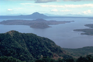
Geological Summary. Taal is one of the most active volcanoes in the Philippines and has produced some powerful eruptions. The 15 x 20 km Talisay (Taal) caldera is largely filled by Lake Taal, whose 267 km2 surface lies only 3 m above sea level. The maximum depth of the lake is 160 m, with several submerged eruptive centers. The 5-km-wide Volcano Island in north-central Lake Taal is the location of all observed eruptions. The island is composed of coalescing small stratovolcanoes, tuff rings, and scoria cones. Powerful pyroclastic flows and surges have caused many fatalities.
Sources: Philippine Institute of Volcanology and Seismology (PHIVOLCS), The National Disaster Risk Reduction and Management Council (NDRRMC), Philippine News Agency (PNA), Office of Civil Defense

