Report on Mauna Loa (United States) — 30 November-6 December 2022
Smithsonian Institution / US Geological Survey
Weekly Volcanic Activity Report, 30 November-6 December 2022
Managing Editor: Sally Sennert.
Please cite this report as:
Global Volcanism Program, 2022. Report on Mauna Loa (United States) (Sennert, S, ed.). Weekly Volcanic Activity Report, 30 November-6 December 2022. Smithsonian Institution and US Geological Survey.
Mauna Loa
United States
19.475°N, 155.608°W; summit elev. 4170 m
All times are local (unless otherwise noted)
HVO reported that the Northeast Rift Zone eruption at Mauna Loa continued during 30 November-6 December. Fissure 4, at the lowest elevation, produced lava flows that moved NE at a rate of about 60 m per hour during 30 November-1 December and crossed the Mauna Loa Weather Observatory Road overnight. A smaller slower lobe of lava traveled E but had stalled by the afternoon of 1 December. Fissure 4 was not very active during the morning of 2 December, and during an overflight on 3 December HVO geologists confirmed that it was no longer erupting and observed only glowing cracks in the vicinity.
Fissure 3, at 3,510 m elevation, was the dominant source of the largest lava flow that continued to advance mainly N towards the Daniel K. Inouye Highway (Saddle Road) during the week. The main flow branched almost halfway down the flow field, but coalesced downslope an advanced as a single front. Lava fountains at the fissure were 20-25 m tall on 30 November, about 33 m tall during 3-4 December, and 40-100 m on 6 December. Molten lava bombs were sometimes ejected, which cooled at the base of the fissure and built a significant spatter rampart around the lava fountains.
The rate of lava flow advancement was variable but generally trended down early in the week from 24-45 m per hour during 30 November-2 December to 6-13 m per hour during 3-5 December, as the lava-flow front reached flatter ground. As the flow rate slowed the flow front was widened and thickened. There were surges in the rate during 5-6 December with the lava flow typically advancing at 21 m per hour but moving up to 27.4 m per hour for shorter periods. Several small overflows were visible during 3-6 December near where the main lava flow branched, on the steeper slopes of the NE flank about halfway down the lava flow. By 0500 on 6 December the flow front was about 3.5 km from the highway; weather conditions hampered views of the eruption most of the day.
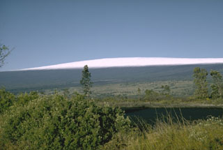
The eruption produced volcanic gas plumes that rose to high altitudes and drifted W, generating vog in areas downwind. Pele's hair (strands of volcanic glass) fell in the Humu‘ula Saddle area, and were also blown great distances, as far as far Laupahoehoe (59 km NW of Fissure 3), and the Mauna Kea Visitor Information Station. Hawai‘i Volcanoes National Park had closed the Mauna Loa Road from Kipukapuaulu, and the closure extended to the summit caldera. Sulfur dioxide emission rates were high through the week with approximate rates of 180,000 tonnes per day on 1 December and 120,000 tonnes per day on 4 December. At 0180 on 4 December the Aviation Color Code was lowered to Orange (the second highest level on a four-color scale) because there was no current threat to aviation from significant volcanic ash emissions. The Federal Aviation Administration issued a temporary flight restriction extending from the surface to 1,500 ft (457 m) above ground level in the eruption area. The Volcano Alert Level remained at Warning (the highest level on a four-level scale) reflecting the ongoing lava-flow hazards.
Geological Summary. Massive Mauna Loa is a basaltic shield volcano that rises almost 9 km from the ocean floor to form the world's largest Holocene volcano. Flank eruptions typically occur from the lengthy NE and SW rift zones, and from the Moku'aweoweo summit is caldera, which is within an older and larger 6 x 8 km caldera. Two of the youngest large debris avalanches documented in Hawaii traveled nearly 100 km from Mauna Loa; the second of the Alika avalanches was emplaced about 105,000 years ago (Moore et al., 1989). Almost 90% of the surface of the volcano is covered by lavas less than 4,000 years old (Lockwood and Lipman, 1987). Beginning about 1,500 years ago, a series of voluminous overflows from a summit lava lake covered about 25% of the volcano's surface. Over the last 750 years, from shortly after the formation of Moku'aweoweo caldera until the present, an additional 25% of the volcano has been covered with lava flows, mainly from summit and NW rift zone vents.
Source: US Geological Survey Hawaiian Volcano Observatory (HVO)