Report on Purace (Colombia) — 1 May-7 May 2024
Smithsonian Institution / US Geological Survey
Weekly Volcanic Activity Report, 1 May-7 May 2024
Managing Editor: Sally Sennert.
Please cite this report as:
Global Volcanism Program, 2024. Report on Purace (Colombia) (Sennert, S, ed.). Weekly Volcanic Activity Report, 1 May-7 May 2024. Smithsonian Institution and US Geological Survey.
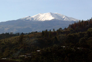
Purace
Colombia
2.32°N, 76.4°W; summit elev. 4650 m
All times are local (unless otherwise noted)
Observatorio Vulcanológico y Sismológico de Popayán, Servicio Geologico Colombiano (SGC) reported that the number of both volcanic tremor (VT) and long-period (LP) seismic events at Puracé increased during 23-29 April. The events had low magnitudes and were located at depths of 0-5 km; the VT events were located beneath the Puracé, Piocollo, and Curiquinga cones. Sulfur dioxide emissions had increased in the previous few weeks and carbon dioxide emissions continued to be above baseline levels at a fumarole on the N crater rim. Slow deformation which began in April 2022 between Puracé and Curiquinga was ongoing.
Both the number and intensity of earthquake events suddenly increased during 29-30 April. Seismicity continued to be elevated during 1-3 May and, along with continuing deformation and increases in gas emissions and other monitoring data, the activity was sustained at a higher level. On 3 May the Alert Level was raised to Orange (the second highest level on a four-color scale). During 3-4 May gas-and-steam emissions rose 1.4 km above the summit and drifted W. Seismicity during 3-6 May continued to increase; VT events were mainly located beneath Puracé at depths less than 4 km and LP events were located beneath the crater and the N flank at depths less than 1 km. Additionally, very low-magnitude events indicating rising magma were located at depths of 1-3.5 km beneath Piocollo and Curiquinga.
Geological Summary. Puracé in Colombia consists of an andesitic stratovolcano with a 500-m-wide summit crater constructed over a dacitic shield volcano. It lies at the NW end of a volcanic massif opposite Pan de Azúcar stratovolcano, 6 km SE. A NW-SE-trending group of seven cones and craters, Los Coconucos, lies between the two larger edifices. Frequent explosive eruptions in the 19th and 20th centuries have modified the morphology of the summit crater. The largest eruptions occurred in 1849, 1869, and 1885.