
The Global Volcanism Program has no activity reports available for Camiguin.
The Global Volcanism Program has no Weekly Reports available for Camiguin.
The Global Volcanism Program has no Bulletin Reports available for Camiguin.
|
|
||||||||||||||||||||||||||||
There is data available for 4 confirmed eruptive periods.
1948 Sep 1 - 1953 Jul 16 ± 15 days Confirmed Eruption (Explosive / Effusive) VEI: 3
| Episode 1 | Eruption (Explosive / Effusive) | Upper NE flank of Hibok-Hibok | |||||||||||||||||||||||||||||||||||||||||||||||||||||||||||||||||||||||||||||||||||||||||||||||||||||||||||||||||
|---|---|---|---|---|---|---|---|---|---|---|---|---|---|---|---|---|---|---|---|---|---|---|---|---|---|---|---|---|---|---|---|---|---|---|---|---|---|---|---|---|---|---|---|---|---|---|---|---|---|---|---|---|---|---|---|---|---|---|---|---|---|---|---|---|---|---|---|---|---|---|---|---|---|---|---|---|---|---|---|---|---|---|---|---|---|---|---|---|---|---|---|---|---|---|---|---|---|---|---|---|---|---|---|---|---|---|---|---|---|---|---|---|---|---|
| 1948 Sep 1 - 1953 Jul 16 ± 15 days | Evidence from Observations: Reported | |||||||||||||||||||||||||||||||||||||||||||||||||||||||||||||||||||||||||||||||||||||||||||||||||||||||||||||||||
|
List of 21 Events for Episode 1 at Upper NE flank of Hibok-Hibok
|
||||||||||||||||||||||||||||||||||||||||||||||||||||||||||||||||||||||||||||||||||||||||||||||||||||||||||||||||||
[ 1902 Jul 27 ] Discredited Eruption
[ 1897 ] Discredited Eruption
1871 Apr 30 - 1875 Confirmed Eruption (Explosive / Effusive) VEI: 2
| Episode 1 | Eruption (Explosive / Effusive) | Lower NW flank of Hibok-Hibok (Mt. Vulcan) | ||||||||||||||||||||||||||||||||||||||||||||||||||||||||||
|---|---|---|---|---|---|---|---|---|---|---|---|---|---|---|---|---|---|---|---|---|---|---|---|---|---|---|---|---|---|---|---|---|---|---|---|---|---|---|---|---|---|---|---|---|---|---|---|---|---|---|---|---|---|---|---|---|---|---|---|
| 1871 Apr 30 - 1875 | Evidence from Observations: Reported | ||||||||||||||||||||||||||||||||||||||||||||||||||||||||||
|
List of 10 Events for Episode 1 at Lower NW flank of Hibok-Hibok (Mt. Vulcan)
|
|||||||||||||||||||||||||||||||||||||||||||||||||||||||||||
1862 Confirmed Eruption (Explosive / Effusive) VEI: 2
| Episode 1 | Eruption (Explosive / Effusive) | Hibok-Hibok | ||||||||||||||||||||||||||||
|---|---|---|---|---|---|---|---|---|---|---|---|---|---|---|---|---|---|---|---|---|---|---|---|---|---|---|---|---|---|
| 1862 - Unknown | Evidence from Observations: Reported | ||||||||||||||||||||||||||||
|
List of 4 Events for Episode 1 at Hibok-Hibok
|
|||||||||||||||||||||||||||||
1827 Confirmed Eruption (Explosive / Effusive) VEI: 2
| Episode 1 | Eruption (Explosive / Effusive) | Hibok-Hibok | ||||||||||||||||||||||||||||
|---|---|---|---|---|---|---|---|---|---|---|---|---|---|---|---|---|---|---|---|---|---|---|---|---|---|---|---|---|---|
| 1827 - Unknown | Evidence from Observations: Reported | ||||||||||||||||||||||||||||
|
List of 4 Events for Episode 1 at Hibok-Hibok
|
|||||||||||||||||||||||||||||
This compilation of synonyms and subsidiary features may not be comprehensive. Features are organized into four major categories: Cones, Craters, Domes, and Thermal Features. Synonyms of features appear indented below the primary name. In some cases additional feature type, elevation, or location details are provided.
Synonyms |
||||
| Catarman | ||||
Cones |
||||
| Feature Name | Feature Type | Elevation | Latitude | Longitude |
| Binone | Pyroclastic cone | |||
| Butay, Mount | Stratovolcano | 679 m | 9° 7' 0.00" N | 124° 46' 0.00" E |
| Camiguin Tanda | Stratovolcano | |||
| Ginsiliban, Mount
Guinsiliban, Mount |
Stratovolcano | 581 m | 9° 6' 0.00" N | 124° 46' 0.00" E |
| Hibok-Hibok
Catarman |
Stratovolcano | 1332 m | 9° 12' 12.00" N | 124° 40' 34.00" E |
| Mambajao
Timpoong |
Stratovolcano | 1552 m | 9° 10' 0.00" N | 124° 43' 0.00" E |
| Uhay, Mount | Cone | |||
Domes |
||||
| Feature Name | Feature Type | Elevation | Latitude | Longitude |
| Campana Hill | Dome | 576 m | 9° 12' 30.00" N | 124° 43' 0.00" E |
| Carling Hill | Dome | 800 m | 9° 13' 0.00" N | 124° 40' 0.00" E |
| Minokol Hill | Dome | 802 m | 9° 9' 0.00" N | 124° 44' 30.00" E |
| Piyakong Hill | Dome | 600 m | 9° 12' 0.00" N | 124° 40' 0.00" E |
| Tibane | Dome | |||
| Tres Marias Hills | Dome | 771 m | 9° 12' 0.00" N | 124° 42' 0.00" E |
| Vulcan, Mount
Camiguin de Mindanao Camiguin de Misamis Camiguin del Sur |
Dome | 580 m | 9° 13' 0.00" N | 124° 39' 0.00" E |
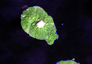
 Camiguin Island, just off the coast of north-central Mindanao Island (lower right), consists of four overlapping cones. Cloud-covered Mt. Mambajao forms the high point of the island. The youngest volcano, Hibok-Hibok (also known as Catarman) at the NW end of the island, has been historically active. Major eruptions during 1871-75 and 1948-53 formed flank lava domes at Hibok-Hibok and produced pyroclastic flows that devastated coastal villages.
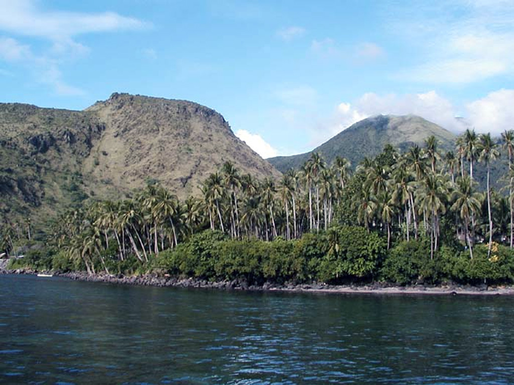
 Mt. Vulcan (left) and Hibok-Hibok (right) are two historically active lava domes on Camiguin Island. These two domes were active in the 19th and 20th centuries, with Mt. Vulcan forming in 1871. Several historical eruptions have occurred at Hibok-Hibok with the most recent during 1948-1953, when pyroclastic flows devastated island villages. The 20-km-long Camiguin Island lies just off the coast of north-central Mindanao Island and consists of four overlapping volcanoes and flank lava domes.
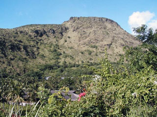
 Mt. Vulcan, a lava dome on the NW flank of the Hibok-Hibok lava-dome complex, formed during the 1871-1875 eruption. Following earthquakes beginning in January 1871, an explosion occurred on 30 April from a vent on the NW flank near the coast, destroying an area with a 3 km radius. Explosive activity continued for about a week, after which lava effusion began. Dome growth lasted for four years, producing by 1875 a dome about 1.6 km in diameter.
 There are no samples for Camiguin in the Smithsonian's NMNH Department of Mineral Sciences Rock and Ore collection.
| Copernicus Browser | The Copernicus Browser replaced the Sentinel Hub Playground browser in 2023, to provide access to Earth observation archives from the Copernicus Data Space Ecosystem, the main distribution platform for data from the EU Copernicus missions. |
| MIROVA | Middle InfraRed Observation of Volcanic Activity (MIROVA) is a near real time volcanic hot-spot detection system based on the analysis of MODIS (Moderate Resolution Imaging Spectroradiometer) data. In particular, MIROVA uses the Middle InfraRed Radiation (MIR), measured over target volcanoes, in order to detect, locate and measure the heat radiation sourced from volcanic activity. |
| MODVOLC Thermal Alerts | Using infrared satellite Moderate Resolution Imaging Spectroradiometer (MODIS) data, scientists at the Hawai'i Institute of Geophysics and Planetology, University of Hawai'i, developed an automated system called MODVOLC to map thermal hot-spots in near real time. For each MODIS image, the algorithm automatically scans each 1 km pixel within it to check for high-temperature hot-spots. When one is found the date, time, location, and intensity are recorded. MODIS looks at every square km of the Earth every 48 hours, once during the day and once during the night, and the presence of two MODIS sensors in space allows at least four hot-spot observations every two days. Each day updated global maps are compiled to display the locations of all hot spots detected in the previous 24 hours. There is a drop-down list with volcano names which allow users to 'zoom-in' and examine the distribution of hot-spots at a variety of spatial scales. |
|
WOVOdat
Single Volcano View Temporal Evolution of Unrest Side by Side Volcanoes |
WOVOdat is a database of volcanic unrest; instrumentally and visually recorded changes in seismicity, ground deformation, gas emission, and other parameters from their normal baselines. It is sponsored by the World Organization of Volcano Observatories (WOVO) and presently hosted at the Earth Observatory of Singapore.
GVMID Data on Volcano Monitoring Infrastructure The Global Volcano Monitoring Infrastructure Database GVMID, is aimed at documenting and improving capabilities of volcano monitoring from the ground and space. GVMID should provide a snapshot and baseline view of the techniques and instrumentation that are in place at various volcanoes, which can be use by volcano observatories as reference to setup new monitoring system or improving networks at a specific volcano. These data will allow identification of what monitoring gaps exist, which can be then targeted by remote sensing infrastructure and future instrument deployments. |
| Volcanic Hazard Maps | The IAVCEI Commission on Volcanic Hazards and Risk has a Volcanic Hazard Maps database designed to serve as a resource for hazard mappers (or other interested parties) to explore how common issues in hazard map development have been addressed at different volcanoes, in different countries, for different hazards, and for different intended audiences. In addition to the comprehensive, searchable Volcanic Hazard Maps Database, this website contains information about diversity of volcanic hazard maps, illustrated using examples from the database. This site is for educational purposes related to volcanic hazard maps. Hazard maps found on this website should not be used for emergency purposes. For the most recent, official hazard map for a particular volcano, please seek out the proper institutional authorities on the matter. |
| IRIS seismic stations/networks | Incorporated Research Institutions for Seismology (IRIS) Data Services map showing the location of seismic stations from all available networks (permanent or temporary) within a radius of 0.18° (about 20 km at mid-latitudes) from the given location of Camiguin. Users can customize a variety of filters and options in the left panel. Note that if there are no stations are known the map will default to show the entire world with a "No data matched request" error notice. |
| UNAVCO GPS/GNSS stations | Geodetic Data Services map from UNAVCO showing the location of GPS/GNSS stations from all available networks (permanent or temporary) within a radius of 20 km from the given location of Camiguin. Users can customize the data search based on station or network names, location, and time window. Requires Adobe Flash Player. |
| DECADE Data | The DECADE portal, still in the developmental stage, serves as an example of the proposed interoperability between The Smithsonian Institution's Global Volcanism Program, the Mapping Gas Emissions (MaGa) Database, and the EarthChem Geochemical Portal. The Deep Earth Carbon Degassing (DECADE) initiative seeks to use new and established technologies to determine accurate global fluxes of volcanic CO2 to the atmosphere, but installing CO2 monitoring networks on 20 of the world's 150 most actively degassing volcanoes. The group uses related laboratory-based studies (direct gas sampling and analysis, melt inclusions) to provide new data for direct degassing of deep earth carbon to the atmosphere. |
| Large Eruptions of Camiguin | Information about large Quaternary eruptions (VEI >= 4) is cataloged in the Large Magnitude Explosive Volcanic Eruptions (LaMEVE) database of the Volcano Global Risk Identification and Analysis Project (VOGRIPA). |
| EarthChem | EarthChem develops and maintains databases, software, and services that support the preservation, discovery, access and analysis of geochemical data, and facilitate their integration with the broad array of other available earth science parameters. EarthChem is operated by a joint team of disciplinary scientists, data scientists, data managers and information technology developers who are part of the NSF-funded data facility Integrated Earth Data Applications (IEDA). IEDA is a collaborative effort of EarthChem and the Marine Geoscience Data System (MGDS). |