The Global Volcanism Program has no activity reports available for La Yeguada.
The Global Volcanism Program has no Weekly Reports available for La Yeguada.
The Global Volcanism Program has no Bulletin Reports available for La Yeguada.
|
|
||||||||||||||||||||||
The Global Volcanism Program is not aware of any Holocene eruptions from La Yeguada. If this volcano has had large eruptions (VEI >= 4) prior to 12,000 years ago, information might be found on the La Yeguada page in the LaMEVE (Large Magnitude Explosive Volcanic Eruptions) database, a part of the Volcano Global Risk Identification and Analysis Project (VOGRIPA).
This compilation of synonyms and subsidiary features may not be comprehensive. Features are organized into four major categories: Cones, Craters, Domes, and Thermal Features. Synonyms of features appear indented below the primary name. In some cases additional feature type, elevation, or location details are provided.
Synonyms |
||||
| Chitra-Calobre | ||||
Cones |
||||
| Feature Name | Feature Type | Elevation | Latitude | Longitude |
| Media Luna | Pyroclastic cone | 700 m | 8° 30' 0.00" N | 80° 53' 0.00" W |
Domes |
||||
| Feature Name | Feature Type | Elevation | Latitude | Longitude |
| Castillo, El | Dome | 1297 m | ||
| Corero de la Charca, Cerro | Dome | 1229 m | ||
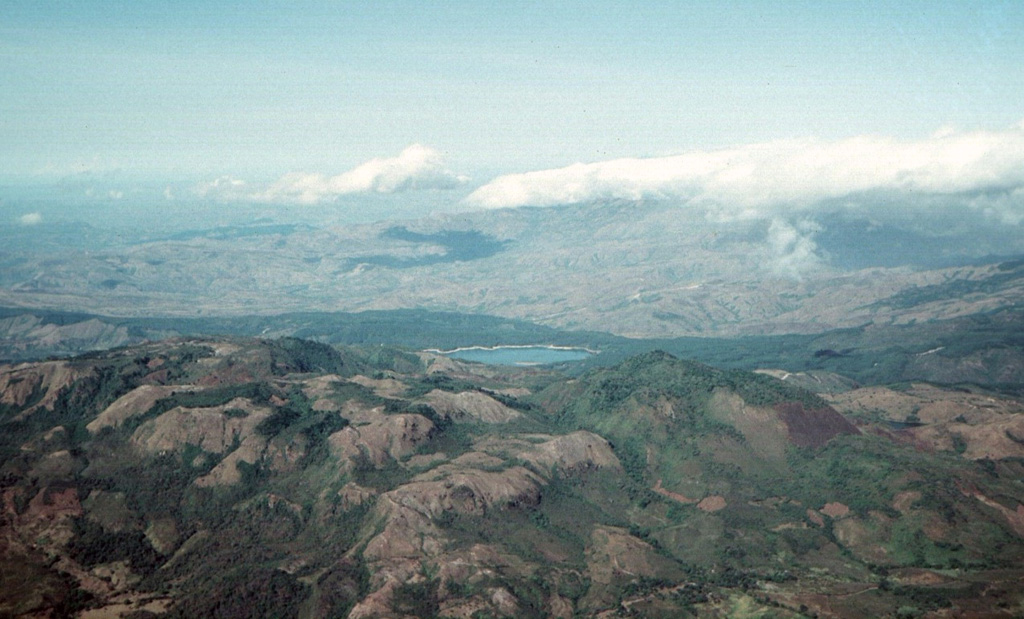
 La Yeguada volcanic complex is in the foreground with Laguna La Yeguada (center) to the west. This massive volcanic center, also known as Chitra-Calobre, lies in west-central Panamá. El Castillo dome (left) is the high point of the complex, and Cerro Corero de la Charca (right) is a late-Pleistocene lava dome.
 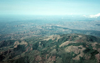 The topographic high point of the fault-bounded central horst of La Yeguada volcanic complex is Cerro el Castillo (right center). It and Cerro Novillo at the lower right are part of older Miocene rocks uplifted in the horst. Quaternary volcanism took place in the northern part of the horst, out of view to the right, about 220,000 years ago. In the background are extensive Tertiary ignimbrite deposits of La Yeguada formation, some of which are thought to have originated from vents in the central horst.
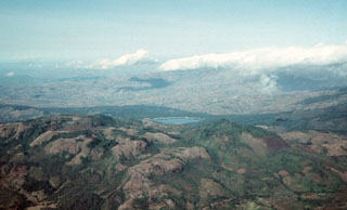
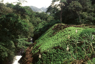 This vegetated slope is the margin of a lava flow erupted from the Media Luna scoria cone that traveled about 3 km down the Quebrada Media Luna and diverted the stream to the northern side of the valley. Near the distal end of the flow it fills a broad valley, diverting the Río Chitra to the far western side of the valley.
 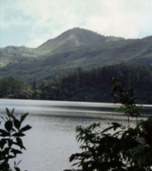 Cerro Corero de la Charca rising above the western shore of Laguna La Yeguada is the youngest silicic feature of La Yeguada complex (also known as Chitra-Calobre). The compound 1229-m-high rhyodacitic lava dome was erupted about 220,000 years ago within a 1.5-km-wide caldera and produced pyroclastic-flow deposits that extend to the SE. This eruption occurred at the northern end of the El Castillo horst and marked its latest activity.
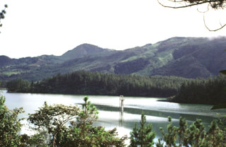 Near the center of this photo is Cerro Corero de la Charca, a lava dome that formed at the northern end of a fault-bounded horst about 220,000 years ago within a small crater within El Castillo dome (right). Recent activity at El Castillo occurred on its northern flanks at the intersection of major faults trending NNW, NW, and ENE.
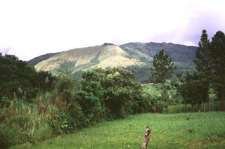 The grassy area in the sunlight at the left center is an explosion crater formed on the SW side of El Castillo volcanic horst, whose high point forms the right horizon. The breached crater is one of the Quaternary vents formed during reactivation of the horst.
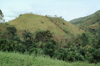 The Media Luna scoria cone at the NW side of La Yeguada volcanic complex is one of its youngest features. A lava flow that erupted from the western flank reached about 3 km to the west. A radiocarbon date of 360 ± 90 years before present (BP) was obtained from lake sediment formed when the lava flow blocked a local drainage.
 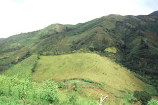 The Media Luna scoria cone in the center of the photo formed in the middle of the Media Luna valley immediately NW of the settlement of the same name. The cone contains two craters and it opens up towards the west. A lava flow from the base of the cone traveled about 3 km down the valley. A radiocarbon date of about 360 years ago was obtained from sediments within a lake formed by the flow.
 There are no samples for La Yeguada in the Smithsonian's NMNH Department of Mineral Sciences Rock and Ore collection.
| Copernicus Browser | The Copernicus Browser replaced the Sentinel Hub Playground browser in 2023, to provide access to Earth observation archives from the Copernicus Data Space Ecosystem, the main distribution platform for data from the EU Copernicus missions. |
|
WOVOdat
Single Volcano View Temporal Evolution of Unrest Side by Side Volcanoes |
WOVOdat is a database of volcanic unrest; instrumentally and visually recorded changes in seismicity, ground deformation, gas emission, and other parameters from their normal baselines. It is sponsored by the World Organization of Volcano Observatories (WOVO) and presently hosted at the Earth Observatory of Singapore.
GVMID Data on Volcano Monitoring Infrastructure The Global Volcano Monitoring Infrastructure Database GVMID, is aimed at documenting and improving capabilities of volcano monitoring from the ground and space. GVMID should provide a snapshot and baseline view of the techniques and instrumentation that are in place at various volcanoes, which can be use by volcano observatories as reference to setup new monitoring system or improving networks at a specific volcano. These data will allow identification of what monitoring gaps exist, which can be then targeted by remote sensing infrastructure and future instrument deployments. |
| IRIS seismic stations/networks | Incorporated Research Institutions for Seismology (IRIS) Data Services map showing the location of seismic stations from all available networks (permanent or temporary) within a radius of 0.18° (about 20 km at mid-latitudes) from the given location of La Yeguada. Users can customize a variety of filters and options in the left panel. Note that if there are no stations are known the map will default to show the entire world with a "No data matched request" error notice. |
| UNAVCO GPS/GNSS stations | Geodetic Data Services map from UNAVCO showing the location of GPS/GNSS stations from all available networks (permanent or temporary) within a radius of 20 km from the given location of La Yeguada. Users can customize the data search based on station or network names, location, and time window. Requires Adobe Flash Player. |
| Large Eruptions of La Yeguada | Information about large Quaternary eruptions (VEI >= 4) is cataloged in the Large Magnitude Explosive Volcanic Eruptions (LaMEVE) database of the Volcano Global Risk Identification and Analysis Project (VOGRIPA). |
| EarthChem | EarthChem develops and maintains databases, software, and services that support the preservation, discovery, access and analysis of geochemical data, and facilitate their integration with the broad array of other available earth science parameters. EarthChem is operated by a joint team of disciplinary scientists, data scientists, data managers and information technology developers who are part of the NSF-funded data facility Integrated Earth Data Applications (IEDA). IEDA is a collaborative effort of EarthChem and the Marine Geoscience Data System (MGDS). |

