Report on Asosan (Japan) — September 2011
Bulletin of the Global Volcanism Network, vol. 36, no. 9 (September 2011)
Managing Editor: Richard Wunderman.
Asosan (Japan) Small ash-bearing eruptions during May and to lesser extent in June 2011
Please cite this report as:
Global Volcanism Program, 2011. Report on Asosan (Japan) (Wunderman, R., ed.). Bulletin of the Global Volcanism Network, 36:9. Smithsonian Institution. https://doi.org/10.5479/si.GVP.BGVN201109-282110
Asosan
Japan
32.8849°N, 131.085°E; summit elev. 1592 m
All times are local (unless otherwise noted)
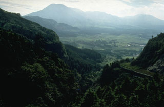
After small ash-bearing eruptions, the Alert Level on Aso was raised from 1 to 2 (on a scale of 1-5) on 17 May 2011. Aso, the largest volcano in SW Japan, consists of a large, 24-km-diameter caldera located on the Japanese island of Kyushu (figure 26). Under normal conditions the area within the caldera is restricted and, with the raising of the Alert Level, authorities restricted entry within 1 km of Naka-dake cone, containing one of the active craters that comprise the Aso volcanic complex.
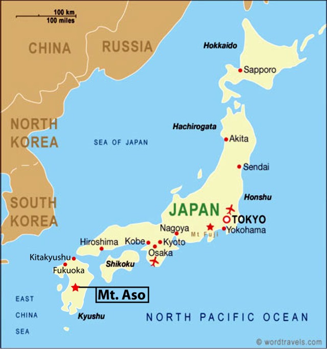 |
Figure 26. Map of the main islands of Japan; Mt. Aso is on the Island of Kyushu. Map from Wordtravels.com. |
Fumarole temperature from hydrogen isotopic ratios. The temperature of fumarole gas is a primary observation used at many volcanoes. Tsunogai and others (2011) describe a method of using hydrogen isotope ratios to determine fumarolic temperature. Because the isotopes can be collected at a distance from the vent and without entering the crater, this method offers several advantages. Aso was one of the volcanoes where this technique was applied because it has a deep crater that makes direct sampling and at-vent measurements impractical. Direct sampling of gases is potentially far more hazardous. Infrared measurements may suffer bias when cooled, outgassed material, such as ash, obstructs the hotter portions of the plume. Such measurements could understate the emission's radiant heat and thus its temperature.
We previously published a topographic map depicting the Aso caldera and the location of Naka-dake within the caldera (BGVN 19:09 ), one of 17 central cones. Of these, Naka-dake is the most active. Naka-dake has a crater lake at its summit that contributes to its tendency towards phreatic and mud eruptions.
Aso resides in a National Park of the same name. Naka-dake is easily accessible by public transport and is a popular tourist destination. The rims of the active crater area contain parking and viewpoints accessible by toll road or the Arcosan Ropeway (steel-cabled aerial tramway). At the rim, massive concrete structures offer some protection from falling ballistics in the case of sudden explosions. Another attraction in the area is the Aso Volcano Museum, which features a webcam and photos of phreatic eruptions at Aso.
Aso has been highly active in recent years, but rarely to an extent where it has become dangerous to people. Aso erupted from 10 June 2003 to 14 Jan 2004 (BGVN 29:01). During that time Aso mainly erupted mud, associated with volcanic tremors, and a small amount of ash. A rise in thermal activity in the area may have been a contributing factor in the eruption (Volcano Research Center, University Tokyo). On 14 April 2005, the volcano erupted again, forcing five tourists to be evacuated after hundreds of small earthquakes were detected in the prior two weeks.
May-June 2011 unrest. The latest series of eruptions began on 6 May 2011 with mud erupting about 5-10 m from the hot caldera lake. On 13 May the temperature of fumarolic emissions in the caldera had increased. The Japan Meteorological Agency noted that "A small volcanic flame [glow?] has been observed at nights at the crater pits in the center of Naka-dake." On 15 May, Naka-dake erupted a small amount of ash, with the plume rising to an altitude of 2.1 km. One approach to measuring areas of elevated temperature involves infrared photographs. Visible and infrared photos of Naka-dake crater documented temperature increases in the crater from 21 April to 15 May (figure 27). The temperature of fumarolic emissions in the crater reached around 370°C (the temperature measurement method was not disclosed).
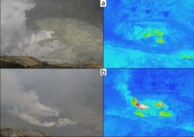 |
Figure 27. Visible (left) and infrared (right) images on two different days (contact JMA for temperature scales). a) 21 April 2011 and b) 15 May 2011. Courtesy of JMA. |
On 16 May, an eruption sent one plume to an altitude of 1.8-2.1 km and another ash plume to 2.4 km, according to the Tokyo Volcanic Ash Advisory Center. A video depicting the plume that day can be found on Youtube (Asahi.com, 2011). The video shows aerial footage of the plume, which is bent downwind. The emission is constant but not vigorous.
Rocks ejected from Naka-dake on 17 May landed in restricted areas, and ash plumes rose to an altitude of 1.8 km. Ash plumes continued rising to similar altitudes through the end of May, and small scale eruptions continued through 10 June, accompanied by low level seismicity. No additional plumes were reported through mid-October. The website of the Mt. Aso Ropeway noted that entry restrictions ended on 20 June 2011, allowing them to carry passengers.
References. Asahi.com, 2011, Naka Erupting, YouTube (URL: http://www.youtube.com/watch?v=uBKJnM2JIZs), posted 16 May 2011.
Tsunogai, U., Kamimura, K., Anzai, S., Nakagawa, F., and Komatsu, K., 2011, Hydrogen isotopes in volcanic plumes: Tracers for remote temperature sensing of fumaroles, Geochimica et Cosmochimica Acta, v. 75, no. 16, p. 4531-4546.
Geological Summary. The 24-km-wide Asosan caldera was formed during four major explosive eruptions from 300,000 to 90,000 years ago. These produced voluminous pyroclastic flows that covered much of Kyushu. The last of these, the Aso-4 eruption, produced more than 600 km3 of airfall tephra and pyroclastic-flow deposits. A group of 17 central cones was constructed in the middle of the caldera, one of which, Nakadake, is one of Japan's most active volcanoes. It was the location of Japan's first documented historical eruption in 553 CE. The Nakadake complex has remained active throughout the Holocene. Several other cones have been active during the Holocene, including the Kometsuka scoria cone as recently as about 210 CE. Historical eruptions have largely consisted of basaltic to basaltic-andesite ash emission with periodic strombolian and phreatomagmatic activity. The summit crater of Nakadake is accessible by toll road and cable car, and is one of Kyushu's most popular tourist destinations.
Information Contacts: Japan Meteorological Agency (JMA), 1-3-4 Otemachi, Chiyoda-ku, Tokyo 100-8122, Japan (URL: http://www.jma.go.jp/); Volcano Research Center, VRC-ERI, Univ. Tokyo (URL: http://www.eri.u-tokyo.ac.jp/VRC/index_E.html); Wordtravels (URL: http://www.wordtravels.com/Travelguide/Countries/Japan/Map).