Report on Soufriere St. Vincent (Saint Vincent and the Grenadines) — 31 March-6 April 2021
Smithsonian Institution / US Geological Survey
Weekly Volcanic Activity Report, 31 March-6 April 2021
Managing Editor: Sally Sennert.
Please cite this report as:
Global Volcanism Program, 2021. Report on Soufriere St. Vincent (Saint Vincent and the Grenadines) (Sennert, S, ed.). Weekly Volcanic Activity Report, 31 March-6 April 2021. Smithsonian Institution and US Geological Survey.
Soufriere St. Vincent
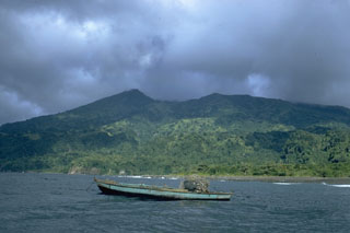
Saint Vincent and the Grenadines
13.33°N, 61.18°W; summit elev. 1220 m
All times are local (unless otherwise noted)
University of the West Indies Seismic Research Centre (UWI-SRC) and National Emergency Management Organisation (NEMO) reported that the lava dome in Soufrière St. Vincent’s main crater continued to slowly grow during 31 March-6 April, expanding to the N and S. Gas-and-steam continued to rise from the top of the dome, as well as along the contact with the pre-existing 1979 dome. A swarm of volcano-tectonic (VT) earthquakes began at 0638 on 5 April. The number and frequency of the VTs increased until about 0830 and then stabilized. The rate declined at around 1400 and then significantly dropped at 1600, though small VT events continued to be detected through 1800. The events were located at depths of 6 km, slightly deeper than the swarm events recorded during 22-25 March, located at revised depths of 3-5 km. Several reports of felt events came from nearby communities, including Fancy and Chateaubelair. The largest event, a M 3.5, was recorded at 0920 and felt by local residents. The swarm was more intense than the previous one, with an average rate of about 50 earthquakes per hour compared with 1.5 per hour during 22-25 March. The Alert Level remained at Orange (the second highest level on a four-color scale).
Geological Summary. Soufrière St. Vincent is the northernmost and youngest volcano on St. Vincent Island. The NE rim of the 1.6-km wide summit crater is cut by a crater formed in 1812. The crater itself lies on the SW margin of a larger 2.2-km-wide caldera, which is breached widely to the SW as a result of slope failure. Frequent explosive eruptions after about 4,300 years ago produced pyroclastic deposits of the Yellow Tephra Formation, which cover much of the island. The first historical eruption took place in 1718; it and the 1812 eruption produced major explosions. Much of the northern end of the island was devastated by a major eruption in 1902 that coincided with the catastrophic Mont Pelée eruption on Martinique. A lava dome was emplaced in the summit crater in 1971 during a strictly effusive eruption, forming an island within a lake that filled the crater. A series of explosive eruptions in 1979 destroyed the 1971 dome and ejected the lake; a new dome was then built.
Sources: University of the West Indies Seismic Research Centre (UWI-SRC), National Emergency Management Organisation (NEMO), Government of Saint Vincent and the Grenadines