Global Volcanism Program | Image GVP-05211

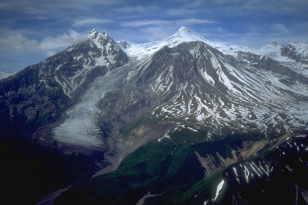
During the late Pleistocene or early Holocene Mount Spurr underwent flank collapse, resulting in the 5-6 km crater that opens to the south shown here in 1993. The collapse produced a debris avalanche that traveled at least 25 km from the summit. The snow-covered peak (center) is a post-collapse lava dome. Crater Peak, in front of it, has been the source of frequent Holocene eruptions.
Photo by Christina Neal, 1993 (U.S. Geological Survey, Alaska Volcano Observatory).
![]() This image is made available as a Public Domain Work, but proper attribution is appreciated.
This image is made available as a Public Domain Work, but proper attribution is appreciated.
Galleries: Lava Domes | Stratovolcanoes
Keywords: stratovolcano | crater | lava dome | landslide scarp

Spurr
