Global Volcanism Program | Image GVP-07832
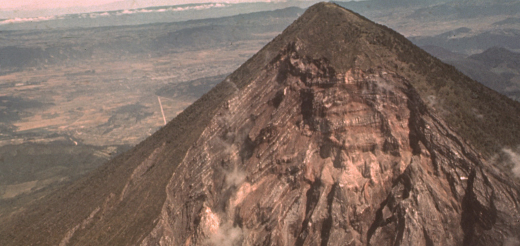
The catastrophic 1902 Santa María eruption formed a massive 1.5-km-wide crater in the SW flank. The upper part of the crater wall, which extends nearly to the summit of Santa María, is seen here from the SW. Guatemala's second largest city, Quetzaltenango, lies in the basin visible to the left, 10 km to the NNE. The 1902 eruption took place after a long period of quiescence that followed construction of the edifice.
Photo by Sam Bonis (Instituto Geográfico Nacional).
![]() This image is made available under the Creative Commons BY-NC-ND 4.0 license terms.
This image is made available under the Creative Commons BY-NC-ND 4.0 license terms.
Galleries: Debris Avalanches / Landslides
Keywords: stratigraphy | outcrop | crater

Santa María