Global Volcanism Program | Image GVP-08572
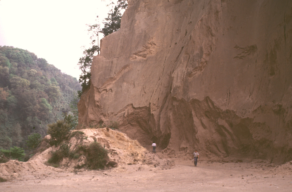
A quarry along the road between Teocelo and Cosautlán de Carvajal exposes thick deposits of the 230 km3 Xáltipan Ignimbrite from Los Humeros volcano. This outcrop lies about 50 km SE of Los Humeros, beyond the Pico de Orizaba-Cofre de Perote range, much of which post-dates the 460,000-year-old ignimbrite. Eruption of the Xáltipan Ignimbrite, which covered an area of about 3,500 km2, resulted in the formation of a 15 x 21 km wide caldera.
Photo by Lee Siebert, 2000 (Smithsonian Institution).
![]() This image is made available under the Public Domain Dedication CC0 license, but proper attribution is appreciated.
This image is made available under the Public Domain Dedication CC0 license, but proper attribution is appreciated.
Keywords: outcrop | stratigraphy | ignimbrite | deposit
Los Humeros