Global Volcanism Program | Image GVP-12434
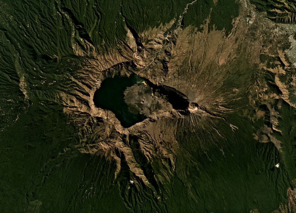
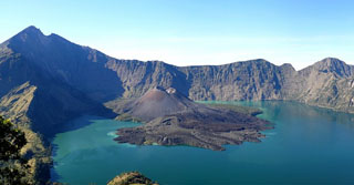
A lake partly fills the Segara Anak caldera (6 x 8.5 km wide, 800 m deep) of Rinjani volcano, shown here in this July 2019 Planet Labs satellite image monthly mosaic (N is at the top). The caldera formed during the 1257 eruption of Samalas volcano, the prior edifice. Barujari cone has formed within the caldera through a series of lava flow-producing eruptions. A roughly 1-km-wide crater is at the summit along the eastern side of the caldera.
Satellite image courtesy of Planet Labs Inc., 2019 (https://www.planet.com/).
Copyrighted image used with permission. All Rights Reserved. Contact photographer for any usage requests.
Galleries: Calderas
Keywords: caldera | scoria cone | crater | erosion
Rinjani