Mount St. Helens 40th Anniversary — The 1980 Eruption
Forty years ago, on May 18th, 1980, Mount St. Helens produced the largest observed eruption in the coterminus United States. This eruption had profound impacts on human life and the science of volcanology, as well as on hazard preparedness, communication, and forecasting.
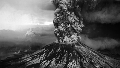
Mount St. Helens is the most active volcano in the Cascade Range and 40 years ago, a large eruption redefined the field of volcanology. The activity started as a series of small earthquakes on 16 March 1980. By 17 May, after more than 10,000 detected earthquakes, a visible bulge had grown outward by 450 ft on the N flank. On the morning of 18 May, a magnitude 5.1 earthquake triggered a huge landslide, resulting in powerful explosions that ejected hot material above the volcano and laterally outwards to the north. Following the explosion, an eruption column rose more than 80,000 ft into the atmosphere, eventually resulting in heavy ashfall across 22,000 square miles. On the afternoon of 18 May, pyroclastic flows were generated in the crater, traveling as far as 5 miles N of the volcano. Hot rocks and gas melted the snow and ice on the volcano, which caused volcanic mudflows (lahars) to run into the river systems, destroying trees, roads, and bridges along the way.
During the summer and fall of 1980, five smaller explosions resulted in eruption columns and pyroclastic flows. Activity continued through 1986, which included the formation of a new lava dome, minor explosions, and lahars. Since the 1986 activity there have been several periods of increased seismicity and small explosions from the dome.
|
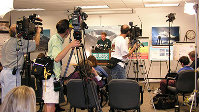
Resident and Other Human Experiences
|
Interview with Jeff Renner, Reporter. Jeff Renner was a science reporter during the 1980 Mount St. Helens eruption. He shares was it was like behind the scenes with the scientists including Dr. David Johnston, and what we can bring forward to the present day in terms of our relationships with scientists during a crisis. |
|
Lahars and Downstream Effects
|
Interview with Jon Major, Research Hydrologist, USGS Cascades Volcano Observatory. The May 18, 1980 eruption drastically changed the landscape in just minutes. The events of that day are still impacting the area, with the enormous amount of volcanic rock that slid from the volcano and was erupted onto the landscape. USGS Research Hydrologist Jon Major discusses the efforts to manage the high sediment load of the system, and Spirit Lake since the output was blocked by the eruption. |
|
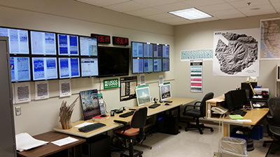
Seismicity of the 1980 Eruption
|
Interview with Steve Malone, Research Professor Emeritus, Department of Earth and Space Sciences, University of Washington, Seattle, WA. Past Director of the Pacific Northwest Seismic Network; in 1980 he was a Senior Research Associate. Seismologist Steve Malone was one of the first people to see signs of life at Mount St. Helens in 1980. He takes us back through what it was like, and how seismology was much different than what it is today. |
|
Forecasting the 1980 Eruption
|
Interview with Heather Wright, Research Geologist, Volcano Disaster Assistance Program (VDAP), USGS Cascades Volcano Observatory. Each volcano is different and understanding the eruption history of a volcano in question is important. The deposits from past eruptions tell us what the volcano might do next. The eruptive history of Mount St. Helens is well understood now, which would help with eruption forecasts in the future. Studying the rocks, the crystals and vesicles in the rocks, tells us more about what the magma did before it erupted and ash it was erupting, providing us with information on how that system works. |
|
Preservation of the Mount St. Helens Landscape
|
Interview with Tom Casadevall, Scientist Emeritus, U.S. Geological Survey. Preserving volcanic landscapes helps us to enjoy these beautiful places and to learn from their past eruptions. The Mount St. Helens May 18, 1980 eruption was recorded in video, photographs, and eye witness accounts, allowing volcanologists to understand the deposits and to use this knowledge on other volcanoes around the world. Tom Casadevall explains the different types of preserved volcanic landscapes and why they are so valuable. |