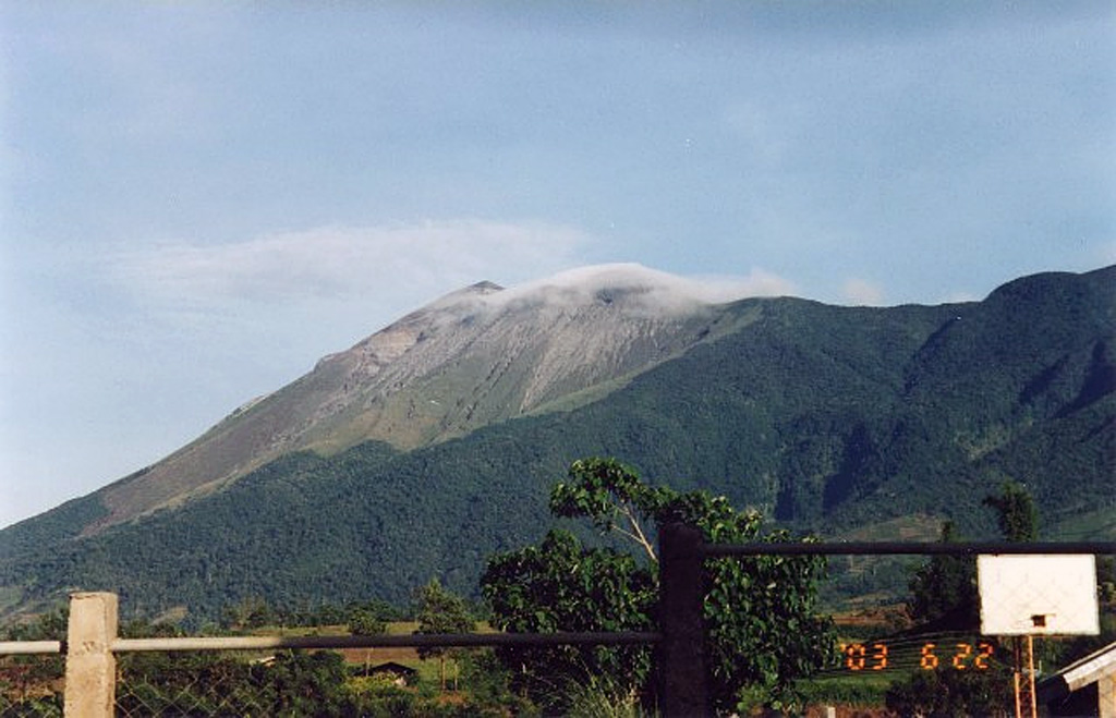
Aira (Japan) | 25 September-1 October 2024 | Continuing Activity Cite this Report Cite this Report |
 Aira Aira
Ryukyu Volcanic Arc
|
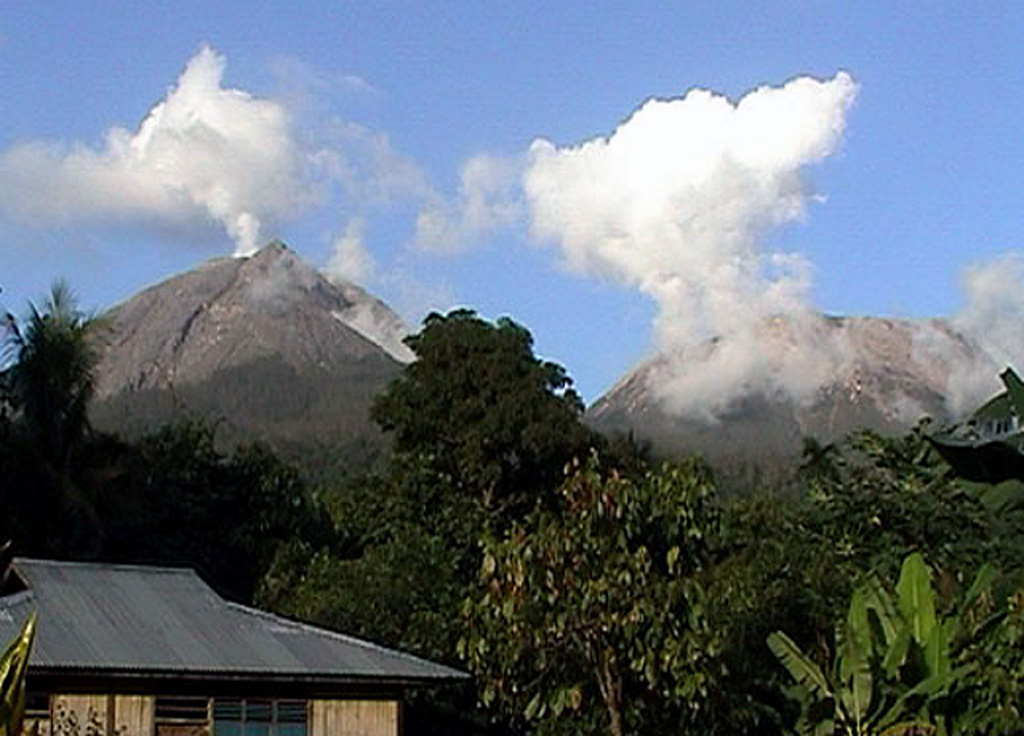
Japan Meteorological Agency (JMA) reported ongoing eruptive activity at Minamidake Crater (Aira Caldera’s Sakurajima volcano) during 23-30 September. Crater incandescence was visible in webcam images during dark hours. During a field survey on 26 September scientists observed no new changes to the geothermal area on the SE flank of Minamidake nor near Showa Crater compared to previous observations. Incandescence at Minamidake was barely visible with the naked eye. An eruptive event at 2001 on 26 September generated an ash plume that rose 1.3 km above the crater rim and drifted SW. Very small eruptive events were occasionally recorded during 27-30 September. The Alert Level remained at 3 (on a 5-level scale), and the public was warned to stay 1 km away from both craters.
Source: Japan Meteorological Agency (JMA)
|
Ambae (Vanuatu) | 25 September-1 October 2024 | Continuing ActivityCite this Report |
 Ambae Ambae
Vanuatu Volcanic Arc
|
On 26 September the Vanuatu Meteorology and Geohazards Department (VMGD) reported that steam-and-gas emissions from the active vents at Ambae were ongoing during the previous month; ash content was not confirmed. The observations were based on webcam and satellite images and field observations. Seismic data also confirmed ongoing unrest. The Alert Level remained at 2 (on a scale of 0-5), and the public was warned to stay outside of the Danger Zone, defined as a 2-km radius around the active vents in Lake Voui, and away from drainages during heavy rains.
Source: Vanuatu Meteorology and Geohazards Department (VMGD)
|
Bezymianny (Russia) | 25 September-1 October 2024 | Continuing ActivityCite this Report |
 Bezymianny Bezymianny
Eastern Kamchatka Volcanic Arc
|
The Kamchatka Volcanic Eruption Response Team (KVERT) reported that a thermal anomaly over Bezymianny was identified in satellite images during 20-21 and 23-26 September. The volcano was obscured by weather clouds on the other days of the week. On 25 September a plume of resuspended ash lifted from the S flank by strong winds was visible in satellite and webcam images drifting 90 km E. The resuspended ash prompted KVERT to briefly raise the Aviation Color Code from Yellow to Orange (the second highest level on a four-color scale) at 2310; the Aviation Color Code was lowered back to Yellow at 0323 on 26 September.
Source: Kamchatkan Volcanic Eruption Response Team (KVERT)
|
Dukono (Indonesia) | 25 September-1 October 2024 | Continuing ActivityCite this Report |
 Dukono Dukono
Halmahera Volcanic Arc
|
Pusat Vulkanologi dan Mitigasi Bencana Geologi (PVMBG) reported that the eruption at Dukono was ongoing during 25 September-1 October. Daily dense gray-and-white ash plumes rose 100-800 m above the summit and drifted W and NW. The Alert Level remained at Level 2 (on a scale of 1-4), and the public was warned to remain outside of the 3-km exclusion zone.
Source: Pusat Vulkanologi dan Mitigasi Bencana Geologi (PVMBG, also known as CVGHM)
|
Ebeko (Russia) | 25 September-1 October 2024 | Continuing ActivityCite this Report |
 Ebeko Ebeko
Kuril Volcanic Arc
|
The Kamchatkan Volcanic Eruption Response Team (KVERT) reported that moderate explosive activity was ongoing at Ebeko during 19-26 September. According to volcanologists in Severo-Kurilsk (Paramushir Island, about 7 km E), explosions during 19, 21, and 24-25 September generated ash plumes that rose as high as 2 km (6,600 ft) a.s.l. and drifted NE, E, and SE. Thermal anomalies were identified in satellite images on 23 and 26 September; on other days either no activity was observed, or weather conditions prevented views. The Aviation Color Code remained at Orange (the third level on a four-color scale). Dates are UTC; specific events are in local time where noted.
Source: Kamchatkan Volcanic Eruption Response Team (KVERT)
|
Etna (Italy) | 25 September-1 October 2024 | Continuing ActivityCite this Report |
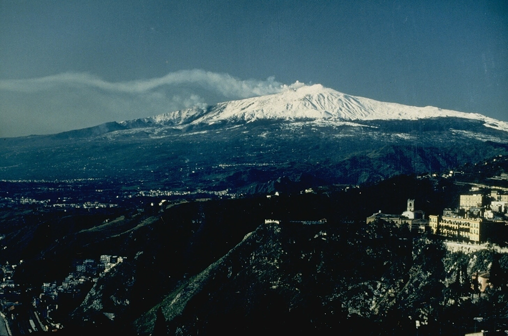 Etna Etna
Sicily Volcanic Province
|
Sezione di Catania - Osservatorio Etneo (INGV) reported that continuous gas emissions rose from Etna’s summit craters during 23-29 September. Explosive activity at NE Crater that began at around 2300 on 23 September continued through the week, though with less frequently, based on webcam images.
Source: Sezione di Catania - Osservatorio Etneo (INGV)
|
Great Sitkin (United States) | 25 September-1 October 2024 | Continuing ActivityCite this Report |
 Great Sitkin Great Sitkin
Aleutian Ridge Volcanic Arc
|
Alaska Volcano Observatory (AVO) reported that slow lava effusion continued to feed a thick lava flow in Great Sitkin’s summit crater during 24 September-1 October. The lava flow had filled most of the summit crater. The local seismic network continued to detect small earthquakes and other signals associated with the ongoing eruption. Weather clouds often obscured views of the summit. The Volcano Alert Level remained at Watch (the third level on a four-level scale) and the Aviation Color Code remained at Orange (the third color on a four-color scale).
Source: US Geological Survey Alaska Volcano Observatory (AVO)
|
Ibu (Indonesia) | 25 September-1 October 2024 | Continuing ActivityCite this Report |
 Ibu Ibu
Halmahera Volcanic Arc
|
Pusat Vulkanologi dan Mitigasi Bencana Geologi (PVMBG) reported that activity at Ibu continued during 25 September-1 October with multiple daily eruptive events. Daily gray or white-and-gray ash plumes that were sometimes dense rose as high as 1.5 km above the summit and drifted in multiple directions. Webcam images posted with the reports showed incandescence visible above the crater rim. The Alert Level remained at 3 (the second highest level on a four-level scale) and the public was advised to stay 4 km away from the active crater and 5 km away from the N crater wall opening.
Source: Pusat Vulkanologi dan Mitigasi Bencana Geologi (PVMBG, also known as CVGHM)
|
Karymsky (Russia) | 25 September-1 October 2024 | Continuing ActivityCite this Report |
 Karymsky Karymsky
Eastern Kamchatka Volcanic Arc
|
Kamchatkan Volcanic Eruption Response Team (KVERT) reported moderate levels of activity at Karymsky during 19-26 September. A minor thermal anomaly over the volcano was identified in satellite images during 22-23 and 25-26 September; weather clouds obscured views on the other days. The Aviation Color Code remained at Orange (the third level on a four-color scale). Dates are based on UTC times; specific events are in local time where noted.
Source: Kamchatkan Volcanic Eruption Response Team (KVERT)
|
Lewotobi (Indonesia) | 25 September-1 October 2024 | Continuing ActivityCite this Report |
 Lewotobi Lewotobi
Sunda Volcanic Arc
|
Pusat Vulkanologi dan Mitigasi Bencana Geologi (PVMBG) reported that eruptive activity at Lewotobi’s Laki-laki volcano continued during 25 September-1 October from a vent on the upper NW flank. Daily gray or white-and-gray ash plumes that were sometimes dense rose as high as 1.2 km above the summit and drifted SW, W, NW, and N. The Alert Level remained at 3 (the second highest level on a scale of 1-4) and the public was warned to stay outside of the exclusion zone, defined as a 3 km radius around both Laki-laki and Perempuan craters, 4 km to the NNW and SSE of Laki-laki.
Source: Pusat Vulkanologi dan Mitigasi Bencana Geologi (PVMBG, also known as CVGHM)
|
Manam (Papua New Guinea) | 25 September-1 October 2024 | Continuing ActivityCite this Report |
 Manam Manam
Bismarck Volcanic Arc
|
The Darwin VAAC reported that during 0000-0600 on 29 September ash plumes from Manam were identified in satellite images rising 2.4 km (8,000 ft) a.s.l. and drifting NW. At 0230 on 1 October an ash plume rose 4 km (13,000 ft) a.s.l. and drifted S.
Source: Darwin Volcanic Ash Advisory Centre (VAAC)
|
Merapi (Indonesia) | 25 September-1 October 2024 | Continuing ActivityCite this Report |
 Merapi Merapi
Sunda Volcanic Arc
|
Balai Penyelidikan dan Pengembangan Teknologi Kebencanaan Geologi (BPPTKG) reported that the eruption at Merapi (on Java) continued during 20-26 September. Seismicity was less intense compared to the previous week. The SW lava dome produced 204 lava avalanches that traveled as far as 1.8 km down the Bebeng drainage on the SW flank. Five pyroclastic flows descended the Bebeng as far as 1.2 km. Morphological changes to the SW lava dome were due to continuing effusion and collapses of material. The Alert Level remained at 3 (on a scale of 1-4), and the public was warned to stay 3-7 km away from the summit, based on location.
Source: Balai Penyelidikan dan Pengembangan Teknologi Kebencanaan Geologi (BPPTKG)
|
Nevado del Ruiz (Colombia) | 25 September-1 October 2024 | Continuing ActivityCite this Report |
 Nevado del Ruiz Nevado del Ruiz
Northern Andean Volcanic Arc
|
Servicio Geológico Colombiano’s (SGC) Observatorio Vulcanológico y Sismológico de Manizales reported that eruptive activity at Nevado del Ruiz continued during 24-30 September. The number of seismic events associated with fluid movement increased in both magnitude and number compared to the previous week but were variable between low and moderate levels throughout the week. Webcam images confirmed ash emissions associated with some of these events along with occasional ejections of hotter material. Ash plumes rose as high as 2 km above the crater rim and drifted NW and WNW during the first half of the week and N, E, and SE during the second half of the week. Ashfall was reported in Cabaña de Brisas (NW) and in areas to the E around the Lagunilla River. Seismicity associated with rock fracturing increased in the number of events, though their magnitudes were comparable to the previous week; these earthquakes, with depths ranging from less than 1 km down to 8 km below the summit, were primarily located within 4 km SSW, S, SE, and SE of Arenas Crater. The largest event was an M 1 which was detected at 2131 on 28 September and located about 2 km SSE and 4 km deep. Sulfur dioxide emissions were variable, and drift directions were not towards measuring stations; satellite measurements indicated increased emissions and a high value on 29 September that had not been recorded since February 2023. Low-to-moderate thermal anomalies on the crater floor were identified in satellite data. The Alert Level remained at Yellow (the second level on a four-level scale), and the public was warned to stay out of the restricted areas around Arenas Crater, not to spend long periods of time on the Murillo-Cerro Gualí Road, and to avoid drainages in the high-threat zones.
Source: Servicio Geológico Colombiano (SGC)
|
Nyamulagira (DR Congo) | 25 September-1 October 2024 | Continuing ActivityCite this Report |
 Nyamulagira Nyamulagira
Albertine Rift Volcanic Province
|
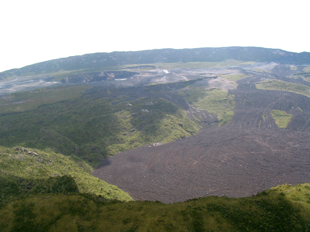
A 28 September satellite image showed some minor advancement (around 200 m) of the W branch of Nyamuragira’s NNW lava flow compared to an 18 September image. Small thermal anomalies were concentrated near the end of the NNW lava flow and at the end of the W branch, and a few were located along the flow about of a third of the way up the flank. A thermal anomaly was present the part of the eastern crater floor. A few small thermal anomalies on the W flank flow were visible, though weather clouds obscured most of W flank. Weather clouds also obscured part of the summit crater and the upper NNW flow.
Source: Copernicus
|
Popocatepetl (Mexico) | 25 September-1 October 2024 | Continuing ActivityCite this Report |
 Popocatepetl Popocatepetl
Trans-Mexican Volcanic Belt
|
Centro Nacional de Prevención de Desastres (CENAPRED) reported that eruptive activity continued at Popocatépetl during 24 September-1 October. Weather clouds sometimes prevented visual observations. The seismic network recorded 9-58 long-period events per day that were accompanied by steam-and-gas emissions; emissions contained minor amounts of ash during 29-30 September. The seismic network also recorded daily tremor with periods lasting from 57 minutes up to five hours and nine minutes, and a period of emissions that lasted 18 minutes during 27-28 September. According to the Washington VAAC ash plumes visible in webcam and satellite images on 28 September rose to 6.7 km (22,000 ft) a.s.l. (or about 1.3 km above the crater rim) and drifted NW and NE. The Alert Level remained at Yellow, Phase Two (the middle level on a three-color scale) and the public was warned to stay 12 km away from the crater.
Sources: Centro Nacional de Prevencion de Desastres (CENAPRED), Washington Volcanic Ash Advisory Center (VAAC)
|
Reventador (Ecuador) | 25 September-1 October 2024 | Continuing ActivityCite this Report |
 Reventador Reventador
Northern Andean Volcanic Arc
|
Instituto Geofísico-Escuela Politécnica Nacional (IG-EPN) reported that an eruption at Reventador was ongoing during 24 September-1 October. Signals from the seismic stations were not transmitted during the first half of the week; during 28 September-1 October seismicity was characterized by 79-105 daily explosions, long-period earthquakes, harmonic tremor, and tremor associated with emissions. Ash-and-gas plumes were observed in webcam images and/or satellite images rising as high as 1.1 km above the crater rim and drifting NW, WNW, and W. Webcams occasionally did not transmit data and weather conditions sometimes obscured views. Thermal anomalies in the crater were identified in satellite images on most days. Secretaría de Gestión de Riesgos maintained the Alert Level at Orange (the second highest level on a four-color scale).
Sources: Instituto Geofísico-Escuela Politécnica Nacional (IG-EPN), Secretaría de Gestión de Riesgos (SGR)
|
Rincon de la Vieja (Costa Rica) | 25 September-1 October 2024 | Continuing ActivityCite this Report |
 Rincon de la Vieja Rincon de la Vieja
Central America Volcanic Arc
|
Observatorio Vulcanologico y Sismologico de Costa Rica-Universidad Nacional (OVSICORI-UNA) reported that small phreatic eruptions at Rincón de la Vieja were recorded at 1715, 2225, and 2248 on 26 September, at 0538 on 27 September, and at 2200 on 29 September. Emissions from the events did not contain ash.
Source: Observatorio Vulcanologico y Sismologico de Costa Rica-Universidad Nacional (OVSICORI-UNA)
|
Sabancaya (Peru) | 25 September-1 October 2024 | Continuing ActivityCite this Report |
 Sabancaya Sabancaya
Central Andean Volcanic Arc
|
Instituto Geofísico del Perú (IGP) reported that the eruption at Sabancaya continued during 23-29 September with a daily average of 18 explosions. Gas-and-ash plumes rose as high as 2.3 km above the summit and drifted less than 10 km SE and S. Thermal anomalies over the lava dome in the summit crater were identified in satellite data. Slight inflation was detected N of Hualca Hualca (7 km N). Sulfur dioxide emissions were at moderate levels, averaging 729 tons per day. The Alert Level remained at Orange (the third level on a four-color scale) and the public was warned to stay outside of a 12 km radius.
Source: Instituto Geofísico del Perú (IGP)
|
Semeru (Indonesia) | 25 September-1 October 2024 | Continuing ActivityCite this Report |
 Semeru Semeru
Sunda Volcanic Arc
|
Pusat Vulkanologi dan Mitigasi Bencana Geologi (PVMBG) reported that eruptive activity continued at Semeru during 25 September-1 October with multiple daily eruptive events recorded by the seismic network. White-and-gray ash plumes that were sometimes dense rose 100-600 m above the summit and drifted NW, W, SW, and S; eruptive events were recorded on 27 September, but no emissions were observed. The Alert Level remained at 2 (the second lowest level on a scale of 1-4). The public was warned to stay at least 5 km away from the summit in all directions, 13 km from the summit to the SE, 500 m from the banks of the Kobokan drainage as far as 17 km from the summit, and to avoid other drainages including the Bang, Kembar, and Sat, due to lahar, avalanche, and pyroclastic flow hazards.
Source: Pusat Vulkanologi dan Mitigasi Bencana Geologi (PVMBG, also known as CVGHM)
|
Sheveluch (Russia) | 25 September-1 October 2024 | Continuing ActivityCite this Report |
 Sheveluch Sheveluch
Eastern Kamchatka Volcanic Arc
|
Kamchatkan Volcanic Eruption Response Team (KVERT) reported that during 19-26 September lava extrusion likely continued at Sheveluch’s “300 years of RAS” dome on the SW flank of Old Sheveluch and at the dome at Young Sheveluch. Daily thermal anomalies over the domes were identified in satellite images. Plumes of resuspended ash drifted 1,500 km E during 25-26 September. The Aviation Color Code remained at Orange (the second highest level on a four-color scale). Dates are based on UTC times; specific events are in local time where noted.
Source: Kamchatkan Volcanic Eruption Response Team (KVERT)
|
Stromboli (Italy) | 25 September-1 October 2024 | Continuing ActivityCite this Report |
 Stromboli Stromboli
Aeolian Volcanic Arc
|
Sezione di Catania - Osservatorio Etneo (INGV) reported that eruptive activity continued at Stromboli during 23-29 September. Webcam images showed Strombolian activity at two vents in Area N within the upper part of the Sciara del Fuoco and from at least two vents in Area C-S (South-Central Crater) on the crater terrace. The vents in Area N continued to produce explosions at a rate of 3-15 events per hour, ejecting lapilli and bombs less than 80 m above the vents. Spattering was observed that was intense on 23 and 26 September. Explosions at the vent in Area C-S mainly occurred at a rate of 1-5 events per hour during 26-28 September and ejected tephra over 250 m above the vent. The Alert Level remained at Yellow (the second lowest level on a four-level scale).
Source: Sezione di Catania - Osservatorio Etneo (INGV)
|
Suwanosejima (Japan) | 25 September-1 October 2024 | Continuing ActivityCite this Report |
 Suwanosejima Suwanosejima
Ryukyu Volcanic Arc
|
Japan Meteorological Agency (JMA) reported that eruptive activity at Suwanosejima's Ontake Crater continued during 23-30 September. Crater incandescence was observed nightly in webcam images. Explosions were recorded by the seismic network at 0337, 0428, 0730, and 1720 on 25 September, at 1415 and 1554 on 26 September, and at 1810 on 28 September. The explosions generated ash-and-gas plumes that rose 1-1.6 km above the crater rim and drifted mainly W and SW. Eruptive events during 24-28 and 30 September produced ash-and-gas plumes that rose 1-1.6 km above the crater rim and drifted and drifted mainly W and SW. Occasional ashfall was reported at the Suwanosejima Branch Office in Toshima village (3.5 km SSW), though dates were unspecified. The Alert Level remained at 2 (on a 5-level scale) and the public was warned to stay at least 1.5 km away from the crater.
Source: Japan Meteorological Agency (JMA)
|
Yasur (Vanuatu) | 25 September-1 October 2024 | Continuing ActivityCite this Report |
 Yasur Yasur
Vanuatu Volcanic Arc
|
On 26 September the Vanuatu Meteorology and Geohazards Department (VMGD) reported that activity at Yasur continued at a level of “major unrest,” as defined by the Alert Level 2 status (on a scale of 0-5). Recent visual observations, webcam mages, and photos taken in the field indicated that explosions continued, producing emissions of gas, steam, and/or ash. Gas emissions and thermal anomalies were identified in satellite images. The report warned that some of the explosions may eject material that falls in and around the crater. The public was reminded to not enter the restricted area within 600 m around the boundaries of the Permanent Exclusion Zone, defined by Danger Zone A on the hazard map.
Source: Vanuatu Meteorology and Geohazards Department (VMGD)
|

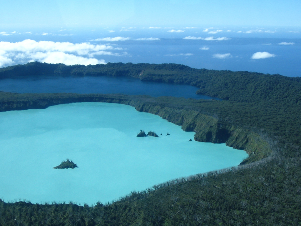
 Kanlaon
 Taal
Taal Whakaari/White Island