Bezymianny (Russia) | 5 February-11 February 2025 | New Activity / Unrest
Cite this Report
|
Bezymianny Eastern Kamchatka Volcanic Arc
|
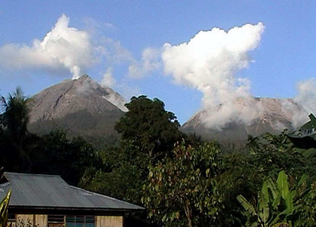
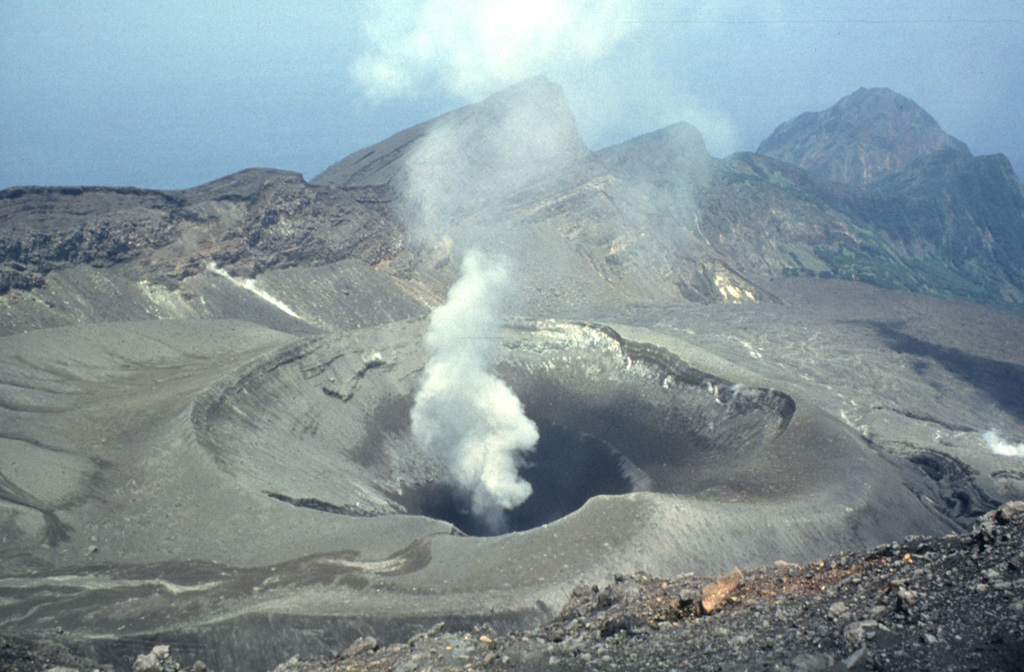
The Kamchatkan Volcanic Eruption Response Team (KVERT) reported that a large thermal anomaly over Bezymianny was identified in satellite images during 1-6 February. A gas-and-steam plume drifted 13 km SW on 6 February. The Aviation Color Code remained at Orange (the second highest level on a four-color scale). Dates are reported in UTC; specific events are in local time where noted.
Source: Kamchatkan Volcanic Eruption Response Team (KVERT)
|
Dempo (Indonesia) | 5 February-11 February 2025 | New Activity / Unrest
Cite this Report
|
Dempo Sunda Volcanic Arc
|
The Pusat Vulkanologi dan Mitigasi Bencana Geologi (PVMBG) reported that an eruptive event at Dempo was recorded at 0952 on 2 February and lasted 27 seconds. A white plume rose about 50 m above the summit and drifted N. The Alert Level remained at 2 (on a scale of 1-4), and the public were reminded to stay 1 km away from the crater and as far as 2 km on the N flank.
Source: Pusat Vulkanologi dan Mitigasi Bencana Geologi (PVMBG, also known as CVGHM)
|
Etna (Italy) | 5 February-11 February 2025 | New Activity / Unrest
Cite this Report
|
Etna Sicily Volcanic Province
|
Sezione di Catania - Osservatorio Etneo (INGV) reported that a new eruption began at Etna on 6 February. Explosive Strombolian activity began at a vent located in the W part of SE Crater. On 8 February a fissure opened at the base of Bocca Nuova Crater at an elevation of around 3,050 m and produced a lava flow that traveled SW towards Mt. Frumento Supino. The first observations through the webcam occurred at 1835, though weather conditions obscured views before that time so there was a possibility that effusion started a few hours earlier. Strombolian activity persisted at SE Crater. The Aviation Color Code was raised to Yellow (the second lowest level on a four-color scale) at 2004 and then to Orange at 2019. By 11 February the lava flow was about 2.6 km long and had reached an elevation of 2,600 m. The Aviation Color Code was raised to Red, the highest level, at 1030 on 12 February because of strong explosive activity at the summit craters.
Source: Sezione di Catania - Osservatorio Etneo (INGV)
|
Home Reef (Tonga) | 5 February-11 February 2025 | New Activity / Unrest
Cite this Report
|
Home Reef Tofua Volcanic Arc
|
On 7 February the Tonga Geological Services reported that analysis of satellite images showed no size changes, and no new lava flows at Home Reef. Thermal activity declined, with the last thermal anomaly identified on 25 January. That same day a series of plumes rose from the vent that were ash-rich near the base and mostly comprised of gas and steam at higher levels. Discolored water to the SW was visible. A new explosive vent, about 20 m in diameter, was located slightly W of the vent that produced lava flows. Ash deposits surrounded the vent and extended W and NW to the shoreline. Discolored water in the vicinity of the island was identified in a satellite image from 1 February. The Maritime Alert Level remained at Orange (the third level on a four-level scale), and mariners were advised to stay at least 2 nautical miles (3.7 km) away from the island. The Aviation Color Code remained at Yellow (the second level on a four-level scale), and the Alert Level for residents of Vava’u and Ha’apai remained at Green (the first level on a four-level scale).
Source: Tonga Geological Services, Government of Tonga
|
Kilauea (United States) | 5 February-11 February 2025 | New Activity / Unrest
Cite this Report
|
Kilauea Hawaiian-Emperor Hotspot Volcano Group
|
The Hawaiian Volcano Observatory (HVO) reported that the eruption within Kilauea’s Kaluapele summit caldera from vents along the SW margin of Halema’uma’u Crater paused on 4 February. Lava flows and fountaining at the N vent ceased at 1907 on 4 February and activity at the S vent ceased at 1923. Small areas of incandescence from the cooling lava on the crater floor and at the N vent were visible during 4-10 February. Gas emissions rose from the N vent. Incandescence at the N vent intensified overnight during 9-10 February and bursts of spatter were occasionally seen in webcam images on 10 February. The spattering intensified overnight during 10-11 February. Lava fountaining at the N vent began at 1016 on 11 February and by 1045 the fountains were 100 m high. Lava flowed onto the crater floor covering about a quarter of the surface. Slow lava effusion began at the S vent at around 1050. Volcano Alert Level remained at Watch (the third level on a four-level scale) and the Aviation Color Code remained at Orange (the third color on a four-color scale).
Source: US Geological Survey Hawaiian Volcano Observatory (HVO)
|
Purace (Colombia) | 5 February-11 February 2025 | New Activity / Unrest
Cite this Report
|
Purace Northern Andean Volcanic Arc
|
The Servicio Geologico Colombiano (SGC) reported that seismicity at Puracé was stable during 4-10 February with no significant variations in both the number and magnitude of events. Earthquakes indicating rock fracturing had a maximum magnitude of 1.1 and were mainly located under Puracé cone, and to a less extent under Piocollo cone, at depths of 1-3 km. Earthquakes indicating fluid movement were located at depths less than 1 km beneath Puracé cone. Sulfur dioxide emissions were above background levels and deformation was occurring between the cones of Puracé, Piocollo, and Curiquinga. Fumarolic plumes rose from the vents on the outer flank of Puracé cone, and from a system of vents and cracks that extended between the Curiquinga and Piocollo cones. The Alert Level remained at Yellow (the second lowest level on a four-color scale).
Source: Servicio Geológico Colombiano (SGC)
|
Spurr (United States) | 5 February-11 February 2025 | New Activity / Unrest
Cite this Report
|
Spurr Alaska Peninsula Volcanic Arc
|
In a special information statement on 6 February, the Alaska Volcano Observatory (AVO) reported that unrest at Spurr continued and was likely caused by new magma beneath the volcano. The nature of the unrest and the 10-month duration suggested that an eruption remained a possibility. The most likely vent location would be at Crater Peak, which erupted in 1953 and 1992; less likely would be the summit vent, which erupted several thousand years ago. The rate of earthquakes increased from an average of 30 per week during April into early October to a rate of 125 per week from early October to 6 February. More than 2,700 earthquakes were located during the unrest episode thus far and the largest was a M 2.9 that occurred on 2 January 2, 2025. Earthquakes were clustered at two depth ranges, 0-10 km and 12-22 km, beneath both the summit and Crater Peak, though there was a recent increase in the number of earthquakes under Crater Peak.
Increased seismicity was accompanied by around 6 cm of inflation detected by the Global Navigation Satellite System (GNSS) stations on the flanks and satellite data. Modeling indicated that the inflation source was located 3-5 km below sea level and 3-4 km W of the summit. A small lake appeared in the summer crater in the early part of the summer in 2024. The lake had grown to an area of about 5 acres. Active steaming from summit area fumaroles has not changed over the current period of unrest and is similar to observations from recent years. There were no significant surface changes at Crater Peak. Instruments aboard gas measurement flights on 23 June and 18 December 2024, and 7 February 2025, detected low levels of sulfur dioxide and carbon dioxide, similar to background levels measured in previous years. The Volcano Alert Level remained at Advisory (the second lowest level on a four-level scale) and the Aviation Color Code remained at Yellow (the second lowest level on a four-color scale).
Source: US Geological Survey Alaska Volcano Observatory (AVO)
|
Ahyi (United States) | 5 February-11 February 2025 | Continuing Activity Cite this Report |
Ahyi Mariana Volcanic Arc
|
Unrest at Ahyi Seamount continued during 31 January-7 February. A satellite image on 1 February showed a plume of discolored water in the vicinity of the seamount, indicating possible submarine activity. Signals indicting minor activity coming from the direction of Ahyi were identified in data from underwater pressure sensors near Wake Island (about 2,270 km E of Ahyi) on 3 and 5 February. The Aviation Color Code remained at Yellow (the second lowest level on a four-color scale) and the Volcano Alert Level remained at Advisory (the second lowest level on a four-level scale).
Source: US Geological Survey
|
Aira (Japan) | 5 February-11 February 2025 | Continuing Activity Cite this Report |
Aira Ryukyu Volcanic Arc
|
The Japan Meteorological Agency (JMA) reported ongoing eruptive activity at Minamidake Crater (Aira Caldera’s Sakurajima volcano) during 3-10 February. Nightly crater incandescence was visible in webcam images. An explosion at 1719 on 4 February was recorded by the seismic network, though details of any emissions were unknown. Explosions at 0702 on 6 February, at 0702, 1412, and 1946 on 8 February, and at 0556, 0737, and 2003 on 9 February generated ash plumes that rose 0.4-2 km above the crater rim and drifted SE. A few of the emissions rose into the weather clouds. Each of the explosions, except the one at 1412 on 8 February, ejected large blocks 400-1,200 m from the crater rim. The Alert Level remained at 3 (on a 5-level scale), and the public was warned to stay 1 km away from both craters.
Source: Japan Meteorological Agency (JMA)
|
Dukono (Indonesia) | 5 February-11 February 2025 | Continuing Activity Cite this Report |
Dukono Halmahera Volcanic Arc
|
The Pusat Vulkanologi dan Mitigasi Bencana Geologi (PVMBG) reported that the eruption at Dukono was ongoing during 4-11 February. Daily white-and-gray ash plumes rose 100-600 m above the crater rim and drifted E and SE. The Alert Level remained at Level 2 (on a scale of 1-4) and the public was warned to stay 4 km away from the Malupang Warirang Crater.
Source: Pusat Vulkanologi dan Mitigasi Bencana Geologi (PVMBG, also known as CVGHM)
|
El Misti (Peru) | 5 February-11 February 2025 | Continuing Activity Cite this Report |
El Misti Central Andean Volcanic Arc
|
The Instituto Geofísico del Perú (IGP) reported that a lahar carrying blocks descended the Matagente drainage on the NW flank of El Misti at 1637 on 7 February. The public was warned to stay away from drainages and roads on that flank. The Alert Level remained at Green (the lowest level on a four-color scale).
Source: Instituto Geofísico del Perú (IGP)
|
Fuego (Guatemala) | 5 February-11 February 2025 | Continuing Activity Cite this Report |
Fuego Central America Volcanic Arc
|
The Instituto Nacional de Sismología, Vulcanología, Meteorología e Hidrología (INSIVUMEH) reported that low-level activity continued at Fuego during 4-11 February. Almost daily gas-and-steam emissions rose as high as 300 m above the summit and drifted downwind. Crater incandescence was observed during dark hours. Explosions have not been detected since 19 January.
Source: Instituto Nacional de Sismologia, Vulcanologia, Meteorologia, e Hidrologia (INSIVUMEH)
|
Gamalama (Indonesia) | 5 February-11 February 2025 | Continuing Activity Cite this Report |
Gamalama Halmahera Volcanic Arc
|
Although there was no eruptive activity reported at Gamalama, in a 5 February press release the Pusat Vulkanologi dan Mitigasi Bencana Geologi (PVMBG) noted that the number of daily deep volcanic earthquakes had increased. A total of 36 deep volcanic earthquakes were recorded during 29 January-4 February, with the highest daily number (10) recorded on 1 February. The number of deep volcanic earthquakes generally averages 1-2 events per day. Other seismic signals were recorded during that period including three tornillo earthquakes and three earthquakes likely indicating emissions. Dense white plumes rose 200-100 m above the summit, remaining at typical levels. The Alert Level remained at 2 (on a scale of 1-4); visitors and residents were warned not to approach the crater within a 1.5-km radius.
Source: Pusat Vulkanologi dan Mitigasi Bencana Geologi (PVMBG, also known as CVGHM)
|
Great Sitkin (United States) | 5 February-11 February 2025 | Continuing Activity Cite this Report |
Great Sitkin Aleutian Ridge Volcanic Arc
|
The Alaska Volcano Observatory (AVO) reported that slow lava effusion continued to feed a thick lava flow in Great Sitkin’s summit crater during 4-11 February. Cloudy weather prevented clear satellite and webcam images. Small earthquakes were detected during 10-11 February. The Volcano Alert Level remained at Watch (the third level on a four-level scale) and the Aviation Color Code remained at Orange (the third color on a four-color scale).
Source: US Geological Survey Alaska Volcano Observatory (AVO)
|
Ibu (Indonesia) | 5 February-11 February 2025 | Continuing Activity Cite this Report |
Ibu Halmahera Volcanic Arc
|
The Pusat Vulkanologi dan Mitigasi Bencana Geologi (PVMBG) reported that the eruption at Ibu continued during 5-11 February. Multiple daily gray or white-and-gray ash plumes that were often dense rose as high as 1.2 km above the summit and drifted mainly SE and S. Incandescence at the summit was visible in some webcam images posted with the reports. The Alert Level remained at 3 (the second highest level on a four-level scale) and the public was advised to stay 4 km away from the active crater and 5 km away from the N crater wall opening.
Source: Pusat Vulkanologi dan Mitigasi Bencana Geologi (PVMBG, also known as CVGHM)
|
Kanlaon (Philippines) | 5 February-11 February 2025 | Continuing Activity Cite this Report |
Kanlaon Negros-Sulu Volcanic Arc
|
The Philippine Institute of Volcanology and Seismology (PHIVOLCS) reported continuing eruptive activity at Kanlaon during 4-11 February. The seismic network recorded 7-23 daily volcanic earthquakes, though during 5-6 February there was a total of 35 events. Average daily sulfur dioxide emissions ranged from 1,611 to 4,186 tonnes per day (t/d); emissions since 3 June 2024 averaged 4,484 t/d. Gas-and-steam emissions rose as high as 100 m above the summit and drifted W, WSW, and SW; plumes occasionally contained ash on 8 February.
A minor explosive eruption began at 1511 on 6 February and lasted for two minutes based on seismic and infrasound data. An ash plume rose 600 m above the summit and drifted SW, causing minor ashfall in Mercedes and San Luis in the Sag-ang barangay (neighborhood) to the SW. The plume was partly obscured by rainy weather. The explosion was detected by instruments 5 km E and produced a booming sound reported in the barangays of Yubo (WSW) and Sag-ang. A sulfur odor was noted in several barangays in La Castellana to the S. Lahars descended the Buhangin River which flows through La Castellana and Moises Padilla.
The National Disaster Risk Reduction and Management Council (NDRRMC) report issued at 0800 on 8 February stated that 9,835 people (3,106 families) were spread across 23 evacuation centers and another 8,383 people (2,651 families) were staying elsewhere. The Alert Level remained at 3 (on a scale of 0-5); the public was warned to stay 6 km away from the summit and pilots were warned not to fly close to the volcano.
Sources: Philippine Institute of Volcanology and Seismology (PHIVOLCS), The National Disaster Risk Reduction and Management Council (NDRRMC)
|
Karymsky (Russia) | 5 February-11 February 2025 | Continuing Activity Cite this Report |
Karymsky Eastern Kamchatka Volcanic Arc
|
The Kamchatkan Volcanic Eruption Response Team (KVERT) reported moderate levels of activity at Karymsky during 30 January-6 February. A weak thermal anomaly over the volcano was identified in satellite images during 30 January and 1-3 February; weather clouds obscured views on the other days. The Aviation Color Code remained at Orange (the third level on a four-color scale). Dates are based on UTC times; specific events are in local time where noted.
Source: Kamchatkan Volcanic Eruption Response Team (KVERT)
|
Lewotobi (Indonesia) | 5 February-11 February 2025 | Continuing Activity Cite this Report |
Lewotobi Sunda Volcanic Arc
|
The Pusat Vulkanologi dan Mitigasi Bencana Geologi (PVMBG) reported that eruptive activity continued at Lewotobi Laki-laki during 4-11 February. At 0108 on 5 February a dense gray ash plume rose 400 m above the summit and drifted N and NE. White emissions rose as high as 300 m above the summit and drifted N, NE, and E on the other days of the week. Eruptive events were recorded during 6-7 February, but emissions were not observed. The Alert Level remained at 3 (on a scale of 1-4). The exclusion zone was lowered on 8 February; the public was warned to stay 4 km away from the center of Laki-laki and 5 km in a semicircle counterclockwise from the NE to the SW.
Source: Pusat Vulkanologi dan Mitigasi Bencana Geologi (PVMBG, also known as CVGHM)
|
Marapi (Indonesia) | 5 February-11 February 2025 | Continuing Activity Cite this Report |
Marapi Sunda Volcanic Arc
|
The Pusat Vulkanologi dan Mitigasi Bencana Geologi (PVMBG) reported that white plumes rose 100-200 m above the summit of Marapi (on Sumatra) during 5-10 February and drifted in multiple directions. An eruptive event was recorded at 1820 on 7 February but emission heights were unknown. The Darwin VAAC reported that an ash plume was visible in a satellite image at 0620 on 8 February drifting E at an estimated altitude of 3 km (10,000 ft) a.s.l. The Alert Level remained at 2 (on a scale of 1-4) and the public was warned to stay 3 km away from the active crater.
Sources: Pusat Vulkanologi dan Mitigasi Bencana Geologi (PVMBG, also known as CVGHM), Darwin Volcanic Ash Advisory Centre (VAAC)
|
Merapi (Indonesia) | 5 February-11 February 2025 | Continuing Activity Cite this Report |
Merapi Sunda Volcanic Arc
|
The Balai Penyelidikan dan Pengembangan Teknologi Kebencanaan Geologi (BPPTKG) reported that the eruption at Merapi (on Java) continued during 31 January-6 February. Seismicity remained at high levels. The SW lava dome produced 88 lava avalanches that traveled as far as 2 km SW down the Bebeng drainage, 31 that traveled as far as 2 km SW down the Krasak drainage, and 13 that traveled as far as 1.8 km SW down the Sat/Putih drainage. Morphological changes at the SW dome were caused by continuing effusion and collapses of material; the dome had an estimated volume of 3,315,900 cubic meters based on an analysis of 4 February aerial photos. No significant morphological changes at the summit dome were visible. The Alert Level remained at 3 (on a scale of 1-4), and the public was warned to stay 3-7 km away from the summit, based on location.
Source: Balai Penyelidikan dan Pengembangan Teknologi Kebencanaan Geologi (BPPTKG)
|
Nevado del Ruiz (Colombia) | 5 February-11 February 2025 | Continuing Activity Cite this Report |
Nevado del Ruiz Northern Andean Volcanic Arc
|
Servicio Geológico Colombiano’s (SGC) Observatorio Vulcanológico y Sismológico de Manizales reported that eruptive activity at Nevado del Ruiz continued during 4-10 February. Seismic data indicated that events associated with fluid movement increased in both number and intensity compared to the previous week. Webcam images, observations from residents, and reports from the Parque Nacional Natural Los Nevados confirmed some ash emissions and higher-temperature ejecta were associated with some of these events. Notably, Long-duration seismic signals associated with continuous ash emissions were only recorded on 4 February. Gas-and-ash plumes rose as high as 1.5 km above the summit and drifted NW, W, and SW; taller plumes, recorded during 9-10 February, rose as high as 2 km as they drifted downwind. Seismicity associated with rock fracturing was similar in number but higher in magnitude compared to the previous week. The earthquakes were located below Arenas Crater and the NE, E, and ESE flanks within 13 km, and had depths of 1-9 km. Two earthquakes were felt by residents on 6 February: a M 2 that occurred at 0131 and was located 6 km E of the crater at a depth of 3 km and a M 2.3 that occurred at 2024 and was located 5 km ESE of the crater at a depth of 4 km. Low-energy thermal anomalies on the crater floor were identified in satellite data. Sulfur dioxide emissions detected in satellite data continued to be significant. The Alert Level remained at Yellow (the second level on a four-level scale), and the public was warned to stay out of the restricted areas around Arenas Crater, not to spend long periods of time on the Murillo-Cerro Gualí Road, and to avoid drainages in the high-threat zones.
Source: Servicio Geológico Colombiano (SGC)
|
Nyamulagira (DR Congo) | 5 February-11 February 2025 | Continuing Activity Cite this Report |
Nyamulagira Albertine Rift Volcanic Province
|
Satellite images acquired on 21 and 31 January showed continuing activity at Nyamuragira. A thermal anomaly in the summit crater was visible, though weather and/or volcanic emissions obscured most of the crater. A lava flow on the W flank was visible in the 31 January image and was about 890 m long. Dense weather clouds obscured the volcano in a 5 February satellite image.
Source: Copernicus
|
Reventador (Ecuador) | 5 February-11 February 2025 | Continuing Activity Cite this Report |
Reventador Northern Andean Volcanic Arc
|
The Instituto Geofísico-Escuela Politécnica Nacional (IG-EPN) reported that eruptive activity continued at Reventador during 4-11 February. Seismicity included 57-101 daily explosions, long-period earthquakes, harmonic tremor, and tremor associated with emissions. Weather conditions occasionally obscured views of summit activity; however, when the weather permitted, ash-and-gas plumes were observed in webcam and/or satellite images rising 200-1,100 m above the crater and drifting N, NW, W, and SW. The surveillance camera network recorded multiple instances of incandescent material descending the flanks as far as 900 m below the crater rim. On 4 February a pyroclastic flow traveled 500 m down the S flank. Secretaría de Gestión de Riesgos maintained the Alert Level at Orange (the second highest level on a four-color scale).
Sources: Instituto Geofísico-Escuela Politécnica Nacional (IG-EPN), Secretaría de Gestión de Riesgos (SGR)
|
Sangay (Ecuador) | 5 February-11 February 2025 | Continuing Activity Cite this Report |
Sangay Northern Andean Volcanic Arc
|
The Instituto Geofísico-Escuela Politécnica Nacional (IG-EPN) reported that moderate levels of eruptive activity continued at Sangay during 4-11 February. The seismic network recorded 20-145 daily explosions. On a few days gas-and-ash plumes were visible rising as high as 1 km above the summit and drifting S, SW, and NW, though weather clouds obscured views of the volcano most of the time. Incandescence at the crater was occasionally visible. Secretaría de Gestión de Riesgos (SGR) maintained the Alert Level at Yellow (the second highest level on a four-color scale).
Sources: Instituto Geofísico-Escuela Politécnica Nacional (IG-EPN), Secretaría de Gestión de Riesgos (SGR)
|
Santa Maria (Guatemala) | 5 February-11 February 2025 | Continuing Activity Cite this Report |
Santa Maria Central America Volcanic Arc
|
The Instituto Nacional de Sismología, Vulcanología, Meteorología e Hidrología (INSIVUMEH) reported ongoing eruptive activity at Santa Maria’s Santiaguito dome complex during 4-11 February with continuing lava extrusion at Caliente dome. Daily explosions, as many as seven per hour when reported, generated gas-and-ash plumes that rose as high as 1.2 km above the dome and drifted SW and W. Effusion of blocky lava and collapses of material produced daily block avalanches that were sometimes heard several kilometers away; these mainly descended the SW and S flanks, but occasionally went SE and E. Incandescence was visible at the crater and upper part of the WSW flank lava flow, and occasionally from ejected incandescent blocks. During 9-10 February ashfall was reported at Finca Monte Bello (6 km WSW) and surrounding areas. Explosions and collapses generated short pyroclastic flows during 10-11 February.
Source: Instituto Nacional de Sismologia, Vulcanologia, Meteorologia, e Hidrologia (INSIVUMEH)
|
Semeru (Indonesia) | 5 February-11 February 2025 | Continuing Activity Cite this Report |
Semeru Sunda Volcanic Arc
|
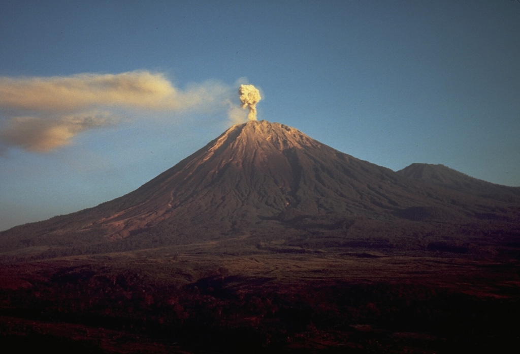
The Pusat Vulkanologi dan Mitigasi Bencana Geologi (PVMBG) reported that eruptive activity continued at Semeru during 5-11 February with daily eruptive events recorded by the seismic network. White-and-gray ash plumes rose 300-900 m above the summit and drifted NE, N, and SW. Emissions were not visible on 5 and 10 February. The Alert Level remained at 2 (the second lowest level on a scale of 1-4). The public was warned to stay at least 5 km away from the summit in all directions, 13 km from the summit to the SE, 500 m from the banks of the Kobokan drainage as far as 17 km from the summit, and to avoid other drainages including the Bang, Kembar, and Sat, due to lahar, avalanche, and pyroclastic flow hazards.
Source: Pusat Vulkanologi dan Mitigasi Bencana Geologi (PVMBG, also known as CVGHM)
|
Sheveluch (Russia) | 5 February-11 February 2025 | Continuing Activity Cite this Report |
Sheveluch Eastern Kamchatka Volcanic Arc
|
The Kamchatkan Volcanic Eruption Response Team (KVERT) reported that lava extrusion may have continued at Sheveluch’s “300 years of RAS” dome on the SW flank of Old Sheveluch and at the Young Sheveluch dome during 30 January-6 February. Daily thermal anomalies over the domes were identified in satellite images. The Aviation Color Code remained at Orange (the second highest level on a four-color scale). Dates are based on UTC times; specific events are in local time where noted.
Source: Kamchatkan Volcanic Eruption Response Team (KVERT)
|
Suwanosejima (Japan) | 5 February-11 February 2025 | Continuing Activity Cite this Report |
Suwanosejima Ryukyu Volcanic Arc
|
The Japan Meteorological Agency (JMA) reported that eruptive activity at Suwanosejima's Ontake Crater continued during 3-10 February. Incandescence was observed nightly in webcam images. An explosion at 0738 on 8 February generated an ash plume that rose 600 m above the crater rim, drifted SE, and entered weather clouds. Large blocks were ejected 400 m from the vent. The Alert Level remained at 2 (the second level on a five-level scale) and the public was warned to stay at least 1.5 km away from the crater.
Source: Japan Meteorological Agency (JMA)
|
Ubinas (Peru) | 5 February-11 February 2025 | Continuing Activity Cite this Report |
Ubinas Central Andean Volcanic Arc
|
The Instituto Geofísico del Perú (IGP) reported that a lahar carrying blocks descended the Sacohaya River on the S flank of Ubinas at 1618 on 10 February. The public was warned to stay away from the drainage and to take precautions while driving on the Arequipa-Querapi-Ubinas-Huarina highway. The Alert Level remained at Yellow (the second level on a four-color scale) and the public was warned to stay 2 km away from the crater.
Source: Instituto Geofísico del Perú (IGP)
|
Whakaari/White Island (New Zealand) | 5 February-11 February 2025 | Continuing Activity Cite this Report |
Whakaari/White Island Taupo Volcanic Arc
|
On 10 February GeoNet reported that weak-to-moderate gas-and-steam plumes from Whakaari/White Island during the previous week did not contain ash. Gas-and-steam plumes were visible in images from satellite and webcams (at Whakatane and Te Kaha), and during clearer weather conditions a larger plume was occasionally visible from the Bay of Plenty. Recent activity was consistent with moderate-to-heightened levels of unrest, therefore the Volcanic Alert Level remained at 2 (on a scale of 0-5). The Aviation Color Code was lowered to Yellow (the second lowest level on a four-color scale) due to the absence of ash in the emissions. GeoNet relies on remote cameras and satellite images to monitor Whakaari and noted that there is uncertainty due to the current lack of consistent, usable, real-time monitoring data.
Source: GeoNet
|