Ahyi (United States) | 1 January-7 January 2025 | New Activity / Unrest
 Cite this Report Cite this Report
|
 Ahyi Ahyi
Mariana Volcanic Arc
|
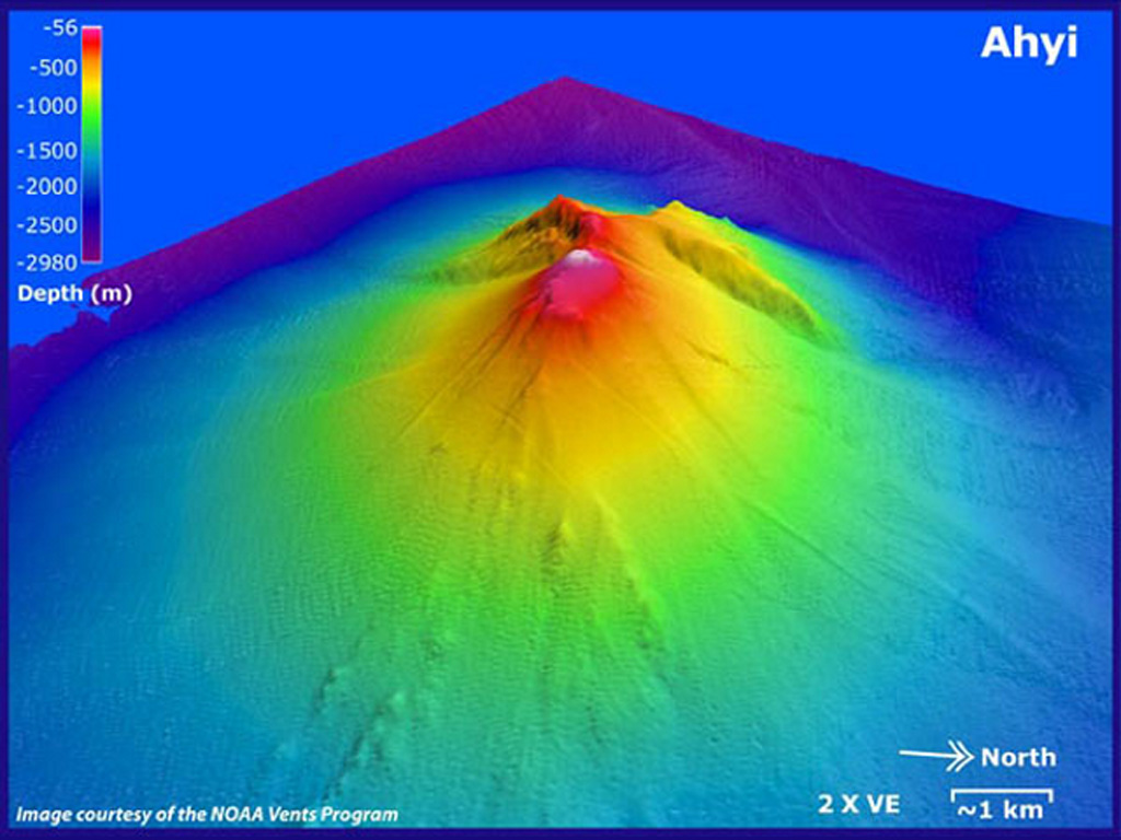
Unrest at Ahyi Seamount continued through 3 January. Signals indicating activity, coming from the direction of Ahyi, were identified in data from underwater pressure sensors near Wake Island (about 2,270 km E of Ahyi) on 28 and 30 December (UTC). Satellite images showed possible signs of underwater activity on 27 and 28 December, and clearer signs on 2 January consisting of a plume of discolored water extending 2.3 km NNW. The Aviation Color Code remained at Yellow (the second lowest level on a four-color scale) and the Volcano Alert Level remained at Advisory (the second lowest level on a four-level scale).
Source: US Geological Survey
|
Dieng Volcanic Complex (Indonesia) | 1 January-7 January 2025 | New Activity / Unrest
 Cite this Report Cite this Report
|
 Dieng Volcanic Complex Dieng Volcanic Complex
Sunda Volcanic Arc
|
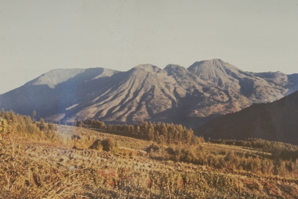
The Pusat Vulkanologi dan Mitigasi Bencana Geologi (PVMBG) reported that a phreatic eruption occurred from the E part of Sileri Crater in the Dieng Volcanic Complex on 18 December and was not preceded by significant signs of elevated volcanic activity. The eruption began at 1058 and lasted for almost 57 seconds based on seismic data. Mud was ejected about 50 m N and NW, about 25 m W, and about 5 m S. A dense white plume rose 70 m above the water’s surface. During a post inspection of the crater scientists noted that volcanic gases remained at normal levels and white plumes rose 20-40 m above the water. The Alert Level remained at 2 (on a scale of 1-4). The public was warned to stay 500 m away from Sileri Crater and not to spend the night around the crater, to stay out of Timbang Crater and other potentially hazardous craters, and to take caution when digging in the ground as gasses could be released.
Source: Pusat Vulkanologi dan Mitigasi Bencana Geologi (PVMBG, also known as CVGHM)
|
Fentale (Ethiopia) | 1 January-7 January 2025 | New Activity / Unrest
 Cite this Report Cite this Report
|
 Fentale Fentale
Main Ethiopian Rift Volcanic Province
|
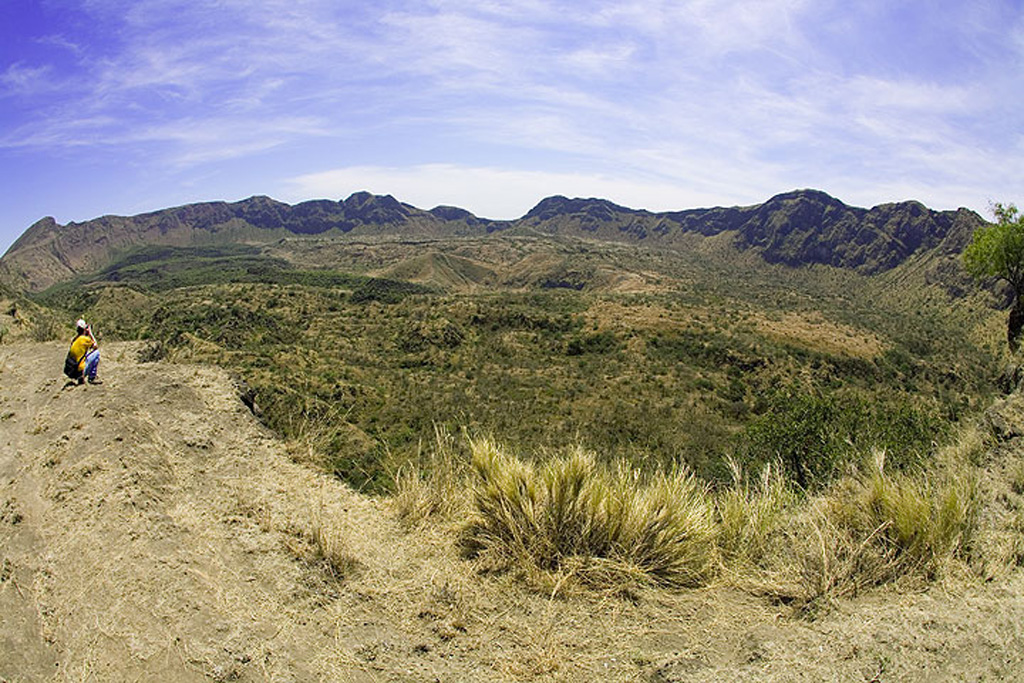
Seismicity and deformation data acquired from satellite radar images indicated that a magmatic intrusion began in late September 2024 in the Afar Region between the Fentale caldera and Dofen volcano. Interferograms, which show upward and downward land movement using sequenced satellite radar data, indicated that a magmatic intrusion aligned along the central to northern part of an axis connecting these two locations began in late September 2024, according to the UK Centre for Observation and Modelling of Earthquakes, Volcanoes and Tectonics (COMET). Many felt earthquakes M 4 and above were associated with the intrusion. Data from 18 October indicated that the intrusion had slowed or paused. A second phase of the intrusion occurred during the end of 2024. An interferogram processed and interpreted by the Universitas Insan Pembangunan Indonesia (UNIPI) group in support of the Addis Abeba University showed very clear ground movement (over 40 cm of uplift) along almost the entire axis from Fentale to Dofen during 17-29 December.
Seismicity continued to be elevated in the region at least through 4 January and was likely associated with the intrusion according to the Ethiopian Geological Institute. A M 5 on 29 December located near Awash Fentale caused the collapse of more than 30 homes and cracks in roads and the ground in the Dulecha and Awash Fentale districts. On 3 January footage of increased activity at a geothermal area near Dofen was reported by news sources. The video showed water, sediment, and rocks being vigorously ejected above vents; the activity was non-volcanic in origin though it increased fears among residents that is was connected to the intrusion and potential volcanic activity. At least 10 earthquakes were recorded during 3-4 January with the largest, a M 5.8, occurring on 4 January. The Ethiopian Geological Institute reported that thousands of people had evacuated to other areas in the region.
Sources: Washington Post, The UK Centre for Observation and Modelling of Earthquakes, Volcanoes and Tectonics (COMET), Carolina Pagli, Università di Pisa, Crisis 24, Ethiopian Disaster Risk Management Commission (EDRMC), Ethiopian Geological Institute, VOA News
|
Home Reef (Tonga) | 1 January-7 January 2025 | New Activity / Unrest
 Cite this Report Cite this Report
|
 Home Reef Home Reef
Tofua Volcanic Arc
|
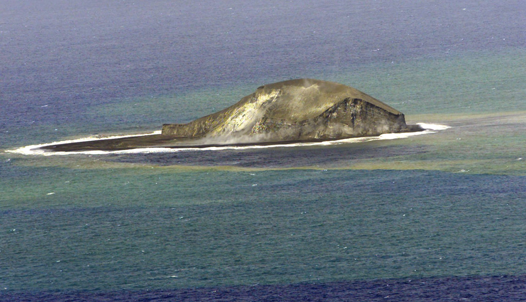
The Tonga Geological Services reported that eruptive activity at Home Reef continued as of 2 January with lava expanding the N and NE shorelines. Satellite images showed emissions that were likely ash rich rising from the central vent on 17 December. Thermal anomalies were detected at least during 20-23 December. On 2 January small gas-and-ash puffs rose from the central vent at approximately one-minute intervals. The lava flow had grown to approximately 76,000 square meters and had a maximum dimension of 350 m (N-S) by 270 m (E-W). The Maritime Alert Level remained at Orange (the third level on a four-level scale), and mariners were advised to stay at least 2 nautical miles (3.7 km) away from the island. The Aviation Color Code remained at Yellow (the second level on a four-level scale), and the Alert Level for residents of Vava’u and Ha’apai remained at Green (the first level on a four-level scale).
Source: Tonga Geological Services, Government of Tonga
|
Kilauea (United States) | 1 January-7 January 2025 | New Activity / Unrest
 Cite this Report Cite this Report
|
 Kilauea Kilauea
Hawaiian-Emperor Hotspot Volcano Group
|
The Hawaiian Volcano Observatory (HVO) reported that the eruption at Kilauea that began at 0220 on 23 December paused on 3 January. Lava continued to erupt during 1-3 January from two vents located at the SW margin of Halema’uma’u Crater within the Kaluapele summit caldera. The vents produced lava fountains that rose 20-30 m above the vents. Lava flows advanced in a broad fan that covered the western portion of the crater floor; flow advancement had increased during the previous few days. Sulfur dioxide emissions remained elevated, averaging around 30,000 tonnes per day on 2 January. An automatic laser rangefinder pointing at an area of the crater floor measured a drop of about 3 m during 0800-1000 on 2 January as a result of a lava dam in the N part of the lake collapsing. At 1416 parts of the more northern vent cone collapsed and activity ceased at the vent. Lava fountains from the active S vent rose 20-30 m during 2-3 January and fed flows that covered most of the crater floor and down-dropped block. By 3 January the crater floor had risen 1 m based on laser rangefinder data. At around 2040 both fountaining and lava-flow effusion ceased at the S vent, and tremor levels also decreased. The crater floor dropped a total of 3 m by 4 January. No lava erupted from the vents during 4-7 December, though lava on the crater floor continued to move and overturn, exposing molten incandescent surfaces. The incandescence on the crater floor began to diminish on 5 January. Sulfur dioxide emissions remained at elevated levels and a plume was visible rising above the crater rim. The Volcano Alert Level remained at Watch (the third level on a four-level scale) and the Aviation Color Code remained at Orange (the third color on a four-color scale).
Source: US Geological Survey Hawaiian Volcano Observatory (HVO)
|
Poas (Costa Rica) | 1 January-7 January 2025 | New Activity / Unrest
 Cite this Report Cite this Report
|
 Poas Poas
Central America Volcanic Arc
|
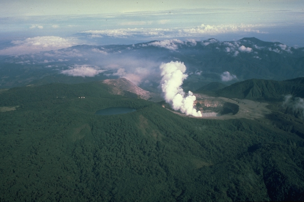
The Observatorio Vulcanologico y Sismologico de Costa Rica-Universidad Nacional (OVSICORI-UNA) reported that an eruptive event from the S part of the lake at Poás was recorded at 0610 on 5 January. The event ejected dark material several meters above the surface of the lake. The event was preceded by a period of slow intensification of several monitoring parameters first observed during November and December 2024, including increased seismicity, an anomalous trend in the ratio of sulfur dioxide and carbon dioxide that accelerated on 5 January, increased gas emissions, and an increase in lake temperatures. Unrest continued during 6-7 January; increased tremor was associated with visible bubbling in the lake during 1400-1700 on 6 January.
Source: Observatorio Vulcanologico y Sismologico de Costa Rica-Universidad Nacional (OVSICORI-UNA)
|
Aira (Japan) | 1 January-7 January 2025 | Continuing Activity Cite this Report Cite this Report |
 Aira Aira
Ryukyu Volcanic Arc
|
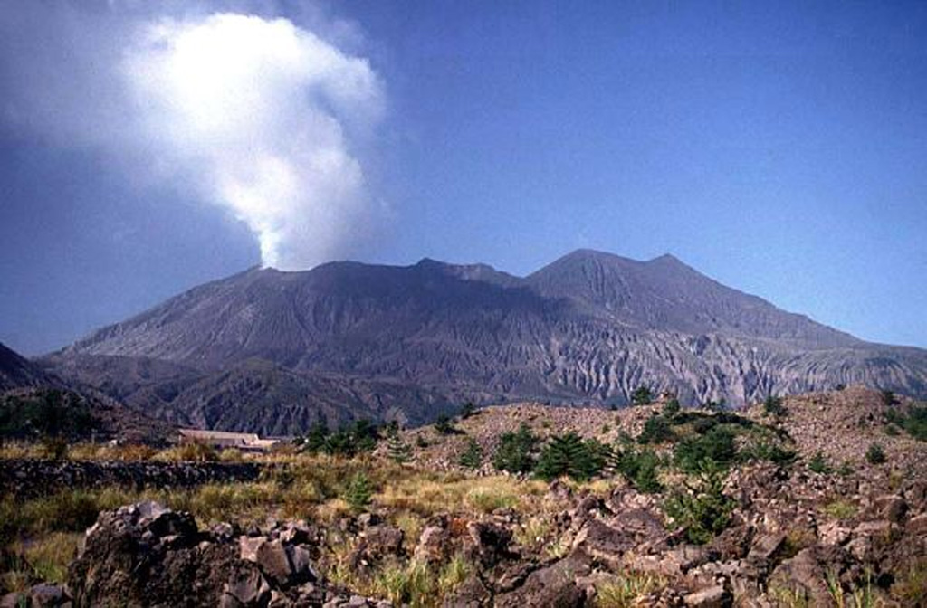
The Japan Meteorological Agency (JMA) reported ongoing eruptive activity at Minamidake Crater (Aira Caldera’s Sakurajima volcano) during 30 December 2024-6 January 2025. Nightly crater incandescence was visible in webcam images. Eruptive events at 1317 and 2029 on 31 December, at 0658 and 1443 on 1 January, at 1335 and 2224 on 2 January, and 1002 and 1045 on 5 January produced ash plumes that rose 1-1.4 km above the crater rim and drifted NE, E, and SE. Explosions at 1317 and 2029 on 31 December, at 0348 on 3 January, at 0125 on 4 January, and at 1002 and 1045 on 5 January produced ash plumes that rose 0.5-1.5 km above the crater rim and drifted S and SE. All of the explosions, except at 1451 on 6 January, ejected large blocks 300-900 m from the crater rim. The Alert Level remained at 3 (on a 5-level scale), and the public was warned to stay 1 km away from both craters.
Source: Japan Meteorological Agency (JMA)
|
Dukono (Indonesia) | 1 January-7 January 2025 | Continuing Activity Cite this Report Cite this Report |
 Dukono Dukono
Halmahera Volcanic Arc
|
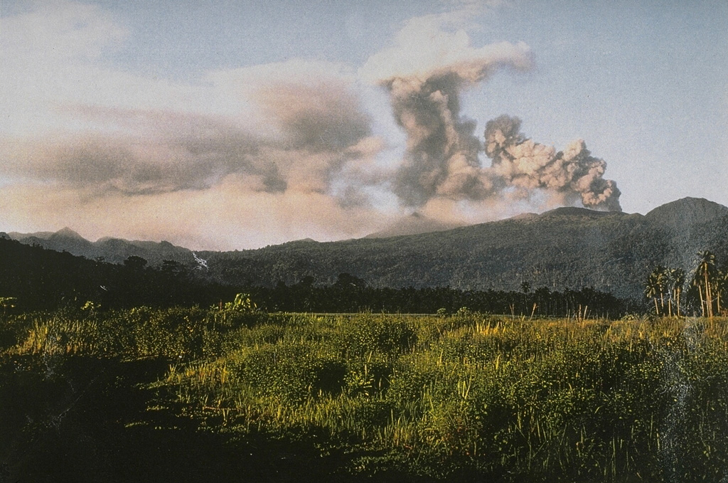
The Pusat Vulkanologi dan Mitigasi Bencana Geologi (PVMBG) reported that the eruption at Dukono was ongoing during 1-7 January. White-and-gray ash plumes rose 100-700 m above the crater rim and drifted E on most days; emissions were not visible on 2 and 4 January possibly in part due to weather conditions. The Alert Level remained at Level 2 (on a scale of 1-4) and the public was warned to stay 4 km away from the Malupang Warirang Crater.
Source: Pusat Vulkanologi dan Mitigasi Bencana Geologi (PVMBG, also known as CVGHM)
|
Ebeko (Russia) | 1 January-7 January 2025 | Continuing Activity Cite this Report Cite this Report |
 Ebeko Ebeko
Kuril Volcanic Arc
|
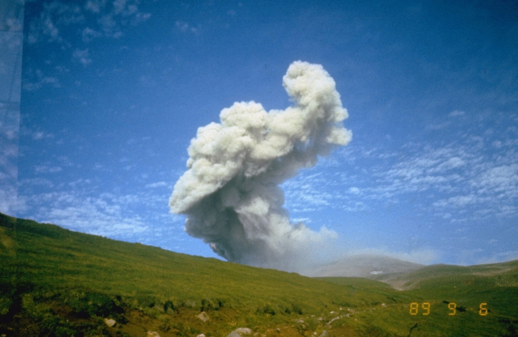
The Kamchatkan Volcanic Eruption Response Team (KVERT) reported that moderate activity was ongoing at Ebeko during 26 December 2024-2 January 2025. Explosions on 31 December generated ash plumes that rose as high as 2 km above the summit and drifted SE, according to volcanologists in Severo-Kurilsk (Paramushir Island, about 7 km E). Satellite images indicated that the volcano was quiet or obscured by weather clouds. The Aviation Color Code remained at Orange (the third level on a four-color scale). Dates are UTC; specific events are in local time where noted.
Source: Kamchatkan Volcanic Eruption Response Team (KVERT)
|
Great Sitkin (United States) | 1 January-7 January 2025 | Continuing Activity Cite this Report Cite this Report |
 Great Sitkin Great Sitkin
Aleutian Ridge Volcanic Arc
|
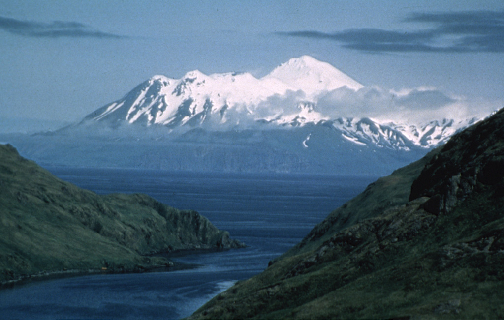
The Alaska Volcano Observatory (AVO) reported that slow lava effusion continued to feed a thick lava flow in Great Sitkin’s summit crater during 31 December 2024-7 January 2025. The local seismic network continued to detect small earthquakes associated with the ongoing eruption. Nothing notable was identified in satellite and webcam images, though weather clouds sometimes obscured webcam and satellite views. Elevated surface temperatures at the summit were identified in satellite images during 31 December-2 January and 5-6 January, consistent with newly erupted lava. The Volcano Alert Level remained at Watch (the third level on a four-level scale) and the Aviation Color Code remained at Orange (the third color on a four-color scale).
Source: US Geological Survey Alaska Volcano Observatory (AVO)
|
Ibu (Indonesia) | 1 January-7 January 2025 | Continuing Activity Cite this Report Cite this Report |
 Ibu Ibu
Halmahera Volcanic Arc
|
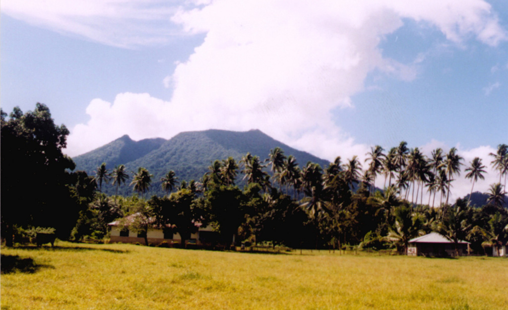
The Pusat Vulkanologi dan Mitigasi Bencana Geologi (PVMBG) reported that the eruption at Ibu continued during 1-7 January. Daily gray or white-and-gray ash plumes that were often dense rose as high as 3 km above the summit and drifted in multiple directions. Webcam images posted with some of the reports showed incandescence at the summit or being ejected above the summit of the inner active cone. The Alert Level remained at 3 (the second highest level on a four-level scale) and the public was advised to stay 4 km away from the active crater and 5.5 km away from the N crater wall opening.
Source: Pusat Vulkanologi dan Mitigasi Bencana Geologi (PVMBG, also known as CVGHM)
|
Kanlaon (Philippines) | 1 January-7 January 2025 | Continuing Activity Cite this Report Cite this Report |
 Kanlaon Kanlaon
Negros-Sulu Volcanic Arc
|
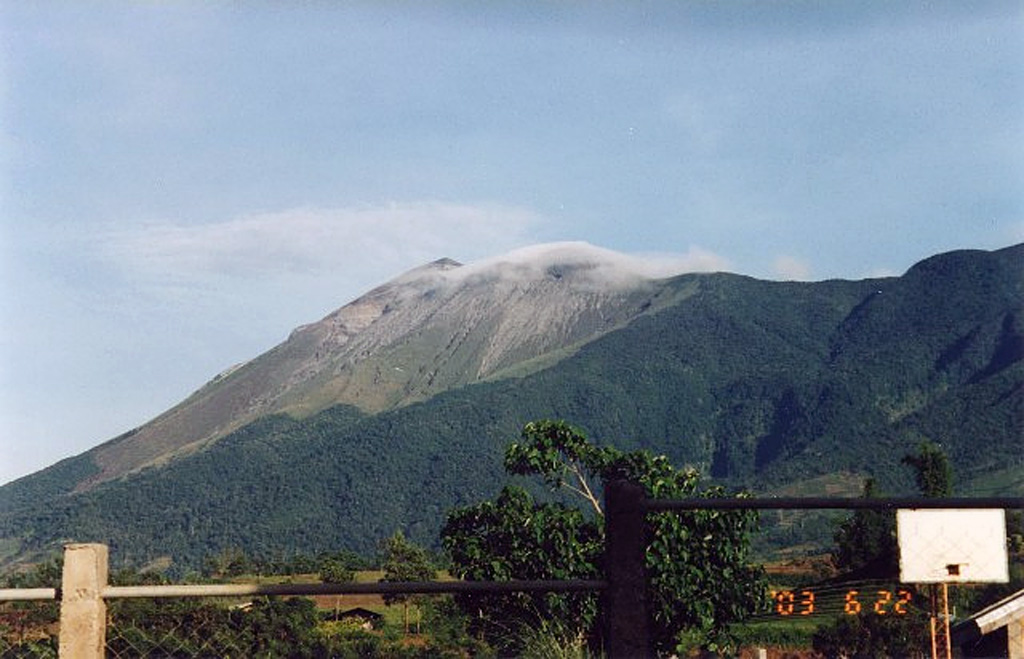
The Philippine Institute of Volcanology and Seismology (PHIVOLCS) reported continuing eruptive activity at Kanlaon during 31 December 2024-6 January 2025. The seismic network recorded 23-45 daily volcanic earthquakes that, during 31 December-2 January and on 4 January, included 3-12 periods of volcanic tremor lasting four minutes to four hours and 42 minutes. Daily sulfur dioxide emissions ranged from 3,406 to 5,840 tonnes per day. There were 5-8 daily period of ash emissions during 31 December-2 January, each as short as five minutes to as long as four hours and 24 minutes. The emissions were voluminous, rising 300-400 m above the summit and drifting W and NW. One ash emission lasting one hour and 51 minutes on 4 January produced voluminous plumes that rose 500 m above the summit and drifted SW. Gas-and-steam plumes during 3 and 5-6 January that were sometimes voluminous and continuous rose as high as 1.4 km above the summit and drifted NW, W, and SW.
The eruption continued to impact residents. The National Disaster Risk Reduction and Management Council (NDRRMC) report issued at 0800 on 7 January stated that 13,246 people (4,070 families) were spread across 34 evacuation centers and another 7,458 people (2,351 families) were staying elsewhere. The report also stated that 34 cities were under a “state of calamity”, jobs continued to be affected, and some classes remained suspended. The Alert Level remained at 3 (on a scale of 0-5); the public was warned to stay 6 km away from the summit and pilots were warned not to fly close to the volcano.
Sources: Philippine Institute of Volcanology and Seismology (PHIVOLCS), The National Disaster Risk Reduction and Management Council (NDRRMC)
|
Karymsky (Russia) | 1 January-7 January 2025 | Continuing Activity Cite this Report Cite this Report |
 Karymsky Karymsky
Eastern Kamchatka Volcanic Arc
|
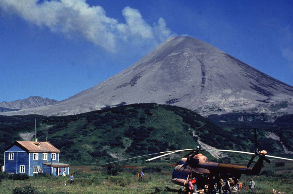
The Kamchatkan Volcanic Eruption Response Team (KVERT) reported moderate levels of activity at Karymsky during 26 December 2024-2 January 2025. A thermal anomaly over the volcano was identified in satellite images during 26 and 29-31 December. The volcano was quiet or weather conditions prevented views on the other days of the week. The Aviation Color Code remained at Orange (the third level on a four-color scale). Dates are based on UTC times; specific events are in local time where noted.
Source: Kamchatkan Volcanic Eruption Response Team (KVERT)
|
Lewotobi (Indonesia) | 1 January-7 January 2025 | Continuing Activity Cite this Report Cite this Report |
 Lewotobi Lewotobi
Sunda Volcanic Arc
|
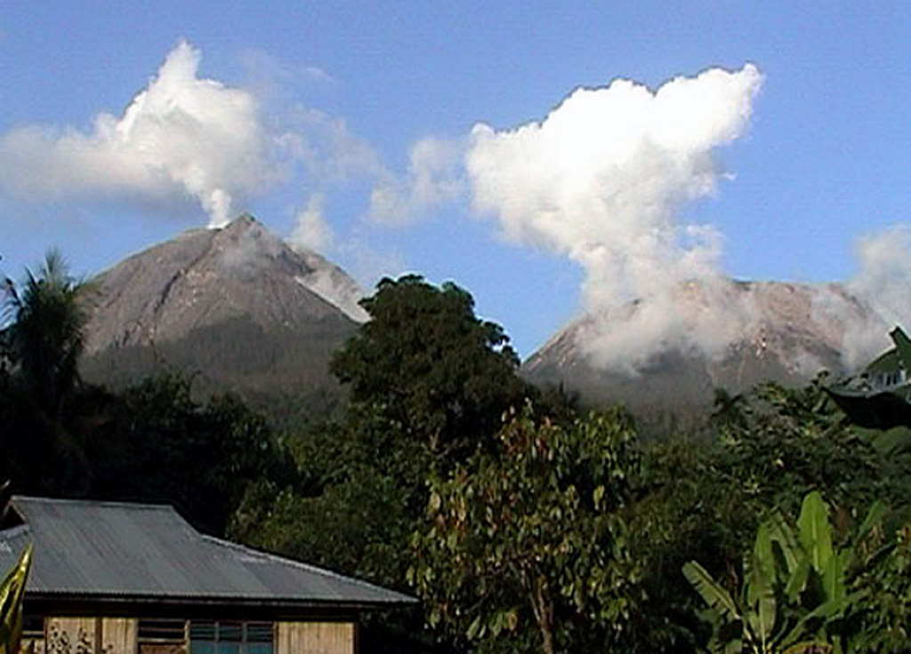
The Pusat Vulkanologi dan Mitigasi Bencana Geologi (PVMBG) reported that eruptive activity continued at Lewotobi Laki-laki during 1-7 January. White-and-gray ash plumes that were sometimes dense rose as high as 1.2 km above the summit and drifted in multiple directions during 1-4 January. White gas-and-steam plumes rose as high as 2 km above the summit and drifted SW, W, and NW on 1 January and 0.1-1 km above the summit and drifted in multiple directions during 5-7 January. Incandescence at the crater was periodically visible in a webcam images. The Alert Level remained at 3 (on a scale of 1-4) and the public was warned to stay 5 km away from the center of Laki-laki and 6 km in a semicircle counterclockwise from the NE to the SW.
Source: Pusat Vulkanologi dan Mitigasi Bencana Geologi (PVMBG, also known as CVGHM)
|
Lewotolok (Indonesia) | 1 January-7 January 2025 | Continuing Activity Cite this Report Cite this Report |
 Lewotolok Lewotolok
Sunda Volcanic Arc
|
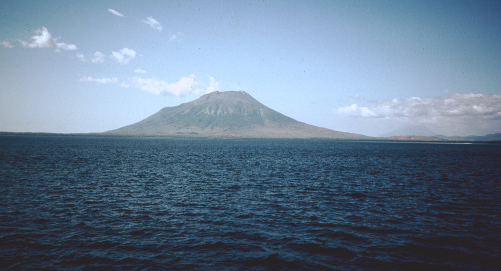
On 5 January the Pusat Vulkanologi dan Mitigasi Bencana Geologi (PVMBG) issued a press release for Lewotolok describing a minor increase in unrest. The seismic network recorded a significant increase in the number of both shallow and deep volcanic earthquakes during December. Typically, one shallow volcanic earthquake and 1-5 deep volcanic earthquakes occurred per day; in December there were a total of 43 shallow and 183 deep volcanic earthquakes. Minor inflation was detected in both tiltmeter and Electronic Distance Measurement (EDM) data, but the changes were not significant. During 1 December 2024-4 January 2025 white plumes of variable densities rose as high as 400 m above the summit and drifting in multiple directions. On 5 January a white-and-gray plume rose 20-100 m above the summit and drifted SE. The color of the plume was likely from material from inside the crater or the crater wall being entrained with a gas emission. The Alert Level remained at 2 (on a scale of 1-4) and the public was warned to stay 2 km away from the vent and 2.5 km away on the S, SE, and W flanks.
Source: Pusat Vulkanologi dan Mitigasi Bencana Geologi (PVMBG, also known as CVGHM)
|
Manam (Papua New Guinea) | 1 January-7 January 2025 | Continuing Activity Cite this Report Cite this Report |
 Manam Manam
Bismarck Volcanic Arc
|
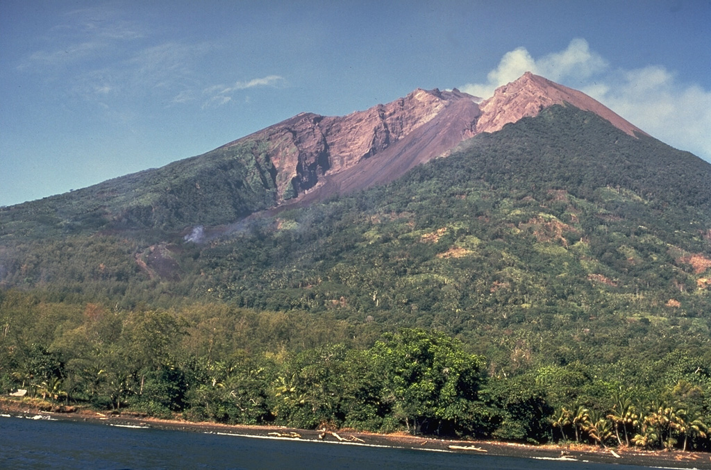
The Darwin Volcanic Ash Advisory Centre (VAAC) reported that continuous ash plumes from Manam were identified in satellite images at 1850 and 2000 on 7 January. The plumes rose to an altitude of 2.4 km (8,000 ft) a.s.l. and drifted E and SE.
Source: Darwin Volcanic Ash Advisory Centre (VAAC)
|
Marapi (Indonesia) | 1 January-7 January 2025 | Continuing Activity Cite this Report Cite this Report |
 Marapi Marapi
Sunda Volcanic Arc
|
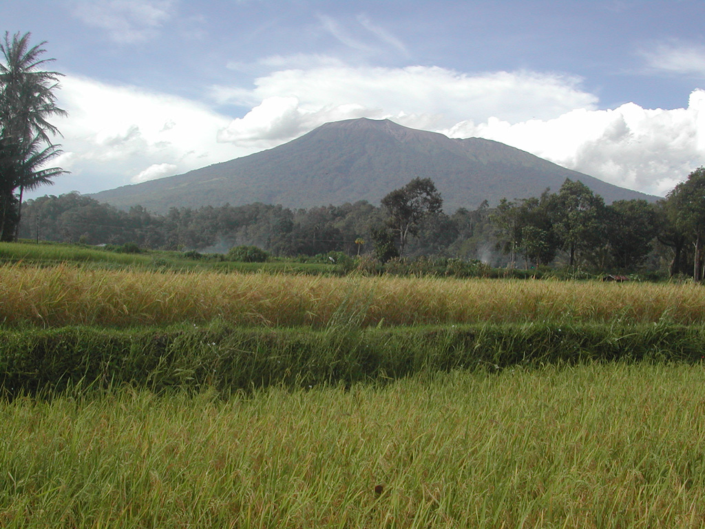
The Pusat Vulkanologi dan Mitigasi Bencana Geologi (PVMBG) reported that eruptive activity at Marapi (on Sumatra) was ongoing during 1-7 January. White steam-and-gas plumes generally rose as high as 400 m above the summit during most of the week; emissions were not observed during 6-7 January. At 0943 on 4 January a dense gray ash plume rose around 1 km above the summit and drifted N and NE. The emission lasted one minute and 40 seconds based on seismic data. The Alert Level remained at 2 (on a scale of 1-4) and the public was warned to stay 3 km away from the active crater.
Sources: Pusat Vulkanologi dan Mitigasi Bencana Geologi (PVMBG, also known as CVGHM), Antara News
|
Merapi (Indonesia) | 1 January-7 January 2025 | Continuing Activity Cite this Report Cite this Report |
 Merapi Merapi
Sunda Volcanic Arc
|
The Balai Penyelidikan dan Pengembangan Teknologi Kebencanaan Geologi (BPPTKG) reported that the eruption at Merapi (on Java) continued during 27 December 2024-2 January 2025. Seismicity remained at high levels. The SW lava dome produced 62 lava avalanches that traveled as far as 1.9 km SW down the Bebeng drainage, 10 that traveled as far as 1.8 km SW down the Krasak drainage, and six that traveled as far as 1.5 km SW down the Sat/Putih drainage. The SW dome had an estimated volume of 3,315,900 cubic meters based on an analysis of webcam images, with morphological changes caused by continuing effusion and collapses of material. No significant morphological changes at the summit dome were visible. The Alert Level remained at 3 (on a scale of 1-4), and the public was warned to stay 3-7 km away from the summit, based on location.
Source: Balai Penyelidikan dan Pengembangan Teknologi Kebencanaan Geologi (BPPTKG)
|
Nevado del Ruiz (Colombia) | 1 January-7 January 2025 | Continuing Activity Cite this Report Cite this Report |
 Nevado del Ruiz Nevado del Ruiz
Northern Andean Volcanic Arc
|
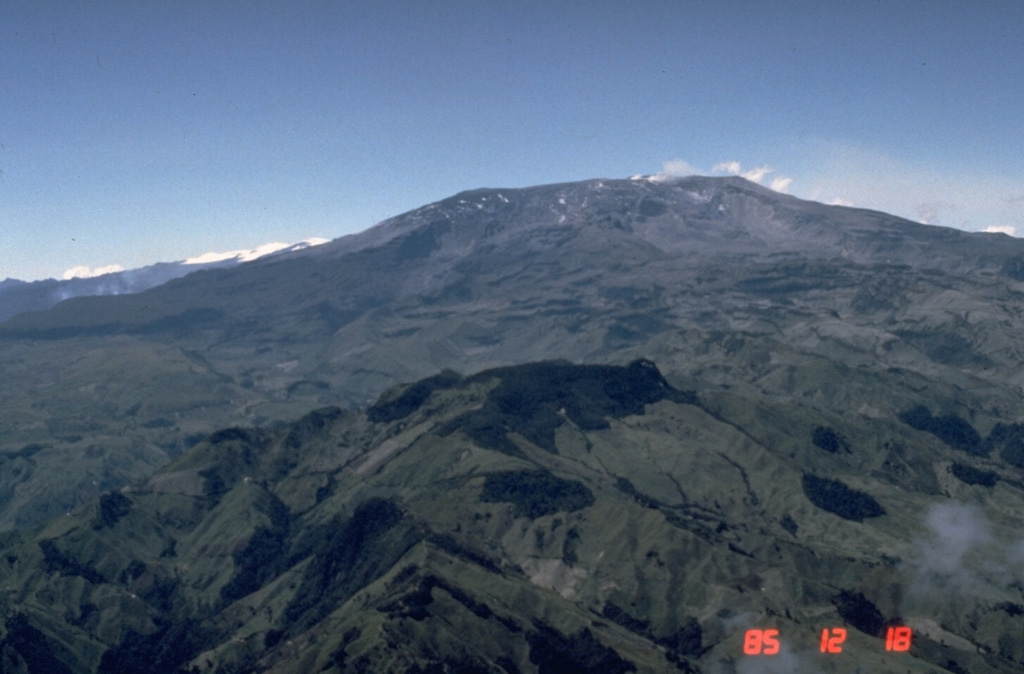
Servicio Geológico Colombiano’s (SGC) Observatorio Vulcanológico y Sismológico de Manizales reported that eruptive activity at Nevado del Ruiz continued during 31 December 2024-6 January 2025. The number of seismic events associated with fluid movement decreased in both number and intensity compared to the previous week, though seismicity indicating continuous ash-and-gas emissions increased (notably on 6 January). Webcam images confirmed several ash emissions and higher-temperature ejecta associated with some of these events; plumes drifted NW, W, and WSW following ash-and-gas emissions that rose 2-2.1 km above the summit at 0814 on 1 January and at 0003 on 3 January. Seismicity associated with rock fracturing decreased in both number and magnitude compared to the previous week. The earthquakes were located below Arenas Crater and the NE, E, SE, SW, and NW flanks within 11 km, and had depths less than 5 km. The largest event, an M 1.2, was recorded at 1551 on 2 January and was located 3 km SW of the crater at a depth of 4 km. Low-energy thermal anomalies on the crater floor were identified in satellite data when weather permitted. Sulfur dioxide emissions detected in satellite data were higher than the previous weeks. The Alert Level remained at Yellow (the second level on a four-level scale), and the public was warned to stay out of the restricted areas around Arenas Crater, not to spend long periods of time on the Murillo-Cerro Gualí Road, and to avoid drainages in the high-threat zones.
Source: Servicio Geológico Colombiano (SGC)
|
Paluweh (Indonesia) | 1 January-7 January 2025 | Continuing Activity Cite this Report Cite this Report |
 Paluweh Paluweh
Sunda Volcanic Arc
|
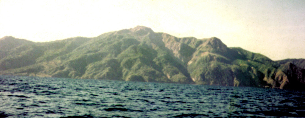
The Pusat Vulkanologi dan Mitigasi Bencana Geologi (PVMBG) reported decreased activity at Paluweh during 16-31 December based on visual observations and monitoring data. No emissions were visible, and the seismic network recorded a decrease in the number of both deep and shallow volcanic earthquakes. At 1200 on 1 January 2025 the Alert Level was lowered to 1 (on a scale of 4) and the public was warned to stay away from the summit area.
Source: Pusat Vulkanologi dan Mitigasi Bencana Geologi (PVMBG, also known as CVGHM)
|
Reventador (Ecuador) | 1 January-7 January 2025 | Continuing Activity Cite this Report Cite this Report |
 Reventador Reventador
Northern Andean Volcanic Arc
|
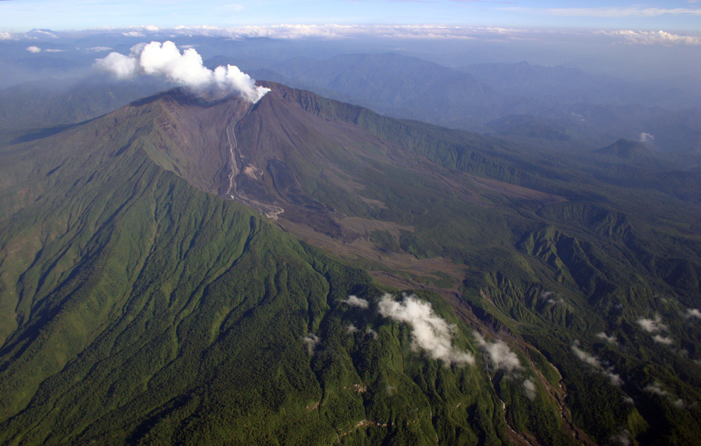
Instituto Geofísico-Escuela Politécnica Nacional (IG-EPN) reported that an eruption at Reventador was ongoing during 31 December 2024-6 January 2025. Seismicity was characterized by 62-88 daily explosions, long-period earthquakes, harmonic tremor, and tremor associated with emissions. Daily ash-and-gas plumes were observed in webcam images and/or satellite images rising 300-1,000 m above the crater and drifting SE, SW, and W. Incandescent material was observed nightly descending the flanks as far as 900 m below the crater rim. Weather conditions occasionally obscured views. Secretaría de Gestión de Riesgos maintained the Alert Level at Orange (the second highest level on a four-color scale).
Sources: Instituto Geofísico-Escuela Politécnica Nacional (IG-EPN), Secretaría de Gestión de Riesgos (SGR)
|
Sangay (Ecuador) | 1 January-7 January 2025 | Continuing Activity Cite this Report Cite this Report |
 Sangay Sangay
Northern Andean Volcanic Arc
|
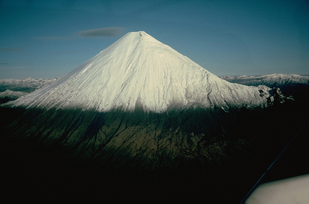
The Instituto Geofísico-Escuela Politécnica Nacional (IG-EPN) reported that eruptive activity continued at Sangay during 31 December 2024-7 January 2025. The seismic network recorded 45-156 daily explosions. Gas-and-ash plumes visible in webcam and/or satellite images rose as high as 1 km above the summit and drifted SW and W during 31 December, 2 January, and 6-7 January. Weather clouds obscured views of the volcano during most of the week. Secretaría de Gestión de Riesgos (SGR) maintained the Alert Level at Yellow (the second highest level on a four-color scale).
Sources: Instituto Geofísico-Escuela Politécnica Nacional (IG-EPN), Secretaría de Gestión de Riesgos (SGR)
|
Semeru (Indonesia) | 1 January-7 January 2025 | Continuing Activity Cite this Report Cite this Report |
 Semeru Semeru
Sunda Volcanic Arc
|
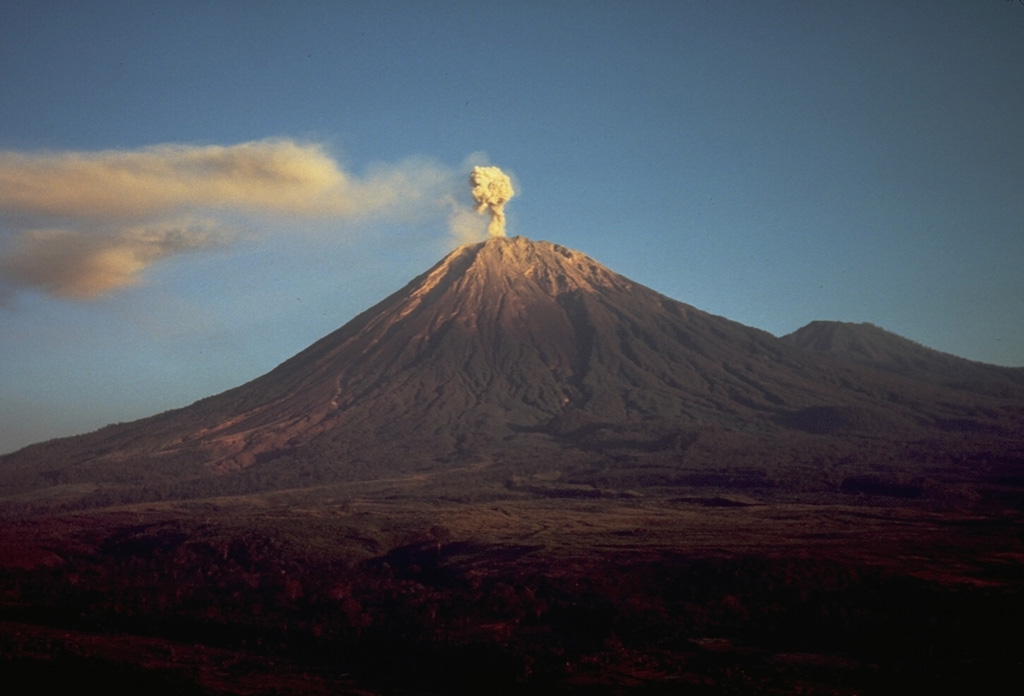
The Pusat Vulkanologi dan Mitigasi Bencana Geologi (PVMBG) reported that eruptive activity continued at Semeru during 1-7 January with several daily eruptive events recorded by the seismic network. Dense white-and-gray plumes rose 300-1,200 m above the summit and drifted SW, N, and NE. The Alert Level remained at 2 (the second lowest level on a scale of 1-4). The public was warned to stay at least 5 km away from the summit in all directions, 13 km from the summit to the SE, 500 m from the banks of the Kobokan drainage as far as 17 km from the summit, and to avoid other drainages including the Bang, Kembar, and Sat, due to lahar, avalanche, and pyroclastic flow hazards.
Source: Pusat Vulkanologi dan Mitigasi Bencana Geologi (PVMBG, also known as CVGHM)
|
Sheveluch (Russia) | 1 January-7 January 2025 | Continuing Activity Cite this Report Cite this Report |
 Sheveluch Sheveluch
Eastern Kamchatka Volcanic Arc
|
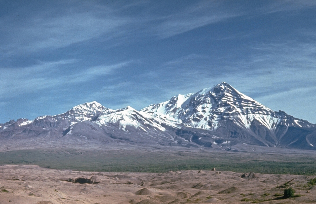
The Kamchatkan Volcanic Eruption Response Team (KVERT) reported that lava extrusion may have continued at Sheveluch’s “300 years of RAS” dome on the SW flank of Old Sheveluch and at the Young Sheveluch dome during 26 December 2024-2 January 2025. Thermal anomalies over the domes were identified in satellite images on all days except for 28 and 29 December when the weather was cloudy. The Aviation Color Code remained at Orange (the second highest level on a four-color scale). Dates are based on UTC times; specific events are in local time where noted.
Source: Kamchatkan Volcanic Eruption Response Team (KVERT)
|
Suwanosejima (Japan) | 1 January-7 January 2025 | Continuing Activity Cite this Report Cite this Report |
 Suwanosejima Suwanosejima
Ryukyu Volcanic Arc
|
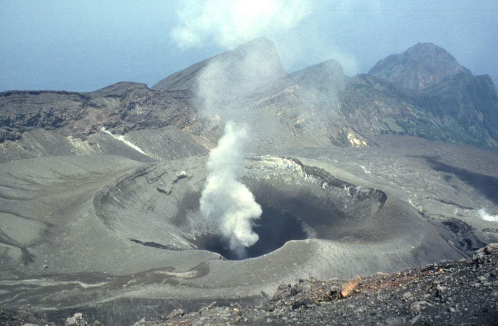
The Japan Meteorological Agency (JMA) reported that eruptive activity at Suwanosejima's Ontake Crater continued during 30 December 2024-6 January 2025. Crater incandescence was observed nightly in webcam images. Explosions at 1033 on 30 December, at 1930 and 2313 on 3 January, at 0619 on 4 January, and at 1803 on 5 January produced ash plumes that rose 0.5-1.1 km above the crater rim and drifted NW, SE, and S; the plume rose into weather clouds at 1930 and 0619. Eruptive events on 30 December, 1 January, and 5 January generated ash plumes that rose 1.1-1.4 km above the summit crater and drifted mainly NE and N. Occasional rumbling was heard at the Suwanosejima Branch Office in Toshima village (3.5 km SSW), though dates were unspecified. The Alert Level remained at 2 (on a 5-level scale) and the public was warned to stay at least 1.5 km away from the crater.
Source: Japan Meteorological Agency (JMA)
|
Taal (Philippines) | 1 January-7 January 2025 | Continuing Activity Cite this Report Cite this Report |
 Taal Taal
Taiwan-Luzon Volcanic Arc
|
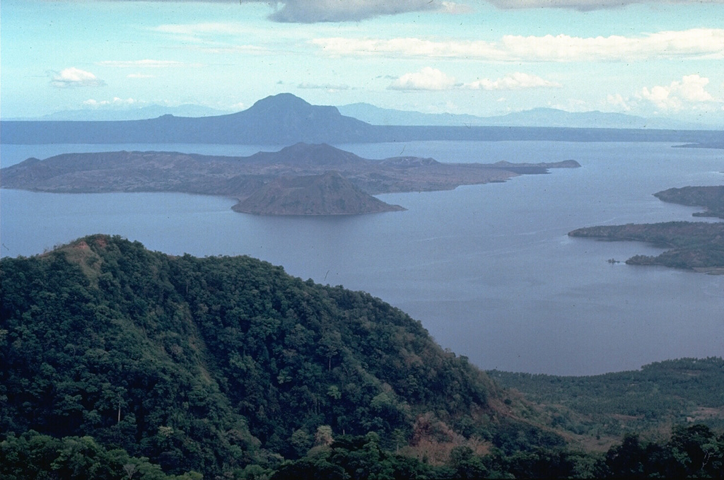
The Philippine Institute of Volcanology and Seismology (PHIVOLCS) reported continuing eruptive activity at Taal during 31 December 2024-6 January 2025. Daily emissions rose 550-900 m above the crater rim and drifted WNW, W, SW, and WSW. There were 1-5 periods of volcanic tremor during 2-4 and 6 January each lasting 3-15 minutes. A longer period of weak tremor was recorded during 4-6 January. Five and seven volcanic earthquakes were detected on 3 and 7 January, respectively.
In a special advisory PHIVOLCS stated that Realtime Seismic Amplitude Measurement (RSAM) values had significantly increased during 4-6 January. Based on visual observations the typical gas plume that rose from Main Crater was absent and, along with increased seismicity, may have indicated a blockage of the volcanic gas pathways. A minor phreatomagmatic event occurred at 1934 on 6 January and lasted for three minutes. A plume rose 600 m above the crater rim and drifted SW. Sulfur dioxide emissions averaged 4,188 tonnes per day that same day. The Alert Level remained at 1 (on a scale of 0-5); PHIVOLCS reminded the public that the entire Taal Volcano Island was a Permanent Danger Zone (PDZ) and recommended that the Main Crater and areas along the Daang Kastila fissure should remain prohibited.
Source: Philippine Institute of Volcanology and Seismology (PHIVOLCS)
|
Villarrica (Chile) | 1 January-7 January 2025 | Continuing Activity Cite this Report Cite this Report |
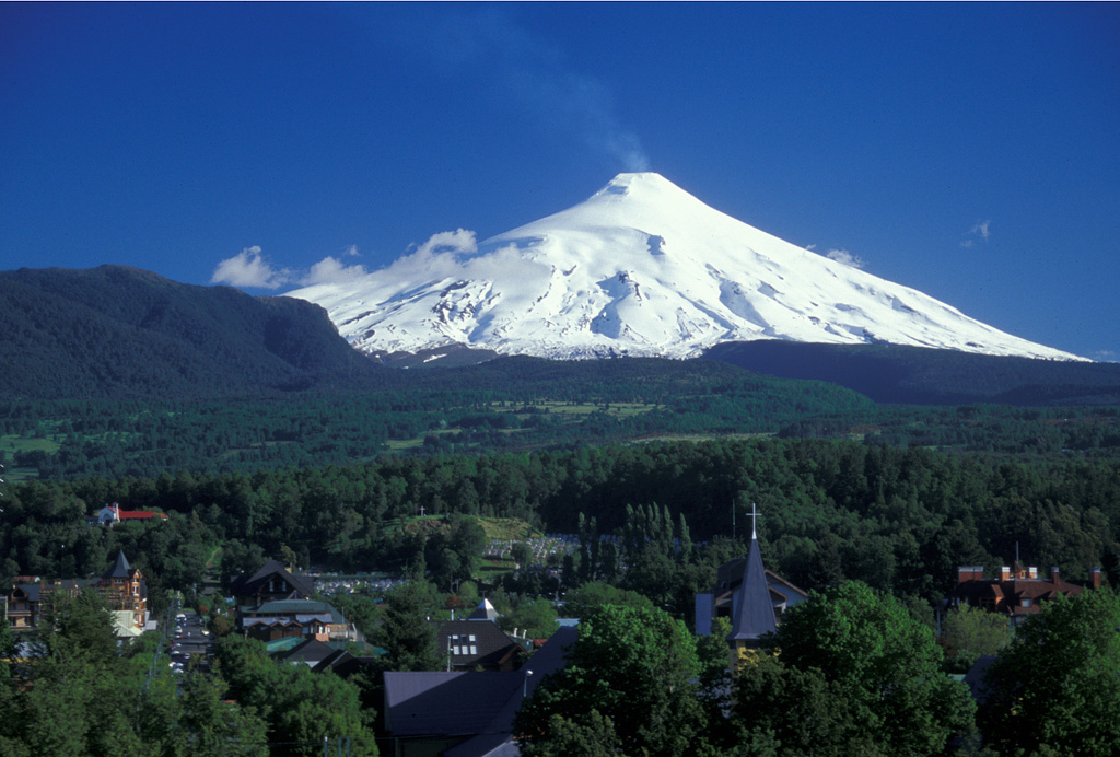 Villarrica Villarrica
Southern Andean Volcanic Arc
|
The Servicio Nacional de Geología y Minería (SERNAGEOMIN) reported that a couple of small explosions at Villarrica were recorded on 7 January. Webcam images showed white and gray plumes rising from the crater. The Volcanic Alert Level remained at Green (the lowest level on a four-level scale).
Source: Servicio Nacional de Geología y Minería (SERNAGEOMIN)
|
![]() Download Smithsonian / USGS Weekly Volcanic Activity Report Network Link
Download Smithsonian / USGS Weekly Volcanic Activity Report Network Link
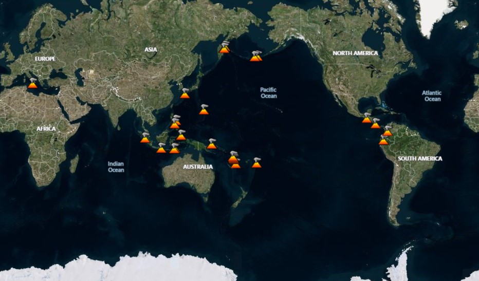
 Ahyi
Ahyi Dieng Volcanic Complex
 Fentale
 Home Reef
 Kilauea
 Poas
Poas Aira
Aira Dukono
 Ebeko
Ebeko Great Sitkin
 Ibu
Ibu Kanlaon
 Karymsky
 Lewotobi
 Lewotolok
 Manam
Manam Marapi
 Merapi
 Nevado del Ruiz
 Paluweh
 Reventador
 Sangay
 Semeru
 Sheveluch
 Suwanosejima
 Taal
Taal Villarrica