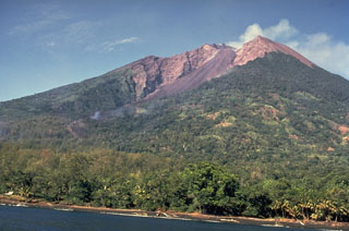
Report on Manam (Papua New Guinea) — July 1993
Bulletin of the Global Volcanism Network, vol. 18, no. 7 (July 1993)
Managing Editor: Edward Venzke.
Manam (Papua New Guinea) Moderate eruption produces ashfall, pyroclastic flows, and lava flows
Please cite this report as:
Global Volcanism Program, 1993. Report on Manam (Papua New Guinea) (Venzke, E., ed.). Bulletin of the Global Volcanism Network, 18:7. Smithsonian Institution. https://doi.org/10.5479/si.GVP.BGVN199307-251020
Manam
Papua New Guinea
4.08°S, 145.037°E; summit elev. 1807 m
All times are local (unless otherwise noted)
"Activity reached a high level in mid-July with a paroxysmal eruption on 14 July from Southern Crater. Activity was then low through the end of the month.
"From 1 to 4 July, both Main and Southern craters released occasional small emissions of mostly white vapours with no audible sounds or night glow. Mild, deep-seated eruptive activity began at Southern Crater on 5 July with occasional forceful emissions of white-grey, ash-laden clouds rising several hundred meters above the summit, accompanied by sub-continuous weak-to-loud roaring and rumbling noises. Rapid degassing started on 7 July with incandescent Strombolian projections up to ~100 m above the summit and rocks cascading down the headwall into SW Valley. This level of activity continued until 11 July, and then declined slightly.
"Activity at Southern Crater intensified at 1200 on 14 July as a new eruptive phase began with continuous strong emission of dark ash-laden clouds. The basaltic scoria-and-ash column reportedly rose to about 11 km and was accompanied by continuous loud roaring sounds. Moderate-heavy ash and scoria fall occurred from 1300 to 2000 on the W flank. Heavy tephra fall caused several hours of partial darkness on the W side of the volcano. The maximum measured ash-fall thickness of 80 mm was recorded between the coastal villages of Yacca and Kuluguma (5 km NW), damaging vegetation and food gardens. No casualties were reported. About 2 mm of ashfall occurred on the mainland at Awar Plantation (20 km W) and Watam village (30 km NW). Ashfall was detected as far as 90 km NW of the volcano. Weather satellite imagery indicated that the emission plume was oriented SW from the volcano and was ~170 km long at 1630 on 14 July.
"Small pyroclastic flows, generated at 1300, descended into SW Valley and stopped 3 km from the coast. At about 1820, moderate-to-large pyroclastic flows in SE Valley stripped and burned vegetation from the upper banks of the valley and along its course before reaching the sea, 5 km from the summit. Lava flows followed the pyroclastic flows into SE and SW Valleys. The largest of the lava flows was in SW Valley, and was ~2.5 km long, 40 m wide, and 3-4 m thick, terminating 3 km from the coast. The level of activity at Southern Crater declined on 15 July and stayed at a low level until the end of the month. Activity consisted of the release of white and blue vapour in small amounts with no audible noises or night glow.
"Main Crater activity remained low throughout the month with the emission of mostly white vapour in small-to-moderate volumes on 6, 16, and 31 July, while moderate volumes of white-grey ash and vapours were released between 7 and 15 July. The seismograph was not operational during most of July. Measurements from water-tube tiltmeters during 1993 have fluctuated over a range of a few microradians, although there may be a slight inflationary trend. The 14 July eruption appears to have had little or no effect on the tilt measurements."
Geological Summary. The 10-km-wide island of Manam, lying 13 km off the northern coast of mainland Papua New Guinea, is one of the country's most active volcanoes. Four large radial valleys extend from the unvegetated summit of the conical basaltic-andesitic stratovolcano to its lower flanks. These valleys channel lava flows and pyroclastic avalanches that have sometimes reached the coast. Five small satellitic centers are located near the island's shoreline on the northern, southern, and western sides. Two summit craters are present; both are active, although most observed eruptions have originated from the southern crater, concentrating eruptive products during much of the past century into the SE valley. Frequent eruptions, typically of mild-to-moderate scale, have been recorded since 1616. Occasional larger eruptions have produced pyroclastic flows and lava flows that reached flat-lying coastal areas and entered the sea, sometimes impacting populated areas.
Information Contacts: B. Talai, R. Stewart, and C. McKee, RVO.

