Report on Kujusan (Japan) — July 1996
Bulletin of the Global Volcanism Network, vol. 21, no. 7 (July 1996)
Managing Editor: Richard Wunderman.
Kujusan (Japan) No ashfall despite seismic increases
Please cite this report as:
Global Volcanism Program, 1996. Report on Kujusan (Japan) (Wunderman, R., ed.). Bulletin of the Global Volcanism Network, 21:7. Smithsonian Institution. https://doi.org/10.5479/si.GVP.BGVN199607-282120
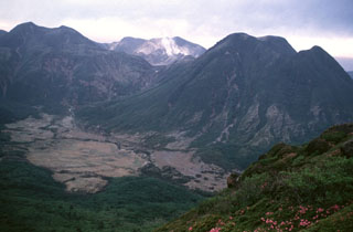
Kujusan
Japan
33.086°N, 131.249°E; summit elev. 1791 m
All times are local (unless otherwise noted)
During June and July, high seismicity around Kuju was recorded. Some of the daily earthquake totals were as follows: 20-30 (18, 26, and 27 June); 39 (3 July); and 31 (15 July). Overall there were 212 events in June and 279 in July. During June and July no ashfall was seen and plume height typically remained lower than 400 m.
Geological Summary. Kujusan is a complex of stratovolcanoes and lava domes lying NE of Aso caldera in north-central Kyushu. The group consists of 16 andesitic lava domes, five andesitic stratovolcanoes, and one basaltic cone. Activity dates back about 150,000 years. Six major andesitic-to-dacitic tephra deposits, many associated with the growth of lava domes, have been recorded during the Holocene. Eruptive activity has migrated systematically eastward during the past 5000 years. The latest magmatic activity occurred about 1600 years ago, when Kurodake lava dome at the E end of the complex was formed. The first reports of historical eruptions were in the 17th and 18th centuries, when phreatic or hydrothermal activity occurred. There are also many hot springs and hydrothermal fields. A fumarole on Hosho lava dome was the site of a sulfur mine for at least 500 years. Two geothermal power plants are in operation at Kuju.
Information Contacts: Volcanological Division, Japan Meteorological Agency, 1-3-4 Ote-machi, Chiyoda-ku, Tokyo 100, Japan