Report on Shishaldin (United States) — April 1999
Bulletin of the Global Volcanism Network, vol. 24, no. 4 (April 1999)
Managing Editor: Richard Wunderman.
Shishaldin (United States) Steam-and-ash plume on 19 April rose to 15-20 km and was carried to great distances
Please cite this report as:
Global Volcanism Program, 1999. Report on Shishaldin (United States) (Wunderman, R., ed.). Bulletin of the Global Volcanism Network, 24:4. Smithsonian Institution. https://doi.org/10.5479/si.GVP.BGVN199904-311360
Shishaldin
United States
54.756°N, 163.97°W; summit elev. 2857 m
All times are local (unless otherwise noted)
Strombolian eruptions, including forceful steam-and-ash plumes, peaked at Shishaldin on 19 April (BGVN 24:03) and continued well into May. The 19 April plume rose to 15-20 km and various components were carried in different directions (figure 3). As discussed further in the Atmospheric Effects section below, scientists studying atmospheric aerosols with a variety of satellite-based instruments as well as ground-based lidar detected atmospheric anomalies through at least late May; some at great distances from the volcano. The initial anomalies seen by satellite were clearly linked to the 19 April eruption, but at longer time intervals after the eruption and at greater distances from the source, this became less certain.
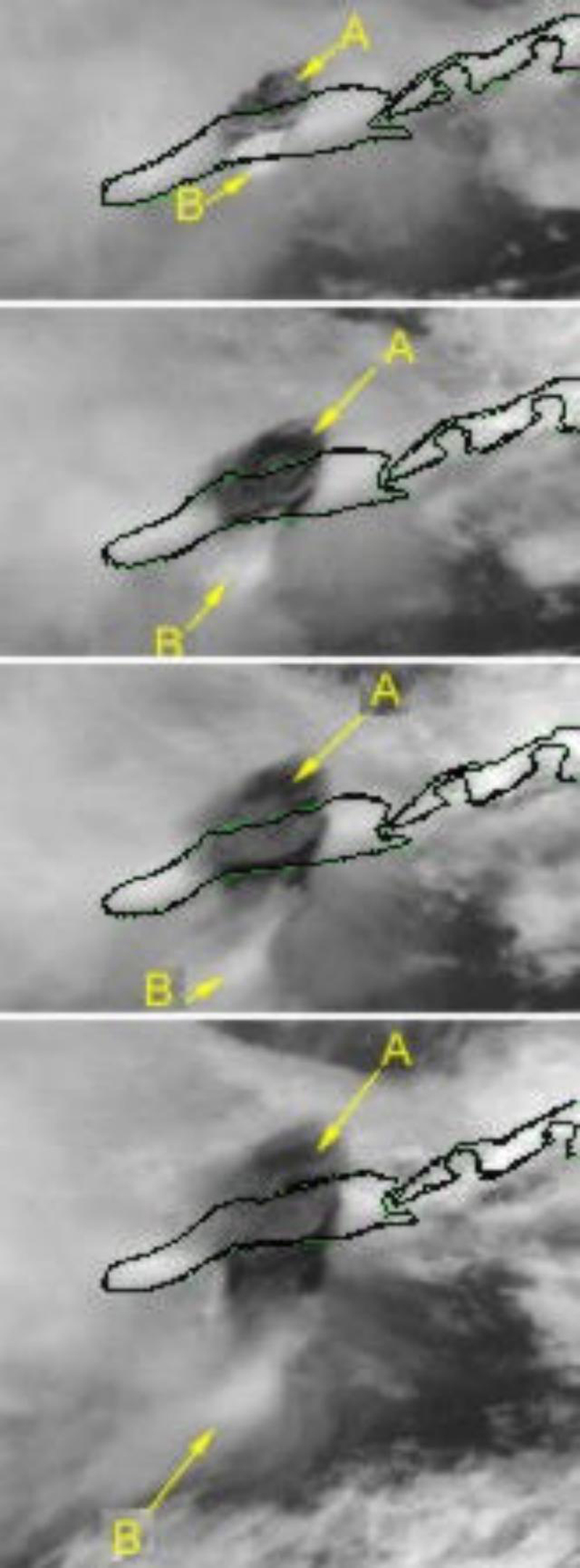 |
Figure 3. Detailed view of the spreading eruption cloud from Shishaldin on 19 April, taken from a series of images taken by the GOES 10 satellite (channel 1). Unimak Island is outlined. The top frame was imaged at 1200; the following frames at subsequent half-hour increments. The cloud labeled "A" was at higher altitude and moved N; cloud "B" was at lower altitude and moved S. Courtesy of NOAA/NESDIS. |
Moderate Strombolian eruptions and elevated seismicity continued following the initial forceful eruption and through the night of 22 April, . Lava fountaining to about 150 m above the summit coincided with satellite images of occasional steam and sparse ash clouds. These clouds extended ~48 km at altitudes less than 4.6 km. Satellite data during the first week of May showed a few small ash-poor plumes, but no thermal anomalies or other indicators of significant eruptive activity were seen.
The next significant reported event, on 13 May, occurred after a night with a small thermal anomaly in satellite imagery and weak tremor. The crew of a National Weather Service boat at the N end of False Pass, 30 km NE from the volcano, saw three puffs at ~1025. A plume rose 300 m above the summit. A pilot's report at 1155 confirmed the activity. Poor weather conditions may have thwarted observers' ability to see eruptive activity the following week and none was reported. At 2311 on 24 May a pilot reported a plume that rose to 6.1 km. Ash-rich steam in a plume was visible in satellite imagery at 1459 on 25 May, extending 160 km S from Shishaldin at an estimated altitude of ~4.6 km.
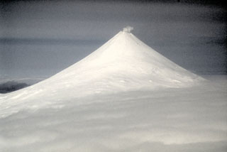
One of the most active volcanoes of the Aleutian Islands, the glacier-covered Shishaldin lies at the westernmost end of three large stratovolcanoes on the eastern half of Unimak Island. The volcano's frequent explosive activity has primarily consisted of Strombolian ash eruptions vented from its small summit crater, and occasional lava flows. The historical record of such events goes back to the 18th century.
Geological Summary. The symmetrical glacier-covered Shishaldin in the Aleutian Islands is the westernmost of three large stratovolcanoes in the eastern half of Unimak Island. The Aleuts named the volcano Sisquk, meaning "mountain which points the way when I am lost." Constructed atop an older glacially dissected edifice, it is largely basaltic in composition. Remnants of an older edifice are exposed on the W and NE sides at 1,500-1,800 m elevation. There are over two dozen pyroclastic cones on its NW flank, which is covered by massive aa lava flows. Frequent explosive activity, primarily consisting of Strombolian ash eruptions from the small summit crater, but sometimes producing lava flows, has been recorded since the 18th century. A steam plume often rises from the summit crater.
Information Contacts: Alaska Volcano Observatory (AVO), a cooperative program of a) U.S. Geological Survey, 4200 University Drive, Anchorage, AK 99508-4667, USA (URL: http://www.avo.alaska.edu/), b) Geophysical Institute, University of Alaska, PO Box 757320, Fairbanks, AK 99775-7320, USA, and c) Alaska Division of Geological & Geophysical Surveys, 794 University Ave., Suite 200, Fairbanks, AK 99709, USA; NOAA/NESDIS Operational Significant Event Imagery Support Team, Interactive Processing Branch E/SP22, 5200 Auth Road, Camp Springs, MD 20746, USA (URL: https://www.nnvl.noaa.gov/).