
The Global Volcanism Program has no activity reports available for Toba.
The Global Volcanism Program has no Weekly Reports available for Toba.
The Global Volcanism Program has no Bulletin Reports available for Toba.
|
|
||||||||||||||||||||||||||
The Global Volcanism Program is not aware of any Holocene eruptions from Toba. If this volcano has had large eruptions (VEI >= 4) prior to 12,000 years ago, information might be found on the Toba page in the LaMEVE (Large Magnitude Explosive Volcanic Eruptions) database, a part of the Volcano Global Risk Identification and Analysis Project (VOGRIPA).
This compilation of synonyms and subsidiary features may not be comprehensive. Features are organized into four major categories: Cones, Craters, Domes, and Thermal Features. Synonyms of features appear indented below the primary name. In some cases additional feature type, elevation, or location details are provided.
Cones |
||||
| Feature Name | Feature Type | Elevation | Latitude | Longitude |
| Batuharang, Dolok | Cone | 1552 m | ||
| Pusukbukit
Poesoek Boekit Nabelberg |
Stratovolcano | 1972 m | 2° 36' 0.00" N | 98° 39' 0.00" E |
| Sibutan, Dolok | Stratovolcano | 2° 59' 0.00" N | 98° 30' 0.00" E | |
| Singgalang, Dolok | Cone | 1865 m | 2° 57' 0.00" N | 98° 37' 0.00" E |
| Tandukbenua, Dolok
Sipisopiso |
Cone | 1947 m | 2° 56' 0.00" N | 98° 32' 0.00" E |
Craters |
||||
| Feature Name | Feature Type | Elevation | Latitude | Longitude |
| Haranggaol | Caldera | |||
| Porsea | Caldera | |||
| Sibandung | Caldera | |||
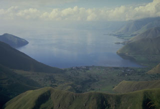 Lake Toba, the largest lake in SE Asia, fills more than half of the 35 x 100 km Toba caldera, the Earth's largest Quaternary caldera. The caldera walls rise steeply 400-1,200 m above the 1,700 km2 lake, which is one of the world's deepest with a maximum depth of 530 m. This view looks south from the northern caldera rim.
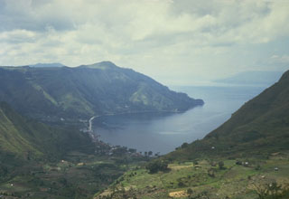 The northern wall of Toba caldera rises about 500 m above the village of Haranggoal. Samosir Island, visible in the distance across Lake Toba on the right, is part of an uplifted block of caldera-fill deposits from the last major eruption of Toba about 74,000 years ago.
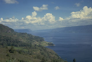 The 35 x 100 km Toba caldera was formed during four powerful explosive eruptions beginning 1.2 million years ago. The latest of these, about 74,000 years ago, was one of the world's largest known Quaternary eruptions, producing the Young Toba Tuff (YTT).
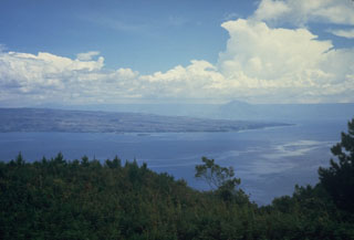 The 35 x 100 km wide Toba caldera, partially filled by Sumatra's Lake Toba, is Earth's largest Quaternary caldera. This view looks W toward the northern end of Samosir Island, which is part of a block that was uplifted after eruption of the Young Toba Tuff (YTT) about 74,000 years ago. The island, once entirely covered by Lake Toba, is formed of caldera-fill deposits of YTT-capped by lake sediments.
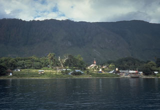 The steep wall behind Tomok village on Samosir Island is part of a block of uplifted caldera-fill rocks. The entire 630 km2 island, which now rises to 700 m above Lake Toba, is capped with lake-floor sediments that were deposited before the island was uplifted above lake level.
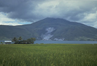 Clouds obscure the summit of Pusukbukit, a young volcano that formed on the western margin of Toba caldera. An active geothermal area forms the light-colored area at the base of the volcano across the strait from Samosir Island on Lake Toba.
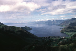 The 100-km-long Lake Toba is seen here from the northern end. The lake fills a 35 x 100 km caldera that formed during four major late-Pleistocene eruptions. The western caldera scarp forms the cliffs at the right. The low-angle slope on the left horizon is Samosir Island, half of a large resurgent block in the center of the caldera. The 1,700 km2 lake is the largest in SE Asia.
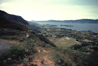 The eastern wall of the Toba caldera forms the horizon across Lake Toba from Samosir Island in the foreground. The small Tuk-Tuk peninsula (center) extends into the lake from the 630 km2 island. The small conical peak on the horizon at left-center is Tandukbenua volcano, which may have erupted only a few hundred years ago.
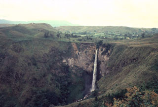 Sipisopiso waterfall, at the northern end of Lake Toba, formed on a cliff in the Middle Toba Tuff (MTT) deposit. The MTT rhyolite ignimbrite (more than 60 km3) was emplaced about 500,000 years ago during the third largest of the four major Toba caldera-forming eruptions. Products of the densely welded MTT eruption are distributed over the northern part of the caldera.
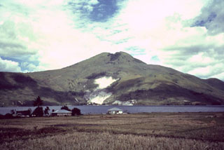 Pusukbukit, a volcano in the Toba caldera, was constructed just within the western caldera rim. It is seen here across a narrow strait from Samosir Island, with light-colored areas containing fumaroles along its northern flank. The youngest lava flow on Pusukbukit is of dacitic composition.
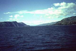 Tuk-Tuk, a small peninsula on Samosir Island, provides a vista of Latung Strait, which separates the opposing resurgent blocks of Samosir (right) and the Uluan block on the left. The Latung Strait marks the center of post-caldera resurgence, which tilted the Uluan block, located within the SE part of the caldera, to the SE and the Samosir Island block to the NE.
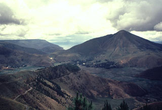 Clouds rise above the summit of Pusukbukit (right), a post-caldera cone constructed just inside the western rim of Toba caldera. Lake Toba, which fills the caldera, is visible beyond the northern (left) flank of Pusukbukit.
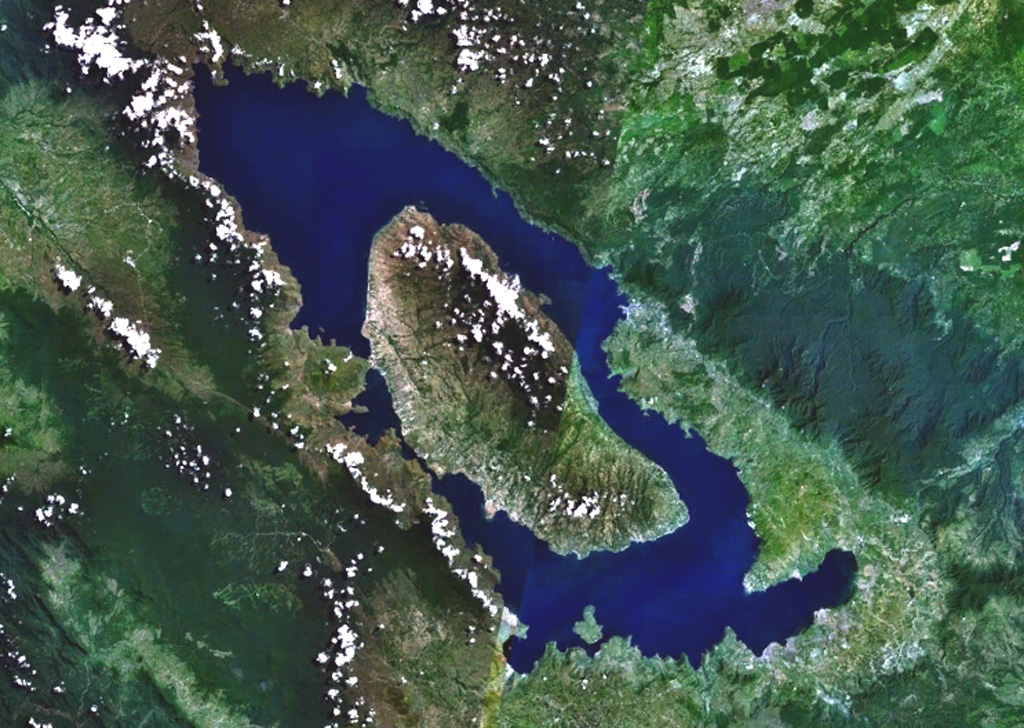
  Toba is Earth's largest Quaternary caldera and is partially filled by Lake Toba, seen here in a NASA Landsat satellite image (N is to the top). The 35 x 100 km caldera formed during four major ignimbrite-forming eruptions in the Pleistocene, the latest of which occurred about 74,000 years ago. The large island of Samosir is an uplifted resurgent dome.
 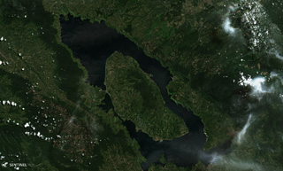 The 30 x 100 km Toba caldera formed during four major eruptions, the most recent occurring 74,000 years ago when it erupted the Young Toba Tuff. Samosir Island is an area of resurgence within the caldera, formed by uplifting of the caldera floor by at least 1.1 km over thousands of years. N is at the top of this 21 June 2019 Sentinel-2 satellite image.
The following 12 samples associated with this volcano can be found in the Smithsonian's NMNH Department of Mineral Sciences collections, and may be availble for research (contact the Rock and Ore Collections Manager). Catalog number links will open a window with more information.
| Catalog Number | Sample Description | Lava Source | Collection Date |
|---|---|---|---|
| NMNH 117312-1 | Pumice | -- | -- |
| NMNH 117312-10 | Tuff | -- | -- |
| NMNH 117312-11 | Tuff | -- | -- |
| NMNH 117312-12 | Tuff | -- | -- |
| NMNH 117312-2 | Pumice | -- | -- |
| NMNH 117312-3 | Pumice | -- | -- |
| NMNH 117312-4 | Pumice | -- | -- |
| NMNH 117312-5 | Pumice | -- | -- |
| NMNH 117312-6 | Tuff | -- | -- |
| NMNH 117312-7 | Tuff | -- | -- |
| NMNH 117312-8 | Tuff | -- | -- |
| NMNH 117312-9 | Tuff | -- | -- |
| Copernicus Browser | The Copernicus Browser replaced the Sentinel Hub Playground browser in 2023, to provide access to Earth observation archives from the Copernicus Data Space Ecosystem, the main distribution platform for data from the EU Copernicus missions. |
|
WOVOdat
Single Volcano View Temporal Evolution of Unrest Side by Side Volcanoes |
WOVOdat is a database of volcanic unrest; instrumentally and visually recorded changes in seismicity, ground deformation, gas emission, and other parameters from their normal baselines. It is sponsored by the World Organization of Volcano Observatories (WOVO) and presently hosted at the Earth Observatory of Singapore.
GVMID Data on Volcano Monitoring Infrastructure The Global Volcano Monitoring Infrastructure Database GVMID, is aimed at documenting and improving capabilities of volcano monitoring from the ground and space. GVMID should provide a snapshot and baseline view of the techniques and instrumentation that are in place at various volcanoes, which can be use by volcano observatories as reference to setup new monitoring system or improving networks at a specific volcano. These data will allow identification of what monitoring gaps exist, which can be then targeted by remote sensing infrastructure and future instrument deployments. |
| IRIS seismic stations/networks | Incorporated Research Institutions for Seismology (IRIS) Data Services map showing the location of seismic stations from all available networks (permanent or temporary) within a radius of 0.18° (about 20 km at mid-latitudes) from the given location of Toba. Users can customize a variety of filters and options in the left panel. Note that if there are no stations are known the map will default to show the entire world with a "No data matched request" error notice. |
| UNAVCO GPS/GNSS stations | Geodetic Data Services map from UNAVCO showing the location of GPS/GNSS stations from all available networks (permanent or temporary) within a radius of 20 km from the given location of Toba. Users can customize the data search based on station or network names, location, and time window. Requires Adobe Flash Player. |
| Large Eruptions of Toba | Information about large Quaternary eruptions (VEI >= 4) is cataloged in the Large Magnitude Explosive Volcanic Eruptions (LaMEVE) database of the Volcano Global Risk Identification and Analysis Project (VOGRIPA). |
| EarthChem | EarthChem develops and maintains databases, software, and services that support the preservation, discovery, access and analysis of geochemical data, and facilitate their integration with the broad array of other available earth science parameters. EarthChem is operated by a joint team of disciplinary scientists, data scientists, data managers and information technology developers who are part of the NSF-funded data facility Integrated Earth Data Applications (IEDA). IEDA is a collaborative effort of EarthChem and the Marine Geoscience Data System (MGDS). |