
The Global Volcanism Program has no activity reports available for Black Rock Desert.
The Global Volcanism Program has no Weekly Reports available for Black Rock Desert.
The Global Volcanism Program has no Bulletin Reports available for Black Rock Desert.
This compilation of synonyms and subsidiary features may not be comprehensive. Features are organized into four major categories: Cones, Craters, Domes, and Thermal Features. Synonyms of features appear indented below the primary name. In some cases additional feature type, elevation, or location details are provided.
Cones |
||||
| Feature Name | Feature Type | Elevation | Latitude | Longitude |
| Beaver Ridge | Vent | |||
| Black Rock Volcano | Cone | 1480 m | 38° 48' 0" N | 112° 30' 0" W |
| Deseret | Vent | |||
| Pavant Butte | Tuff cone | 1753 m | 39° 8' 0" N | 112° 33' 0" W |
| Tabernacle Hill | Tuff cone | 1512 m | 38° 54' 0" N | 112° 32' 0" W |
Craters |
||||
| Feature Name | Feature Type | Elevation | Latitude | Longitude |
| Crescent | Crater | 38° 58' 0" N | 112° 30' 0" W | |
| Ice Spring | Crater | 1550 m | 38° 58' 0" N | 112° 30' 0" W |
| Miter | Crater | 38° 58' 0" N | 112° 30' 0" W | |
| Terrace | Crater | 38° 58' 0" N | 112° 35' 0" W | |
Domes |
||||
| Feature Name | Feature Type | Elevation | Latitude | Longitude |
| White Mountain | Dome | 38° 54' 0" N | 112° 30' 0" W | |
|
|
||||||||||||||||||||||||||||
There is data available for 1 confirmed Holocene eruptive periods.
1290 ± 150 years Confirmed Eruption
| Episode 1 | Eruption | Ice Springs Craters | ||||||||||||||||||||||||
|---|---|---|---|---|---|---|---|---|---|---|---|---|---|---|---|---|---|---|---|---|---|---|---|---|---|
| 1290 ± 150 years - Unknown | Evidence from Isotopic: 14C (uncalibrated) | ||||||||||||||||||||||||
|
List of 3 Events for Episode 1 at Ice Springs Craters
| |||||||||||||||||||||||||
There is no Deformation History data available for Black Rock Desert.
There is no Emissions History data available for Black Rock Desert.
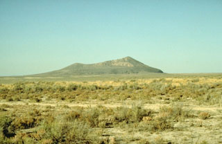 Pavant Butte, a large tuff cone in the Black Rock Desert volcanic field, was constructed on top of pahoehoe and aa lava flows about 16,000 years ago. Pavant Butte owes its morphology to the fact that it was erupted through a water depth of 85 m in Pleistocene Lake Bonneville. A prominent wave-cut shoreline is visible on the flanks of the cone. The subaerial portion of the 275-m-high cone consists of palagonite, formed by alteration of volcanic glass. The Pavant field is the northernmost in the Black Rock Desert.
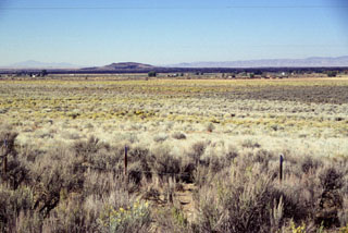 The inconspicuous hill on the left-center horizon to the SW is Ice Springs volcano, part of the Black Rock Desert volcanic field in central Utah. The black area extending across the photo from the cinder cone complex is a 660-year-old basaltic lava flow from Ice Springs volcano. An additional NNE-SSW chain of small volcanic vents is located NE of the main vent complex. The volcanic fields in the Black Rock Desert area were first described by pioneering U.S. Geological Survey geologist G.K. Gilbert in the late 19th century.
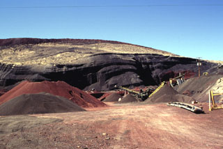 The multi-colored scoria deposits of the eastern side of Crescent Crater, part of the cinder and spatter cone complex at Ice Springs volcanic field, are the object of a mining operation to produce road aggregate. Ice Springs was the source of Utah's youngest lava flow about 660 years ago.
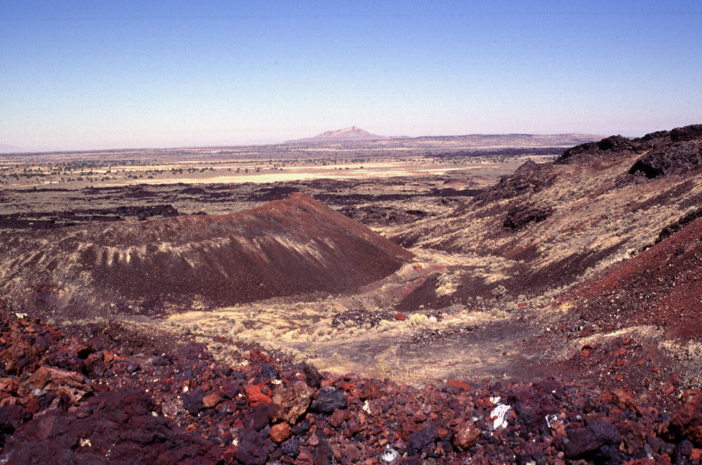
 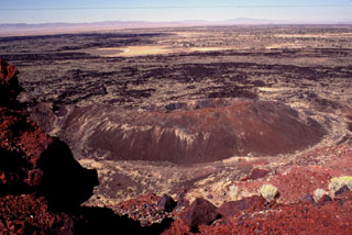 The youngest volcanic eruptions in Utah took place from the Ice Springs volcanic center. Root fragments from soil beneath the lava flow are C-14 dated at 660 ± 170 years old. Lava flows from the Ice Springs crater complex traveled about 4 km to the west and north, overlapping late-Pleistocene flows from the Pavant volcano. This view looks to the west from the rim of Crescent Crater, the largest of the overlapping cinder and spatter cones that fed the flows. Pocket Crater is the symmetrical cone in the center of the photo.
 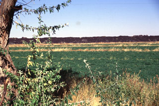 Farmlands encroach on the eastern margin of the Ice Springs lava flow, Utah's youngest. The 660-year-old lava flow originated from a complex of cinder and spatter cones and extends a maximum distance of 8 km from its source. The flow contains abundant xenoliths of partially fused granite.
 The Black Rock Desert volcanic field consists of a cluster of closely spaced small volcanic fields of Pleistocene-to-Holocene age in the Black Rock and Sevier deserts. This view shows Utah's youngest known lava flow, the 660-year-old Ice Springs flow, which originated from a series of nested cinder and spatter cones. The rim of Crescent Crater is at the right, with the symmetrical Pocket Crater at the left and Pavant Butte in the distance. This tuff cone erupted through the waters of Pleistocene Lake Bonneville about 16,000 years ago.
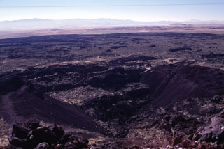 The Terrace, a crater seen here in the foreground from the rim of Mitre Crater, was the source of the voluminous lava flows seen extending toward the SE. The crater derives its name from several terraces, now partly removed by quarrying operations, that were formed by cooled lava lakes. These SE flows from The Terrace are the youngest of a series of eruptions at the Ice Springs volcanic field about 660 years ago. The Ice Springs volcanic field is one of several closely spaced volcanic fields in the Black Rock Desert of south-central Utah.
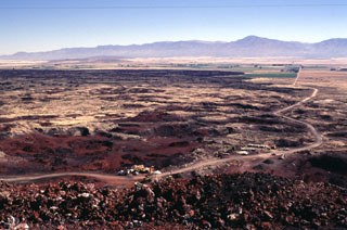 The summit of Ice Springs volcano provides a perspective of the extensive lava field erupted from the volcano about 660 years ago. Ash and scoria from Crescent Crater on the east side of the cone complex was blown primarily to the east by prevailing winds and forms the lighter-colored material that mantles the lava flow in this direction. The eastern lava flows were erupted early during the Ice Springs eruption. The road in the foreground provides access to a quarrying operation at the cinder and spatter cone complex.
 Maps are not currently available due to technical issues.
The maps shown below have been scanned from the GVP map archives and include the volcano on this page. Clicking on the small images will load the full 300 dpi map. Very small-scale maps (such as world maps) are not included.
The following 9 samples associated with this volcano can be found in the Smithsonian's NMNH Department of Mineral Sciences collections, and may be availble for research (contact the Rock and Ore Collections Manager). Catalog number links will open a window with more information.
| Catalog Number | Sample Description | Lava Source | Collection Date |
|---|---|---|---|
| NMNH 111123-100 | Basalt | ICE SPRING FIELD | -- |
| NMNH 111123-97 | Scoria | ICE SPRING FIELD | -- |
| NMNH 117121 | Basalt Volcanic Bomb | ICE SPRING CRATER | 1 Oct 1996 |
| NMNH 117122 | Basalt | ICE SPRING CRATER | 1 Oct 1996 |
| NMNH 35372 | Basalt | ICE SPRING FIELD | -- |
| NMNH 35372 | Basalt | ICE SPRING CRATER | -- |
| NMNH 35374 | Basalt | ICE SPRING FIELD | -- |
| NMNH 35374 | Basalt | ICE SPRING FIELD | -- |
| NMNH 35538 | Volcanic Lapilli | ICE SPRING FIELD | -- |
| Copernicus Browser | The Copernicus Browser replaced the Sentinel Hub Playground browser in 2023, to provide access to Earth observation archives from the Copernicus Data Space Ecosystem, the main distribution platform for data from the EU Copernicus missions. |
| MIROVA | Middle InfraRed Observation of Volcanic Activity (MIROVA) is a near real time volcanic hot-spot detection system based on the analysis of MODIS (Moderate Resolution Imaging Spectroradiometer) data. In particular, MIROVA uses the Middle InfraRed Radiation (MIR), measured over target volcanoes, in order to detect, locate and measure the heat radiation sourced from volcanic activity. |
| MODVOLC Thermal Alerts | Using infrared satellite Moderate Resolution Imaging Spectroradiometer (MODIS) data, scientists at the Hawai'i Institute of Geophysics and Planetology, University of Hawai'i, developed an automated system called MODVOLC to map thermal hot-spots in near real time. For each MODIS image, the algorithm automatically scans each 1 km pixel within it to check for high-temperature hot-spots. When one is found the date, time, location, and intensity are recorded. MODIS looks at every square km of the Earth every 48 hours, once during the day and once during the night, and the presence of two MODIS sensors in space allows at least four hot-spot observations every two days. Each day updated global maps are compiled to display the locations of all hot spots detected in the previous 24 hours. There is a drop-down list with volcano names which allow users to 'zoom-in' and examine the distribution of hot-spots at a variety of spatial scales. |
|
WOVOdat
Single Volcano View Temporal Evolution of Unrest Side by Side Volcanoes |
WOVOdat is a database of volcanic unrest; instrumentally and visually recorded changes in seismicity, ground deformation, gas emission, and other parameters from their normal baselines. It is sponsored by the World Organization of Volcano Observatories (WOVO) and presently hosted at the Earth Observatory of Singapore.
GVMID Data on Volcano Monitoring Infrastructure The Global Volcano Monitoring Infrastructure Database GVMID, is aimed at documenting and improving capabilities of volcano monitoring from the ground and space. GVMID should provide a snapshot and baseline view of the techniques and instrumentation that are in place at various volcanoes, which can be use by volcano observatories as reference to setup new monitoring system or improving networks at a specific volcano. These data will allow identification of what monitoring gaps exist, which can be then targeted by remote sensing infrastructure and future instrument deployments. |
| Volcanic Hazard Maps | The IAVCEI Commission on Volcanic Hazards and Risk has a Volcanic Hazard Maps database designed to serve as a resource for hazard mappers (or other interested parties) to explore how common issues in hazard map development have been addressed at different volcanoes, in different countries, for different hazards, and for different intended audiences. In addition to the comprehensive, searchable Volcanic Hazard Maps Database, this website contains information about diversity of volcanic hazard maps, illustrated using examples from the database. This site is for educational purposes related to volcanic hazard maps. Hazard maps found on this website should not be used for emergency purposes. For the most recent, official hazard map for a particular volcano, please seek out the proper institutional authorities on the matter. |
| IRIS seismic stations/networks | Incorporated Research Institutions for Seismology (IRIS) Data Services map showing the location of seismic stations from all available networks (permanent or temporary) within a radius of 0.18° (about 20 km at mid-latitudes) from the given location of Black Rock Desert. Users can customize a variety of filters and options in the left panel. Note that if there are no stations are known the map will default to show the entire world with a "No data matched request" error notice. |
| UNAVCO GPS/GNSS stations | Geodetic Data Services map from UNAVCO showing the location of GPS/GNSS stations from all available networks (permanent or temporary) within a radius of 20 km from the given location of Black Rock Desert. Users can customize the data search based on station or network names, location, and time window. Requires Adobe Flash Player. |
| DECADE Data | The DECADE portal, still in the developmental stage, serves as an example of the proposed interoperability between The Smithsonian Institution's Global Volcanism Program, the Mapping Gas Emissions (MaGa) Database, and the EarthChem Geochemical Portal. The Deep Earth Carbon Degassing (DECADE) initiative seeks to use new and established technologies to determine accurate global fluxes of volcanic CO2 to the atmosphere, but installing CO2 monitoring networks on 20 of the world's 150 most actively degassing volcanoes. The group uses related laboratory-based studies (direct gas sampling and analysis, melt inclusions) to provide new data for direct degassing of deep earth carbon to the atmosphere. |
| Large Eruptions of Black Rock Desert | Information about large Quaternary eruptions (VEI >= 4) is cataloged in the Large Magnitude Explosive Volcanic Eruptions (LaMEVE) database of the Volcano Global Risk Identification and Analysis Project (VOGRIPA). |
| EarthChem | EarthChem develops and maintains databases, software, and services that support the preservation, discovery, access and analysis of geochemical data, and facilitate their integration with the broad array of other available earth science parameters. EarthChem is operated by a joint team of disciplinary scientists, data scientists, data managers and information technology developers who are part of the NSF-funded data facility Integrated Earth Data Applications (IEDA). IEDA is a collaborative effort of EarthChem and the Marine Geoscience Data System (MGDS). |